
Usage Notes

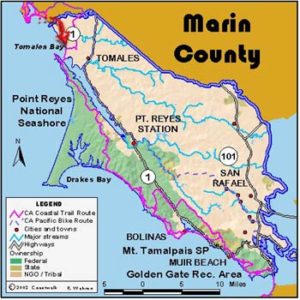
Legend: For details on the icons and trail colors, please click the legend icon on the map above.

Layers: Other layers are available. See the California Coastal Commission and Coastal Conservancy Completed Sections layer for the official completed trail segments. (About progress on the trail completion project.)
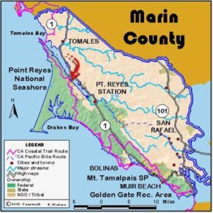
Marin Section 1
Valley Ford to Lawson's Landing, Dillon Beach
Through most of Marin County a hiker can walk the CCT all the way to the Golden Gate on trails and beaches. However, this first Marin County CCT section requires the only significant road walking in the entire county. Narrow county roads roll through dairy land with occasional farmsteads dotting the hills. The road crosses the upper watersheds of the wildlife-rich Estero Americano and Estero de San Antonio. Paddlers launch canoes and kayaks at these crossings and boat down to the beaches at the mouths of the isolated and beautiful marine estuaries.
Valley Ford, where this walk begins, is noted for Christo's monumental artwork, Running Fence. Made of big nylon panels stretched between posts, it swept across Sonoma and Marin counties for 25 miles and through Valley Ford.
Running Fence made a dramatic statement about both art and the environment as it billowed in the wind, reflecting light, and wound over hills and across valleys, finally dropping into the ocean west of Valley Ford. It made an important artistic and political statement in these parts in the 1970s because Christo considered the planning, public meetings, and differences of opinion part of the art process. After months securing county permits and permission from dozens of land owners to cross their land, Christo assembled a large team of volunteers to erect and take down the fence. The final product was up for only two weeks.
Valley Ford is only a block long so it isn't hard to find Valley Ford-Franklin School Road at the north end of town in front of Dinucci's Italian Dinners. At the street sign "VALLEY FORD ESTERO," head southwest on the road, crossing the Estero Americano at ¾ mile and entering Marin County. Continue 5 miles through rolling hills to Dillon Beach Road, dipping across the Estero de San Antonio at 4⅛ miles. Turn right on Dillon Beach Road at 5¾ miles. Elephant Rock near the junction has fine views of Bodega Head, Bodega Bay, Tomales Bay and Tomales Point. Descend to the small village of Dillon Beach at 6¾ miles. Pass the small store and restaurant on the left and walk to the beach. Cross the parking lot and walk south on the beach. This sand-dune backed beach rims the south end of Bodega Bay. Walk around Sand Point on the beach and come to hike's end at Lawson's Landing around 8 miles, depending on how much sand has piled up on the point. Lawson's is a funky fishing camp with a pier and boat rentals. They run a barge to the clam beds in season.
ALTERNATE ROUTE: Walk the road from the beach parking area at Dillon Beach through the Lawson's Landing entrance station and campground. Day use fee for Lawson's is $5. If you intend to continue south on Marin Section 2, you need to either arrange in advance a boat shuttle from Lawson's to Tomales Point or walk the Highway 1 shoulder south from Dillon Beach Road on a long but scenic detour.
Distance: 8 miles (12.9 kilometers).
Open to: Hikers. Bicyclists on road.
Surface: Beach, road shoulder.
Access point: Valley Ford.
How to get there: Take Highway to Valley Ford just north of the Sonoma-Marin County line.
Other access: Anywhere along route.
Difficulty: Easy
Elevation gain/loss: 860 feet +/900 feet-.
Cautions: Watch for vehicle traffic on road.
Further information: Lawson's Landing (707)878-2443.
Facilities: Store, gas station, restaurant in Valley Ford and Dillon Beach.
Campgrounds: Lawson's Landing is a private campground at the mouth of Tomales Bay.
Lodging: West Marin has several B&Bs.

Interested in contributing to this project?
Register to add new photos and information, update existing results and share your trip reports.