

June 14: Humboldt County Table Bluff Beach to Guthrie Creek Trailhead. 13.3 miles
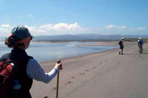
We left the relative warmth of our camp at the Ferndale Fairgrounds and met our day leader, Robert Smoak, in the crisp, breezy fog at Table Bluff Beach. Even though the tide had reached its low 2 ½ hours before, we still had a wide swath of hard sand to walk upon. As it was yesterday, the group was soon swallowed up by the fog.
As we neared the mouth of the Eel River, the amount of driftwood on the back beach kept increasing. Occasional big stumps had been partially sawn away, their parts ending up in the burl shops along Highway 101. Lying among the wood were two large banana-shaped colored and shaped objects. On inspection they turned out to be made of styrofoam and chicken-wire, covered with a plastic substance. Later, back at camp in Ferndale and talking with Dale Olsen, we learned that what we had seen on the beach were the remnants of an entry in the kinetic sculpture race. Held each Memorial Day, the race runs over land and water from Arcata to Ferndale. Dale has been an entrant for the last 24 years with his contraption “Grandpa’s Flying Machine”
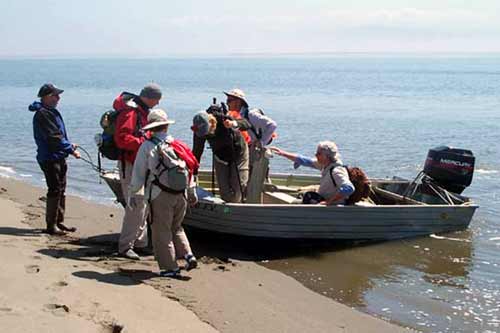
At the mouth of the Eel, we met up with Bruce Slocum, who boated us across the river. The Eel ends in an extensive estuary filled with backwater sloughs and islands. It was extremely beautiful as the morning fogs drifted here and there. We watched as the incoming tide swept over an island covered with resting harbor seals. Bruce explained to us that we were in an area of “sedimentary give and tectonic take”. The Eel is laden with sediment, which is deposited at the mouth. At the same time the area sinks with each new earthquake. The result, he said, was that there is now 12,000 feet of sediment before one comes to bedrock.
After crossing the Eel, instead of continuing our trek up the ocean beach, we walked along the shores of an extensive salt marsh in the estuary. Coming finally to diked farmland, we again went up the ocean side of the sand spit. Within a mile or so, we were met by afternoon guide Carl May. In order to get a leg up on tomorrow’s early morning scramble around False Cape, Carl led us approximately 3 miles down Centerville Road to Guthrie Creek Trailhead. Tomorrow in the early AM we will begin our walk at this spot. (Jon Breyfogle; photos: Linda Hanes)