

July 23, San Mateo County
Pigeon Point Lighthouse to Waddell Creek. 11.7 miles.
We began in a wet fog at the lighthouse where we met Carl May and J who arrived with warm chocolate chip cookies in hand. Our first miles are again on the highway. This was somewhat of a disappointment as we have been told that POST (Peninsula Open Space Trust) recently purchased the lands between the highway and the sea, theoretically clearing the main obstacle of recalcitrant land ownership towards developing a bluff top trail. But there is no trail now, only tall weeds, and we must stay on the shoulder of the highway.
At the Gazos Creek Coastal Access parking lot, we met our Coastwalker friend Willie Wool and her two fellow hikers Josephine Garcia and Vern Sproat, all from Sunnyvale and out to join us for a day’s hike. Willie, too, had chocolate cookies for us and in addition, packaged pieces of watermelon.
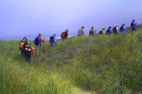
We gratefully abandoned the highway and walked the beautiful beach to Franklin Point. Carl explained that both Pigeon and Franklin Points are named after ships which had the misfortune of running aground on them. Franklin Point, lesser known than Pigeon Point to the north or Año Nuevo Point and Island to the south, is spectacular. The point itself is of sandstone, some of which has been eroded into tafoni, delicate lace-like patterns. Behind the point is a wonderful dune complex. Here we were restricted by cable barriers to a very well defined trail in order that the dunes be as undisturbed as possible. This means that we were given a good look at the tracks left by all the small creatures that inhabit the dunes instead of human shoe prints. Also approaching Franklin Point, we walked a new boardwalk, less than a year old, to the point itself. We are told that under the boardwalk lie the remains of some of the sailors who perished when the Franklin ran aground.
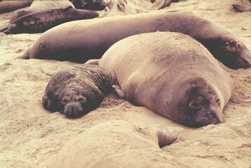
The highlight of the day was Año Nuevo. Carl arranged with State Park Ranger Gary Strachan for us to walk directly along the beach through the State Reserve. Gary was unable to be with us because he has had a run in with an errant wind surfer, but we did find Earle Jones, volunteer docent, on the beach ahead of us. Also ahead of us are tons and tons of male elephant seals. Our lunch on the beach is an exercise in multi-tasking. In addition to eating, we listened to Earle as he told us about the Reserve and the habits and ways of the elephant seals themselves. At the same time, we had a hundred or so behemoths fifty yards away both lying on the beach and swimming in the water. Those on land lie about like giant slugs, occasionally throwing sand with a flipper or raising their head and neck up to initiate a fight with a neighbor. The ones in the water are also engaged in trial or mock battles. Again, with neck and head out of the water, they spar with each other, hitting their opponents neck with their canine teeth, attempting to slash the neck area. All the while they were making a low sound, somewhat like the exhaust of a motorboat or motorcycle.
After lunch we walked back through the reserve to the highway and within a mile entered Santa Cruz County, our eighth county. Another mile or so walking the highway at the foot of the Waddell Bluffs and we were at Waddell Creek, our destination for the day. (Jon Breyfogle; photo left by Linda Hanes. Photo right by Cal State University Monterey Bay)Left: Roped trail at Franklin Point. Right: Mother & pup elephant seals at Año Nuevo State Reserve.
For trail section - San Mateo Section 10, San Mateo Section 9