
August 28: Ventura County Punta Gorda (Oil Island) to the Ventura Pier. 11.7 miles
After spending the night at Emma Woods Group Camp, which is situated between the railroad tracks and the freeway, we went with our day leader Burt Elliott back to Punta Gorda to start our days walk. (We were to be joined at noon by Don Mills.) Our first mile was like walking through a labyrinth: first on the old Pacific Coast Highway (PCH), then across rip rap and then through a box culvert under the freeway and railroadall happening within a quarter mile of our start. We then took an ad hoc trail which seemed to follow a buried gas pipeline (judging from surface indications) for a short ways. This afforded us a look down on the railroad tracks, and the railroad obliged us by having a long freight train pass below.
Then it was down and across the tracks, across an abandoned portion of the PCH and through a pedestrian undercrossing of the freeway. The rip rap here was not a problem as a wooden stairway had been provided to take us to the beach. After a short stretch of beach we were back up on the old PCH where we would stay for most of the day.
In this area the land between the shoreline and the base of the hills is a vast multiuse transportation corridor, leaving little room for hikers. What land is not used up by roads or railroads is residential. All of these uses have declared the ocean their enemy and have thrown down rocks and cement walls to keep it at bay. I see it like this: at first all human movement here was by foot. Then transportation became more and more sophisticated. Horses supplanted feet, then came trains and automobiles, all traveling faster and faster. Along the way, those of us who travel by foot got lost in the shuffle, forgotten. So we find ourselves picking out a route from what is left over: makeshift drainage structures, abandoned sections of road, what beach is left after the sea walls and rip rap have been laid in place, or along streets in front of residences.
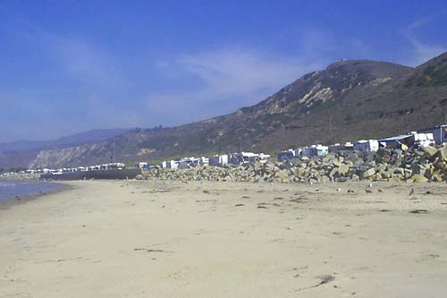
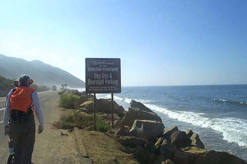
Past Hobson County Park, along the Rincon Parkway Campground, we no longer had house after house blocking off our view of the ocean; here it was RV after RV, parked in a row that seemed to go on forever. These obstacles, along with the constant rip rap, would keep us off the beach until Emma Wood State Beach. Here we rejoined the beach or the back beach until we reached the promenade in the Town of Ventura, just after we waded through the small Ventura River near its mouth. The river marks one boundary of the fairgrounds (called the Ventura Fairgrounds, but technically a district fairgrounds). We followed a bike path for a ways in front of the fairgrounds, until it ended with a barrier signaling a spot where the sea had taken out part of it and the adjacent parking lot. The parking lot is used by many people for access to the beach, but part of it is closed now, because a decision has not been made about rebuilding the bike path. This bike path and parking lot led to the promenade, which follows the city beach and gives excellent views of one of the consistently best surfing spots along this section of coast.
Within a mile of gaining the promenade, we had reached the Ventura Pier and our days end. Some of us had anticipated shopping at Cheap Sports in Ventura for weeks, so we hit this store on what turned out to be a sale day, looking for socks, wickable shirts and other items to see us through to the end of our trek. We were driven to our camp site for the next four days, McGrath State Park, featuring showers and pleasant camping spots. Some of us noticed the damp ground at our sites, and found out that a week ago it was flooded because the Santa Clara river mouth closed. (Jon Breyfogle; photos by Linda Hanes)
Left: Rip rap protects the ‘parkway’ on this long section of the Ventura coast. Right: Rincon Parkway RV Park.