

September 7, Los Angeles County King Harbor at Redondo Beach to Point Vicente. 9.0 miles
Stan Bluhm again took the task of guiding us along the way to Mexico. The van arrived at King Harbor at 8:30 to find Stan ready to go, as the beach was beginning to come to life. The small shops were preparing for their opening, bicyclists and joggers were passing by on the multi-use path. In the ocean, surfers and body boarders and even scuba divers were out in force. Several times, we passed individuals working out under the watchful eye of their own personal trainers. Most interesting were the roller bladers who shot by us in formation. Single file and in groups of 3 or 4 they silently passed; their hands clasped behind their backs as they skated along. Their single file formations were a reminder of the pelicans we have seen flying by and with us on our journey.
Along Redondo Beach, we had the choice of the promenade, the multi-use strand or the beach itself. Where the promenade and strand stopped at Torrance County Beach we all walked along the firm sand next to the water.
At the end of Torrance County Beach at Malaga Cove and just before the private Palos Verdes Beach and Athletic Club we rose up from the beach to the streets of the Palos Verdes Estates above. We were approaching the southerly cusp of Santa Monica Bay on the point of the Palos Verdes Peninsula. To the north, we could just make out some of the buildings in Santa Monica and the spine of Boney Mountain. Were it clearer we could have made out the northerly cusp of the bay at Point Dume, obscured from us by the fog and haze. Between these two points live millions of people, few of who have had the experience of walking the coast of their own Santa Monica Bay.
The coast is such a valuable amenity that the homes along this walk have been outrageously expensive. Our coast adds billions in value to the lands near it. The Palos Verdes Peninsula is certainly no exception. Here, by and large, the homes are spacious and sit on large parcels. The primary color scheme is of beige stucco with red tile roofs, reflecting the Spanish influence. These colors duplicate those found on the bluff cliffs where light soils mix with ones that are more reddish.
Our walk ended at the Point Vicente lighthouse (closed for renovation right now) and the temporary Point Vicente Interpretive Center. Fencing cordons off the former center: apparently, the site it is situated on was former a military shooting range and the soil is riddled with lead. (Linda notes: it is hoped it will be expanded and open in about 2 years. Lead bearing soils have been removed and trucked to Nevada dump sites. This building is prime whale watching territory, and we noted fence posts in front were numbered so whale watchers could call out the fence post number when a whale was seen, indicating area of sighting.)
Our walk today has been primarily on streets although often we can look down to the base of the bluffs and see the rocky beach below which is passable, but a more arduous walk. In the past the argument has been strenuously made by some of the walkers that it is important to walk the beach whenever possible. No such argument was made today; June 3rd was a long time ago and we are all beginning to get tired. (Jon Breyfogle; photos by Linda Hanes)
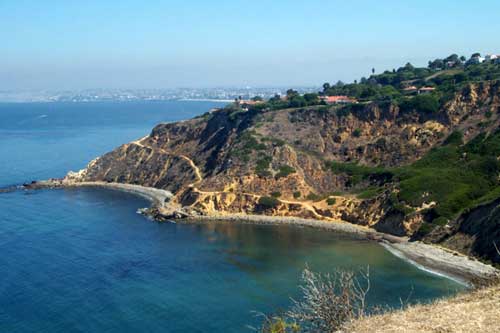
Left: Bluff Cove and Flat Rock Point, with Torrance in the background.
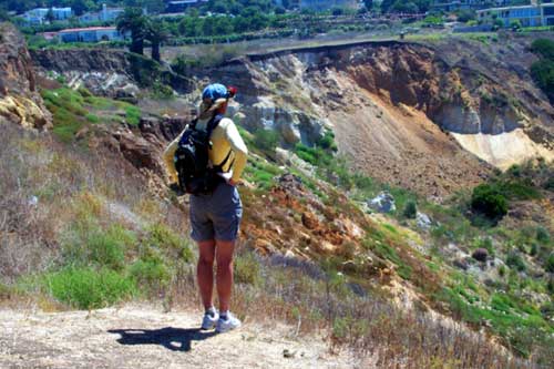
Right: Diana Savage observing the major landslide at Portuguese Bend.
For trail section - Los Angeles Section 7, Los Angeles Section 8