


June 21: Mendocino County
Chemise Mountain to Orchard Camp, 11.5 miles
On a beautiful blue solstice day we hiked up Chemise Mountain. We began at Hidden Valley Trailhead near Nadelos Campground, winding our way up past two small hidden valleys, then up switchbacks for a time. We wound our way gently up the ridge, as wind swished through spruce-forest treetops. At about 2500 feet, yellow crumbled sandstone was our path through low-growing (pygmy-like) manzanita, in full sunshine. We reached the high point at 2598 feet, looking out to the ocean on one side and the Yolla Bolly Mts on the other. At the 4 mile point, we descended down ancient marine terraces and looked down on the houses of Whale Gulch. At the edge of a grassy slope, the skeleton of an unfinished cabin stood just at the border between BLM land and State Park land. Continuing past this point, descending the mountain, we crossed the line from Humboldt into Mendocino County.
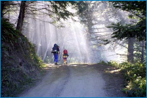
Further on, a narrow, steep, slippy trail brought us sharply down about 60 feet to a knife ridge that featured a sheer cliff to the ocean on one side and a house nestled under the ridge on the other. For those of us afraid of heights and edges, this was the scary point of the day, and for some, the entire Lost Coast. After this, we switchbacked our way down to dark Whale Gulch stream crossing. The day continued with a two mile hike to the Sinkyone Visitor Center at Needle Rock, then 2.8 miles up a gravel road to Orchard Camp, our night’s campsite. Here we discovered medievalists camping next to us, and we ate our camp dinner of Annie’s Organic Macaroni and Cheese to the spectacle of battle conducted with duct tape weapons. More fun than TV! (Linda Hanes; photos, Don Nierlich)
For trail section - Humboldt Section 16, Mendocino Section 1