
Usage Notes

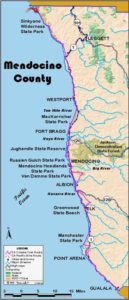
Legend: For details on the icons and trail colors, please click the legend icon on the map above.

Layers: Other layers are available. See the California Coastal Commission and Coastal Conservancy Completed Sections layer for the official completed trail segments. (About progress on the trail completion project.)
Humboldt Section 16
Hidden Valley Trailhead, King Range National Conservation Area, to Needle Rock Visitor Center, Sinkyone Wilderness State Park
This lightly traveled CCT section ascends a wooded ridge to the top of 2598-foot Chemise Mountain, the southernmost peak in the King Range. It then descends along the coastal ridge with magnificent views, entering Sinkyone Wilderness State Park and returning to the coast. While the middle portion requires a steep descent of 2800 feet, it a reveals a wonderful transition from the hardwood and fir forests and dense chaparral of the King Range to the lush grasslands and redwood forests of the Sinkyone. If possible day hikers should arrange shuttle or a picka up at Needle Rock Visitor Center to avoid climbing back up the steep ridge from near sea level.
The trail heads southwest on an old road. Cross a tiny creek at ⅛ mile and enter the lush meadow of Hidden Valley from which you can see the ocean to the west and south. Go left at a fork at ¼ mile. The right fork leads to an old apple orchard, ending before ½ mile.
Come to a signed switchback overlooking Hidden Valley before ½ mile. Veer left and ascend north into forest, then climb steeply by a dozen switchbacks to a ridgetop saddle before one mile. Ascend steeply south past large firs along the ridgetop with the often snow-clad peaks of the North Yolla Bolly Mountains rising to the east.
Your trail follows the ridge as it contours then dips and rises repeatedly to 1⅝ miles. After climbing through a brush field with sweeping ocean views, return to forest and meet a junction at 1⅞ miles. The left fork descends to Wailaki and Nadelos Campgrounds on Chemise Mountain Road. Turn right and continue up the ridge through forest. The vegetation turns brushy again before the trail's summit at 2⅝ miles where a vague track on the left winds 150 feet to the very top of Chemise Mountain.
CCT continues along the ridgetop, descending briefly to contour then rise to another top at 2¾ miles. Dip and rise twice more before brushy Chemise Flat at 3⅛ miles. Descend steeply on rocky tread with short rises to two more ridgetop knobs by 3¾ miles. The steep descent turns shady before another brief ascent to the summit called Manzanita at 4 miles where an expansive view looks south over steep terrain to the Sinkyone Wilderness below.
CCT descends southeast by switchbacks, entering mature Douglas Ar forest by 4¼ miles. After dropping steeply through a gully, contour to return to the ridge. After a steep descent, contour through a grassy clearing. Drop through mixed forest then climb to another ridgetop knob at 4¾ miles. The trail contours along a shady ridgetop to 5⅜ miles. a After a short steep descent, climb along the razor ridge crest around 5½ miles. CCT descends then climbs through a large grassy clearing with abundant native blackberry and sweeping views south. After dropping steeply through forest, descend gradually through grasslands with many wildflowers. You soon join a road and ascend to a flattop on the ridge at 6 miles where an unfinished hip-roofed building sits beside the trail.
As the trail descends along the ridgetop, it quickly enters Sinkyone Wilderness State Park, so equestrians and bicyclists should turn back here. CCT descends gradually through ridgetop grasslands until 6¼ miles where you return to forest and descend steeply. You soon see a private house below. Follow the trail down the razor ridge to avoid private property, the surf churning far below. At 6⅜ miles your trail veers left and descends east through hardwood forest by switchbacks. After one more view down to the coast, the trail zigzags steeply east. At 6¾ miles CCT drops to a shady, slippery ford of Whale Gulch Creek. Across the creek the trail climbs uphill briefly, then winds south through small gullies to ascend to a summit overlooking the mouth of Whale Gulch.
Descend south above two small lakes at 7 miles, then climb southeast to cross a tiny creek. Leave the forest for grasslands, passing a side trail to Jones Beach on the right. Just beyond at 7⅝ miles, you pass Jones Beach Environmental Camp where three sites cluster around a eucalyptus grove beside a small creek, the only water source. To camp here you must register at Needle Rock Visitor Center one mile south.
CCT contours south on an old ranch road across the coastal prairie. Dip to cross a bridge over Low Gap Creek at 7⅞ miles, then contour through grasslands before climbing to the west end of the Low Gap Trail. Drop to a bridge across another creek at 8⅛ miles, then traverse the prairie. The trail rounds an eroding bluff edge to pass Streamside Camp and cross another creek at 8⅜ miles. Follow the bluff above the sea stack called Needle Rock, then climb east past Needle Rock Camp and a barn, coming to the unpaved park road and Needle Rock Visitor Center in the old ranch house at 8⅝ miles.
ALTERNATE ROUTE: The only other option follows Chemise Mountain Road south for 6¼ steep, dusty miles to Four Corners Junction. Then turn right and descend Briceland Road 3½ miles to Needle Rock Visitor Center.
SUGGESTED ROUND TRIPS & LOOPS: You can follow the trail to the top of Chemise Mountain or farther south to Manzanita, then return the way you came or loop back via Wailaki or Nadelos Campground and Chemise Mountain Road. A shorter day hike leaves from the south end and follows CCT north to the Whale Gulch ford, 3¾ miles round trip.
Distance: 8⅝ miles (13.9 kilometers).
Open to: Hikers. Equestrians and bicyclists on BLM land only.
Surface: Trail.
Access point: Hidden Valley Trailhead.
How to get there: Exit Highway 101 from south at Garberville, Milepost 10.8, or from north at Redway, Milepost 14.6. Take Briceland Road from Redway (2.8 miles north of Garberville on Redwood Drive) for 17.7 miles. Go left on Chemise Mountain Road ¼ mile to trailhead on right.
Other access: Nadelos or Wailaki Campground.
Difficulty: Hard
Elevation gain/loss: 1450 feet+/2950 feet-.
Cautions: Ford at Whale Gulch Creek may be impassable in rainy season. No water on trail until Whale Gulch. Watch for timber rattlesnakes and poison oak. Nearest year-round facilities at Shelter Cove.
Further information: Bureau of Land Management (707)825-2300 or 468-4000. Sinkyone Wilderness State Park (707)986-7711.
Facilities: None until south end.
Campgrounds: Nadelos and Wailaki Campgrounds are 1.4 and 1.7 miles south of access point.
Lodging: Garberville, Redway and Shelter Cove have several motels and inns.
Points of Interest
No individual points found.
In the News
Interested in contributing to this project?
Register to add new photos and information, update existing results and share your trip reports.