
Usage Notes

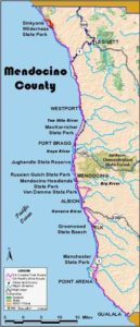
Legend: For details on the icons and trail colors, please click the legend icon on the map above.

Layers: Other layers are available. See the California Coastal Commission and Coastal Conservancy Completed Sections layer for the official completed trail segments. (About progress on the trail completion project.)
Mendocino Section 1
Needle Rock Visitor Center to Orchard Creek, Sinkyone Wilderness State Park
This area is the most "civilized" portion of 7567-acre Sinkyone Wilderness State Park, but don't expect to find the usual amenities. In the Sinkyone, civilization refers to historic development and perhaps a higher concentration of campsites, certainly not to commercial facilities.
The area was long the home of the Sinkyone tribe, southernmost of the Athapascan language tribes on the coast. European settlers came in the 1860s, developing cattle ranches, lumber mills and ship loading facilities. The heyday of such endeavors came at the dawning of the 20th century, but by 1960 most of the settlers had moved on. Nature quickly reasserted its control, obliterating most signs of human endeavor in short order. The visitor center has a wonderful album of historic photos showing the changes this wild coast has endured since 1860.
This CCT section follows the unimproved dirt road south to its end, with vistas of this enthralling coast and the coastal grasslands, forests and deep creek canyons all along the way. On the road you might encounter the herd of wild Roosevelt elk that roam the park. If you do, give them plenty of room, especially in mating season in September when the bulls sometimes charge without warning.
Follow the narrow dirt road south across coastal grasslands with superb ocean views. The road climbs and descends as it winds through several wooded canyons in the first mile. Descend to cross tiny Flat Rock Creek, then ascend over the flank of High Tip around 1½ miles. Descend steeply with grand views down the coast to cross another creek, then descend gently along a lush valley to road's end and Orchard Creek Camp at 2½ miles.
Distance: 2½ miles (4 kilometers).
Open to: Hikers, bicyclists, equestrians.
Surface: Dirt road.
Access point: Needle Rock Visitor Center.
How to get there: Exit Highway 101 at Garberville (Milepost 10.8) from the south or Redway (Milepost 14.6) from the north. Take Briceland Road west from Redway 2.8 miles north of Garberville on Redwood Drive. In 12 miles go left through Whitethorn. In 4.5 miles (last part dirt), you come to the junction called Four Corners. Go straight, descending a steep, narrow, winding dirt road 3.6 miles to the visitor center. This road is impassable to RVs or trailers and may even be closed after heavy rains.
Other access: You can park at various turnouts along the road south of the visitor center.
Difficulty: Moderate
Elevation gain/loss: 390 feet+/ 520 feet-.
Cautions: This isolated country is far from phones, towns or services. Watch for vehicle traffic when you are walking on the road. Stay back from wild elk.
Further information: Sinkyone Wilderness State Park (707)986-771 I.
Facilities: Filtered water, chemical toilet, camping self-registration, visitor center in historic building with nature and history exhibits.
Campgrounds: Needle Rock, Streamside and Jones Beach Environmental Camps are at the north end. Orchard Creek Environmental Camp is at the south end.
Lodging:
Points of Interest
No individual points found.
In the News

Interested in contributing to this project?
Register to add new photos and information, update existing results and share your trip reports.