
Usage Notes

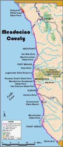
Legend: For details on the icons and trail colors, please click the legend icon on the map above.

Layers: Other layers are available. See the California Coastal Commission and Coastal Conservancy Completed Sections layer for the official completed trail segments. (About progress on the trail completion project.)
Mendocino Section 2
Orchard Creek to Usal, Sinkyone Wilderness State Park
Heaven and hell go hand in hand on this most strenuous and most spectacular section of the Coastal Trail. Plan at least two days, preferably three or four, to hike the whole section. While the 17 miles may sound short, the elevation change is equivalent to hiking to the bottom of the Grand Canyon and back out.
Fortunately you never exceed an elevation of 1200 feet. Still, it is a shame, and exhausting, to rush through such breathtaking country.
Sinkyone State Park was established in 1977, but the entire Lost Coast Trail opened only after the southern half of the park was acquired in 1987. As recently as 1980, vast virgin redwood forests still stood between Wheeler and Usal. After most of the big trees were logged out, the timber company agreed to sell. You will see serious scars from the timber operation, but the rugged grandeur of the land remains.
Follow the trail on a gentle descent past Railroad Creek Camp to Bear Harbor before ½ mile where more camps lie near the beach. The Lost Coast Trail heads east up a creek canyon. Cross the creek at ⅞ mile and ascend by switchbacks to views of the rugged coast. Top ridge at 1½ miles, then descend into Duffy's Gulch on tread built in 1862. After crossing the stream beneath virgin forest at 2¼ miles, climb fitfully, patches of forest soon alternating with steep coastal grasslands. Follow the coast south, climbing steeply beyond 3¼ miles, then following a ridgetop as it dips and rises three times. Descend, then contour through forests and grasslands with coastal vistas.
At 4⅛ miles the trail switches to the east side of the ridge to descend long switchbacks into the virgin forest called Schoolmarm Grove. The descent ends at a grassy clearing beside the North Fork of Jackass Creek where the Wheeler School was located in the 1950s. Campsites and an outhouse are nearby. A spring lies in the gulch to the west.
The trail heads south across the creek and through the town site, coming to the mill site at the confluence of the North Fork and Jackass Creek at 4½ miles. Ford the creek and continue south, passing the cliff-edged beach at 4⅞ miles. Follow the trail southeast up a gulch, soon climbing steeply through dense brush, then tall forest. Crest a ridge around 7 miles and descend into a hanging valley surrounded by the sheer Anderson Cliff along the shoreline. Cautiously cross an overgrown seasonal creek jammed with nettles at 7½ miles, then ascend steeply by a dozen switchbacks. The stiff climb ends at a grassy ridge at 8⅜ miles, elevation 1137 feet, offering the first glimpse of the coast south.
The trail descends gradually, then very steeply south, switchbacking nearly to sea level in Little Jackass Canyon by 9¼ miles. The trail levels at a junction where an outhouse serves the downstream camps. The side trip to the beach framed by the magnificent cliffs of Mistake Point is ¼ mile round trip.
CCT and the Lost Coast Trail go left at the fork, ascending the canyon and crossing the creek. Soon the trail passes two more campsites and another toilet beneath virgin redwoods near the creek. The trail south crosses the creek and ascends steadily by six switchbacks. At 10¼ miles the trail turns right and follows an old road south above Northport Gulch. Beyond 10⅞ miles, the road turns northeast at a broad landing, but the trail veers right to descend south. Drop steeply by nine switchbacks into Anderson Gulch. Reach the final trail camp with a view down Anderson Gulch to the ocean at 11¾ miles.
Descend two more switchbacks to ford, then climb steeply to precipitous, grassy headlands above the rugged shore. Descend steeply to the edge of Dark Gulch, then follow it upstream to a crossing at 12⅞ miles.
The trail makes one last long ascent, climbing 900 feet in 1¼ miles to cross Timber Point. Descend south through forest, cross a seasonal creek, and drop into grasslands at 15¼ miles. Follow the grassy ridge southeast with great views over ocean and forest. After one more climb to the top of the ridge at 15⅞ miles, descend east by twenty switchbacks to Usal Road, 16¾ miles from Orchard Creek.
ALTERNATE ROUTE: If the elevation change for the section is simply too much, you can nearly halve it (and shorten your hike by 2¾ miles) by taking the following route, much less scenic. Follow the Lost Coast Trail to Wheeler. After the second creek crossing there, head east and south on the old Wheeler Road for 3½ miles, then turn right on the Hotel Gulch Horse Trail (Road 4500) and follow it 5¾ miles to Usal.
SUGGESTED ROUND TRIPS & LOOPS: For day hikers, a short walk to rugged Bear Harbor or a hike over the first ridge to the virgin redwood grove at Duffy's Gulch is quite manageable. The 10-mile round trip hike to Wheeler Beach is moderately strenuous, 2900 feet of up and down, so expect it to take all day. From its south end, the trail climbs more steeply, but the 5¼ miles round trip to Timber Point, or even the 1¾ miles round trip to the top of the first hill, provides inspiring views.
Distance: 16¾ miles (27 kilometers).
Open to: Hikers. Equestrians allowed on 4½ miles to Wheeler.
Surface: Trail.
Access point: Orchard Creek.
How to get there: Follow directions to Needle Rock Visitor Center in previous section, then drive 2.5 miles to end of road.
Other access:
Difficulty: Hard
Elevation gain/loss: 5300 feet+/5300 feet-.
Cautions: Access road may be closed in rainy season. Permit required to stay overnight along trail; a fee is charged. Camping allowed only in designated areas. This isolated country is far from towns and traveled roads. Timber rattlesnakes, ticks, scorpions, poison oak and stinging nettles occur along trail. THIS IS THE MOST STRENUOUS SECTION OF THE ENTIRE CALIFORNIA COASTAL TRAIL.
Further information: Sinkyone Wilderness State Park (707)986-7711.
Facilities: Primitive camping, chemical toilets.
Campgrounds: Environmental Camps at Orchard Creek, Railroad Creek, Bear Harbor. Trail camps at Wheeler, Little Jackass Creek and Anderson Gulch. Car camping at Usal, the southern trailhead.
Lodging:
Points of Interest
No individual points found.
In the News

Interested in contributing to this project?
Register to add new photos and information, update existing results and share your trip reports.