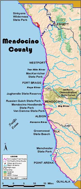


June 23: Mendocino County
Little Jackass Creek to 3 miles past Usal, 10.3 miles
The 23rd presents similar terrain as the 22nd. It’s up out of Little Jackass Creek, across the upper slope of Northport Gulch, and down into Anderson Gulch. One more up takes us to an elevation of approximately 1,100 feet and our high point. From there it is mostly downhill into Usal. As we descend, we meet Bob Lorentzen, outdoor’s man, writer, Mendocino Coastwalk volunteer and our leader for the next few days.
It has been hard work but it is not without its rewards. Picture as steep a slope as you can; not a cliff, but a vegetated slope with redwoods and firs, and a solid blanket of forest-understory plants. It is early in the morning, and the sun has just topped the ridge above, its light comes at you through the trees, almost parallel to the ground. As the trail switchbacks above, the other hikers move into and out of the light; silhouettes tacking ever higher above you.
It has been a late and wet spring, and we have been blessed with luxuriant plants and beautiful wildflowers. Hiking along, you will miss many and not know all their names, but your partial list might include: black, thimble, straw, huckle and elderberry; oxalis, cow parsnip, poison oak, brodeia, wild cucumber, iris, ferns, columbine, nettles, tanbark oak, madrone, spruce, fir and redwood, hound’s tongue, blue-eyed grass, rough fairy bell, lupine, sticky monkey flower, coyote bush, digitalis, gum weed, lilies, yarrow, morning glory, California poppies, farewell to spring. Fine companions all on a glorious hike.
Once into Usal, we take a half-hour break to catch our wind and then we are off with Bob on the Usal Road. We head south for 3 miles and up to an elevation of perhaps 1,000 feet. This will give us a leg up on the next day’s walk, which will be a very long one.
Back in camp, we clean out our backpacks; they will be loaded into David Hane’s car and taken south for safe storage; our backpacking days are now behind us. (Jon Breyfogle; photos, Don Nierlich)
