
June 24: Menodcino County 3 miles south of Usal to Westport Union Landing State Beach. 15.1 miles
We began our day by missing our stopping point from the prior evening. The Melmobile stopped about 0.2 mile past our designated starting point, so those of us who were so inclined walked back to begin the day at its proper starting point. As we walked along the Usal Road, we were flanked on both sides of the roadway by lands that had been heavily logged in the past. Still evident were cat trails and piles of brush and other debris. Occasionally we would pass large redwood stumps from hand logging days. In order to avoid the very base of the tree which could have a much greater diameter than the tree itself, the woodsmen would cut notches in the tree in which they placed springboards. With one man on either side of the tree standing off the ground on these boards and a 2-man saw between them, the tree would soon be horizontal. All that was left for us to see was the stump with the notches still visible; those first little scratches that brought down a giant.
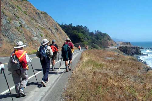
Our true change from the wonderful backwoods reality of the last days ended with the Usal Road’s end. There before us stretched the ribbon of asphalt known as US Highway 1, the Shoreline Highway. We had already met its bigger brother US 101. They are cut from the same mold. Putting on our orange safety vests for visibility, we began the work of staying together as we walked and staying alert as the traffic went by. Often there were only inches between the white fog line marking the traffic lane’s edge and the metal barrier rail. It is not a good place to be walking. By contrast, less than 100 feet away, Cottoneva Creek played over the stones in its bed, seemingly oblivious to its nearby highway neighbor.
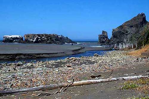
Bob Lorentzen, our leader for the day, had been able to contact the Mendocino Redwood Company and the Thompson family, owners of lands adjoining the highway. As a result, we were able to leave the highway after two miles and utilize logging roads on both properties for our journey. Immediately upon leaving the highway, we crossed Cottoneva Creek on a mammoth redwood that had fallen across it to form a bridge. The tree, reluctant to quit life, was sprouting vertical saplings from its horizontal trunk; saplings we were able to use as handholds during our crossing. We then walked a logging road to Rockport Beach, site of an old mill and dog-hole port, now deserted.
Plants and flowers noted today: simple purple geranium, inside-out flower, coffee berry, California wax myrtle, California hazel, yerba de selva, Oregon grape, hairy honeysuckle, star lily, and a spectacular red brodea, perhaps “Chinese firecracker”.
After lunch on the beach, we began a 1,000-foot climb to the ridge at Cape Vizcaino. Even without our backpacks and with a well-graded logging road for our trail, it seemed a harder climb than those made in the Sinkyone Wilderness, probably because this area has been recently logged and as a result the sun shone on us with full force. In several spots along the way, pink ribbons labeled “Timber Harvest Boundary” were seen. Bob indicated that they were exactly the same as the yellow ribbons in urban settings marked “Crime Scene”. We then came back down to again join US 1. For the next 6 or so miles, we followed the highway to Westport Union Landing State Beach. Along the way we met and briefly chatted with 4 ladies from Arizona. They were Laquita Searles, Liz and Ruby Standerfer and Maxine Menveg. They gave us a donation. On their dashboard was a notice: “Don’t let these innocent smiles fool you, we’re a bunch of mean old ladies.” They were fibbing. (Jon Breyfogle; photos, Linda Hanes)
Left: Walking the shoulder of Highway 1. Right: Looking north.
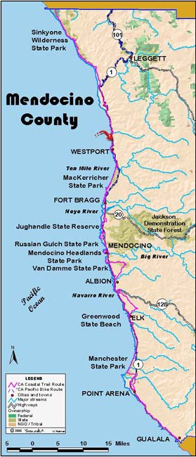
For trail section - Mendocino Section 3, Mendocino Section 4