
Usage Notes

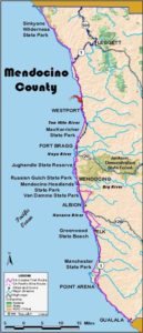
Legend: For details on the icons and trail colors, please click the legend icon on the map above.

Layers: Other layers are available. See the California Coastal Commission and Coastal Conservancy Completed Sections layer for the official completed trail segments. (About progress on the trail completion project.)
Mendocino Section 4
Usal Road to Westport-Union Landing State Park Vista Point
Suddenly the Coastal Trail hits the pavement for the first time since around Shelter Cove. Until we can get this section off the pavement, CCT hikers will need to follow Highway 1 on one of its steepest and most twisting segments for the next 9¾ miles. If you walk this stretch of highway be especially careful to stay out of the road. Though traffic isn't usually heavy, it does include plenty of logging trucks and RVs, many of which have trouble staying in their lane and even on the pavement. Read the feature CCT Needs a Trail Corridor off Highway 1 around Rockport and lobby your elected representatives to complete the CCT.
Follow the highway shoulder south on a gentle descent through the lush valley of Cottaneva Creek. Where you cross the creek around ¼ mile, abundant blackberry patches may offer a tasty snack in summer. Continue south past old ranch buildings and into the forest.
Beyond 2¼ miles, watch on the right for Mendocino Redwood Company's Demonstration Forest where the only outhouse and picnic area along this section offer a shady pleasant place to rest. A short side trail explores a scenic, wooded stretch of Cottaneva Creek.
Continue along Highway 1 through l the ghost town of Rockport. At 3¼ miles you cross a bridge over the South Fork of Cottaneva Creek as the creek veers west down its canyon to the Pacific Ocean. Climb a big hill on the winding highway, gaining 710 feet in elevation in less than 2 miles. Just before the summit at 5¼ miles, a clearcut on your left offers a view north to the Lost Coast.
Highway 1 descends gradually then steeply by sweeping curves. After a grand view of the coast south all the way to Mendocino at 5½ miles, follow the highway shoulder as it drops through the wooded canyon of a fork of Hardy Creek. At 7⅛ miles you round a bend to the right, and the Pacific comes into view. Cross Hardy Creek at 7¼ miles and climb along the shoulder to the ocean bluff where a broad shoulder on the right provides stunning views north to razor-edge Cape Vizcaino and south past Hardy Rock to the northern Mendocino coast.
Follow the highway south as it climbs and descends with ocean vistas, crossing Juan Creek at 8⅛ miles. Around 8⅜ miles you pass another ghost logging settlement at Union Landing where nothing remains of a small lumber town that lasted into the 1920s. As you continue along Highway 1, state park lands begin west of the road at 8½ miles, but no trail provides relief for your road-weary soles until you come to section's end at the vista point on the right at 9¾ miles.
Distance: 9 ¾ miles (15.7 kilometers).
Open to: Hikers, bicyclists.
Surface: Highway shoulder.
Access point: Usal Road at Highway 1.
How to get there: On Highway north of Rockport and south of Hales Grove at Milepost 90.88 where Usal Road heads north. Best parking available at Milepost 90.68.
Other access: Anywhere along highway.
Difficulty: Moderate
Elevation gain/loss: 920 feet+/1020 feet-.
Cautions: Stay out of roadway and on shoulder. Use extreme caution when crossing road.
Further information: None.
Facilities: None at access point. Chemical toilet and picnic area at Mendocino Redwood Company's Demonstration Forest. Chemical toilet, water, phone, picnic area at state park just south of south end.
Campgrounds: Westport-Union Landing State Park is just south of south end. Find more sheltered camping with showers at private Wages Creek Campground on next section.
Lodging: Howard Creek Ranch is a great bed and breakfast inn a mile south of vista point. Other lodgings in Westport.

Interested in contributing to this project?
Register to add new photos and information, update existing results and share your trip reports.