
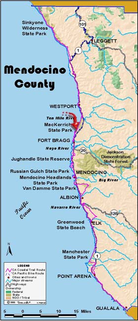

June 25: Mendocino County
Westport Union Landing State Beach to MacKerricher State Park. 17.2 miles
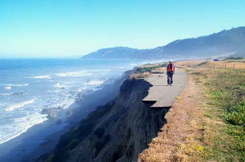
All of yesterday’s hard walking seemed worthwhile last night as we watched the sunset over the Pacific. The breeze was mild, the fog was only beginning to introduce itself to us, and our tents were pitched not more than 10 feet from the bluff top, the surf crashed below. We sat about during our nightly meeting, this time listening first to the next days itinerary and then to Janette as she read from two articles she had prepared for her hometown newspaper, the Laguna Beach Independent News.
Perhaps this is why we are doing this, why we want a trail to exist the length of the state. Here we are, not yet a month into our journey and after a hard day’s walk, we sit together as friends, maybe even good friends to be; people with whom we will be with in spirit long after this walk is done. The nine of us, who came together from different backgrounds and brought with us all the baggage of our separate lives, now walk a common path, feel a common wind at our back or in our face, toil under a common sun and feel the chill of a common foggy morning.
Our walk today starts with a leap across Howard Creek; our first trail is the old alignment of Highway 1, now being gobbled up by the ocean below. We are soon in Westport, where Marie Fostiak at the Westport Community Store treats us to coffee “on the house”. Last night she gave us the bread for our dinner. Leaving Westport we walked across the Westport Community Headlands, a 14-acre parcel saved from development by the community in 1999 with help from the California Coastal Conservancy. Leaving Westport we find a sign at a home, “One nice person and one old grouch live here.” We meet neither. Soon after passing an Italianate mansion south of town, we find Francis Dubois, an elderly gentleman, who upon learning of our journey informs us that he once walked across Canada and then Alaska.
We now begin some serious road walking. For mile after mile we are consigned to a narrow ribbon of roadway — sometimes the fog line marking the edge of the lane ventures up onto the berm at the very edge of the road leaving us no room at all on the highway itself. The road shoulders are narrow or nonexistent and if present, are filled with weeds.
At noon we take a break from the highway and climb down to a nice pocket beach at Bruhel Point. After lunch we continue along the bluffs of the point on Caltrans property for a mile or so, filing our socks with weed seeds but also getting some extraordinary views of the rocks flanking the point. We are stopped by a wire fence with the mowed field of Pacific Star Winery on the other side. How nice it would be if we could continue our bluff walk. But it is soon back to our friend the highway and down to Seaside Beach where we again can again relax on a sandy trail.
We arrived at 10 Mile River at low tide and have an easy ford — knee high water only — and then we begin the walk on hard beach sand to MacKerricher State Park. Once again we are on a very flat hard beach and the play of water and light is amazing. On the beach is a phenomenon I can only report; I do not know what is really happening, if anything. For the several miles of the beach the high water line is littered with thousand upon thousand of By the Wind Sailors, a colonial jellyfish with a built in sail. That in itself is not unusual, but with these Sailors are million upon millions of cucumber beetles and oak moths, yet neither of these insects can be seen flying about.
Our MacKerricher dinner is provided by Roger Sternberg and Patty Madigan of the Mendocino Land Trust. After dinner Roger gave us a good talk about the work the trust has been involved in and what it is currently doing. (Jon Breyfogle; photos, Linda Hanes)
For trail section - Mendocino Section 5, Mendocino Section 6