
Usage Notes

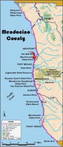
Legend: For details on the icons and trail colors, please click the legend icon on the map above.

Layers: Other layers are available. See the California Coastal Commission and Coastal Conservancy Completed Sections layer for the official completed trail segments. (About progress on the trail completion project.)
Mendocino Section 6
Bruhel Point to Ten Mile River, MacKerricher State Park
After a pleasant respite from the pavement at the dramatic headlands overlooking Bruhel Point's tidepools, the Coastal Trail returns to highway shoulder until it reaches MacKerricher State Park at the Ten Mile River. Once again most of the road portion looks out over mostly open headlands and marine terraces where a suitable route could be found for the CCT.
Once upon a time an earlier coastal trail traversed all these bluffs and headlands. By 1868 the Humboldt Trail traversed this coastline, more or less, from Fort Bragg to Eureka. It was established so that Mendocino coast settlers could ride a horse or walk to the State Land Office branch in Eureka to register their land claims. The modern CCT follows the route of the Humboldt Trail in several places, notably along the coastline of today's MacKerricher State Park, along Usal Road, at Duffy's Gulch in Sinkyone State Park, and at Bruhel Point and north of Seaside Beach on this section. Most of the Humboldt Trail fell into disuse by the 1920s, when steamships and better roads provided easier links between the two north coast cities.
Of course even before the Humboldt Trail, many native tribes developed and used trails along the coast. What we today call Bruhel Point was an important hub and destination for native trails of several tribes. The Coast Yuki people, who resided here and from Rockport to Ten Mile River, called this placed Lilim. Kato and Huchnom people came from the east, Sinkyone and Wailaki from the north, and Northern Pomo from the south to camp at Lilim to harvest shellfish and net and spear salmon and surf fish for drying at this bountiful spot. The marine waters at Bruhel Point were so abundant that all these tribes, several of them not otherwise on friendly terms, agreed to use Lilim as a neutral place where the harvest would be shared by all. Remarkably the tidal zone here still yields an abundant harvest to fishers, tidepoolers and divers who visit.
From the break in the fence, descend west across sloping headlands, heading toward the tip of Bruhel Point. Around ⅛ mile, as you approach the tip of the grassy bluff above the rocky point, look for a path that drops steeply south to a tiny beach. Use caution descending the rough trail down the steep slope, then scramble across the rock shelf to the beach. Cross the beach and ascend the rough trail that climbs east to the headlands around ¼ mile.
Locate the vague path that follows the edge of the grassy bluff and follow it south. The trail winds along the blufftop overlooking a large rocky tidal zone. CCT stays on the bluff edge past several steep side trails that descend to the tidal flats.
Around ⅝ mile, your trail forks. You can take the side trail on the right for a longer exploration along the bluff's edge. The Coastal Trail follows the left fork, veering southeast then south toward a stand of Monterey pines. Past the pines at ⅞ mile, it comes to a "T" intersection with an east-west trail. You have a choice here. With a left turn you'd quickly climb to a paved vista point, from which you would need to follow the highway shoulder south. The CCT's new slightly longer but more pleasant route turns right to descend west to the bluff's edge at one mile, then turns left to head south across the headlands near the bluff's edge. Around 1¼ miles the path splits, but both forks soon rejoin. At the next fork in 300 leet, the right fork leads 150 feet to approach a deep rocky cove, a good fishing spot. CCT follows the left fork southeast near the bluff's edge, passing through a broken down fence, then climbing to top a hill at 1½ miles at a fence marking the private property of Pacific Star Winery. Turn left and climb along the fenceline on a vague path. When you near Highway 1 at 1¾ miles, angle northeast toward a big clump of cypress. Find a vague path just to the right of the cypress clump and left of two smaller cypresses and follow it to a two-wheel track along a phone line right of way. CCT turns right and follows the track briefly, returning to the highway shoulder at Milepost 73.64.
From there you must follow the highway shoulder south. Dip across tiny Kibesillah Creek at 2 miles, then ascend past a cluster of old buildings to the west. These weatherbeaten structures are the remains of the lumber ghost town of Kibesillah which thrived here from 1867 until 1885 when the sawmill's new owner moved his lumber operation to the abandoned military post at Fort Bragg. Most of Kibesillah's residents followed, and Fort Bragg soon became an important commercial center.
CCT continues along the highway shoulder, climbing until almost 2⅝ miles, then descending south with Kibesillah Rock the largest of the many picturesque sea stacks offshore. As the road levels around 3⅛ miles, you pass the remains of another ghost town west of the road. Newport was a busy shipping point from 1875 until 1900. Follow the highway over a bluff and across a gully at 3½ miles. You come to South Kibesillah View Area on the west side of the highway.
CCT leaves the road shoulder at a paved road leading to blufftop picnic tables with views south along the coast. But unless you're staying to enjoy the great view, walk south to find a rough two-wheel track west of the highway. Follow its right fork south for 1600 feet until it returns to the highway around 3⅞ miles, where you once again are forced along the highway shoulder.
Use caution as the road narrows and winds down to cross Abalobadiah Creek at 4⅛ miles, then winds back up to the blufftop with the ocean obscured by private residences. You soon drop along cypress windbreak cross tiny Seaside a to Creek at 4¾ miles. Just before the windbreak ends, look east of the roadway for the remains of the tread of an earlier coastal trail. Named the Humboldt Trail, it was built in the 1860s to allow Mendocino coast settlers to get to Eureka to file land claims at the state land office there.
At Seaside Creek you have access to Seaside Beach which stretches south ⅜ mile to Ten Mile River. See Alternate Route. Due to the uncertainty of the river ford, the CCT continues along the highway shoulder, winding east up to a bluff, then contouring south. Cross the long, narrow Ten Mile River bridge and reach the section's end at 5⅝ miles. Happily the CCT stays off Highway 1 for most of the next 32 miles.
ALTERNATE ROUTE: In summer and early fall you can leave Highway 1 at Seaside Beach and walk the beach south to ford the Ten Mile River at its mouth. During those times the river usually ranges from knee-deep to waist-deep, depending on tides and recent rains. Do not attempt to ford the river when it is deeper, especially during the rainy season.
SUGGESTED ROUND TRIPS & LOOPS: Explore Bruhel Point from either the north or south end. North of the vista point you can loop back on the upper path after walking the blufftop route. Walk Seaside Beach to the mouth of Ten Mile River.
Distance: 5⅝ miles (9.1 kilometers).
Open to: Hikers. Bicyclists on highway.
Surface: Trail, highway shoulder.
Access point: Northern end of Bruhel Point.
How to get there: South of Westport and north of Fort Bragg, turn west off Highway at Milepost 74.6 into unmarked broad dirt turnout.
Other access: Vista Point at Milepost 74.09 or anywhere along highway portion. DIFFICULTY: Easy.
Difficulty: Easy
Elevation gain/loss: 460 feet+/560 feet-. For Bruhel trail: 130 feet+/|60 feet-.
Cautions: If you attempt to ford Ten Mile River, use extreme caution and don't be afraid to turn back. Always stay off road and use caution when walking highway shoulder.
Further information: CalTrans (707)445-6444.
Facilities: None at access point. Picnic tables at South Kibesillah View Area.
Campgrounds: MacKerricher State Park is on next section. Westport-Union Landing State Beach was on previous section.
Lodging: Several in Westport to north or Cleone and Fort Bragg to south.

Interested in contributing to this project?
Register to add new photos and information, update existing results and share your trip reports.