

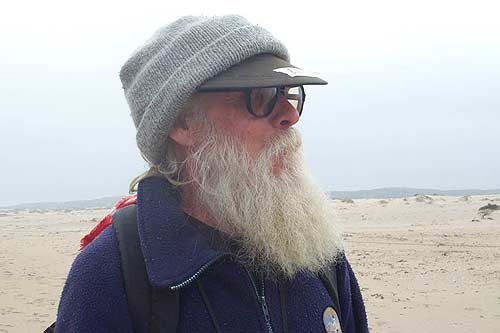
August 18: Santa Barbara Guadalupe Dunes to mile post 2.82 on Brown Road. 14.1 miles Last night we stayed in the hostel/home of Bill Denneen. Bill is an environmental legend and long an advocate for the Nipomo Dunes habitat and the Point Sal region. Bill’s hostel is not describable by a poor scribe such as me. A competent novelist with a large bag of adjectives needs to be called in for that duty. (Note from Linda: I will say that his one acre of Mesa home-ground includes, besides the house, goats, horses, chickens, organic garden, fruit trees, a surrey and no lawn. Inside are stacks and piles of material devoted to dunes preservation, getting vehicles off the dunes and activism. These activities are all more important than housekeeping.)
Bill is leading us on a hike to his favorite place in the world; the place he has devoted some 40 years of his life to, and for which he feels very passionate, Point Sal. He says he worried if he could still make it all the way and keep up with us. We assure him that we are happy to be with himat his pace.
The walk starts out as a beach walk, but soon we are walking up a slant toward the summit of Mussel Rock Dune at some 280 ft elevation. This walking is on soft sand and on a steep gradient for much of the way. Sometimes we hit a welcome patch of hard sand for several yards. As we walk along, we come upon remnants of past times: first a World War II vintage roadway built so that guards could protect this section of the coast from a possible invasion; then second, a huge midden of perhaps several acres, comprised of rock chips and shell fragments left from millennia of the Chumash-peoples habitation.
At the top of the dune, we take a break and then find a metal rod driven in the ground: the tie-off for a rope descending down to Mussel Rock Dune Creek many feet below. The rope is not really necessary for safetys sake but is reassuring as we walk or run down the steep soft sand. This stream ends at a drop off to the beach, so we follow a trail parallel and above the beach until we find a sandy spot to descend to the beach itself.
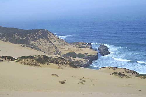
We are now on Paradise Beach and follow it to its end toward Point Sal, where we begin another ascent through sand, stopping along the way for our lunch break. Then, in the fog, we walk the ridge away from Point Sal, occasionally catching glimpses of Point Sal Beach (at the end of the washed out and closed Brown Road) and, to the south, Vandenberg Air Force Base. Walking the ridge turns out to entail several steep ascents and descents as we move higher and higher, perhaps a little like climbing a scaly dragon’s back, until we reach a point at approximately 1,200 feet. We then descend a short way until we achieve Brown Road. At this point, we are beyond a locked gate prohibiting vehicles, so we descend some miles more before we catch up with the Melmobile. But this is not the end of this trip. We continue a few more miles down the road, past ranch lands, to lessen the mileage the next day.
Our dinner is in Guadalupe at the home of John Moule. Assisting him is Philip Teresi. Both are members of the Surfrider Foundation. We celebrate Mel’s birthday; which one it is, he does not say. (Jon Breyfogle; photos by Linda Hanes)
Left: Bill Denneen. Right. Tip of Point Sal.