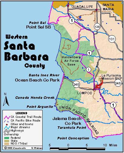


August 20, Santa Barbara County Intersection of Lompoc-Casmalia Road to Intersection of Floradale Avenue and Ocean Avenue. 12.9 miles
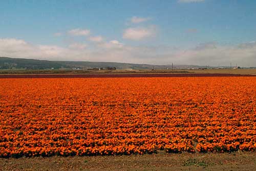
Our campsite last night was at the Lompoc River Park, situated next to a seed farm. Our campsite was next to fields of purple and orange blossoms whose seeds would soon to be sold across the country.
The first order of business was a check-in at the Vandenberg AFB Visitor’s Center to make sure our route wasn’t interfering with the new and tighter security at the base. Having the OK, we proceeded.
From our start point, the Lompoc-Casmalia road is closed to traffic but hikers can use it. This route is different from that described in Hiking the California Coastal Trail and is a little shorter. This route includes a long ford across San Antonio Creek, perhaps as much as a quarter mile. For 200 feet the roadway is mid-calf deep in water. With shoes off, it is an easy ford. Some in our merry band have a thing for alternative trails. Thus, while two of us waited after having waded the short wet stretch along the road , the rest thrashed about in the swamp nearby, hoping somehow to avoid the perils of calf-deep water on the road. After some 20 minutes, we coalesced as one group again and continued along on the road with wet boots.
The Lompoc-Casmalia road took us directly to the Vandenberg AFB main gate. From that point on, according to the book, we were to travel Highway 1 – here a four lane divided highway. Mike Minky, our section hiker, discovered a little dirt road paralleling the highway – an access way along various utility pipes and lines. We used this, avoiding the traffic, which was perhaps 100 feet to our left. After about 2 miles, this petered out and we were forced onto the highway shoulder.
We continued on Highway 1 for another mile or two until Santa Lucia Canyon Road. Deviating again from the CCT in the book, we took this route to escape the traffic. Within a half-mile, two members of the Vandenberg AFB police stopped us! We had been reported by someone as being a suspicious looking crowd, so the police were there to check us out. Apparently, we did not have the patina of terrorism upon us, and we were allowed to pass on.
Immediately, we began traversing through the Lompoc Federal Prison facility. It appeared that if you were really bad, you’d be in the penitentiary; if you were only just bad, you’d end up behind the concertina wire of the Correctional Facility, and if you’d been convicted of a white-collar crime, it would be the Intensive Confinement Unit for you. Government is a big business in this area.
Past this facility, we had only a couple of miles to go through fine, rich bottom land devoted to agriculture. We passed fields of celery, asparagus and bush beans and then walked among fields devoted to seed production of both vegetables and flowers.
After meeting up with the Melmobile, we drove to Jalama Beach County Park where the gatekeepers had never heard of us or our reservation for the night. Diana was able to set them straight with her famous friendly persuasion, so we got a nice group campsite all to ourselves. (Jon Breyfogle; photos by Linda Hanes)
Left: Flower seed fields. Right: Walking an unused road.
