
Usage Notes

Legend: For details on the icons and trail colors, please click the legend icon on the map above.

Layers: Other layers are available. See the California Coastal Commission and Coastal Conservancy Completed Sections layer for the official completed trail segments. (About progress on the trail completion project.)
Del Norte Section 5
Battery Point to Enderts Beach Trailhead, Redwood National Park
The city walk through Crescent City continues for the first two miles of this section, the real beauty here being that you walk right past the heart of downtown without getting bogged down in it. 1f you choose to leave CCT to shop or have a meal out or a capuccino, or even to check into the Holiday Inn for a night of R&R, it's all there in the first mile. The second mile explores the marine heart of town with seafood cafes, fishing boats and canneries along the route. Suddenly when you get to Crescent Beach, the city rapidly falls away and you approach the rugged wilderness coast of Redwood National Park.
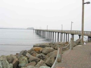
The CCT follows the waterfront northeast over the breakwater. (A side trail follows the breakwater ¾ mile for a whale's eye view of town and sometimes a close-up look at migrating whales.) Descend the paved path from the breakwater to walk past the sewage treatment plant, quickly coming to Howe Drive at ⅛ mile.
A paved bike path parallels the length of Howe Drive on the bay side. Follow that path through Fred Endert Park, leaving the coast to follow Elk Creek upstream. The path passes the city indoor swimming pool at ½ mile. Continue along the creek until ⅝ mile where the Redwood National Park Information Center is across Front Street. Follow the paved service road upstream to a bridge across the creek beside Highway 101 at ⅜ mile.
After you cross the bridge, the route of CCT becomes vague and tricky to follow. Basically you want to follow the waterfront southeast through the marina district. Beyond the Elk Creek bridge, veer right on a dirt trail and pass the entrance to Shoreline RV Park and Campground. Jog northeast briefly then follow a paved road east. Before one mile Sunset House Antiques is on your right. Turn right and walk along the edge of the parking lot, then walk southeast on a gravel track behind the Holiday Inn. Continue on grassy track, following it as it turns a southwest toward the waterfront.
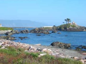
You reach the waterfront at 1⅛ miles. Turn southeast and walk to the Small Boat Basin. Follow its perimeter east past a restroom, then south and west through the parking lot to 1½ miles. Turn left and walk through the vehicle entrance to the boat basin. The paved street straight ahead is called Starfish Way. Follow it a past a couple of seafood restaurants and another RV park. When Starfish Way ends at 1¾ miles, turn right on the road signed "MARINA." In 250 feet you have easy access to Crescent Beach on your left, stretching southeast. Another restroom is just beyond. (Another side trail heads seaward along the southern breakwater out to Whaler Island, a l- to 1½-mile round trip.) At high tide you may have to veer east along the highway briefly before you are able to walk out onto the beach. But at medium to low tide, just scramble down the rocks of the breakwater and walk along the broad tidal flat of Crescent Beach.
CCT follows the beach for nearly 2 miles. (Crescent Beach continues south for about one mile beyond that point. You can use it as an alternate route, but it is difficult to find the volunteer trail that climbs the bluff to join the main route.) Look for the trail east through the vegetation above the beach at 3⅜ miles. Follow the path past the Crescent Beach Picnic Area and restrooms and east across Enderts Beach Road, climbing to a terrace 80 feet above sea level where the path ends at a grassy trail running north-south.
Turn south and follow the CCT as it contours along the marine terrace. It descends to cross the paved road again at 4¾ miles. The path continues south on the west side of the road, dropping to cross a bridge across Cushing Creek in a beautiful wooded spot. A picnic table overlooks the verdant scene. The path climbs from the creek to parallel the paved road. At the top of the hill at 5⅜ miles you come to Crescent Beach Overlook, which has a deck from which you can survey the coast you just walked. Picnic tables are nearby. Del Norte Section 6 starts 300 feet south where Enderts Beach Road ends.
SUGGESTED ROUND TRIPS & LOOPS: From the Crescent Beach Picnic Area, you have a pleasant walk north or south along CCT. If you go north, you can stop for a seafood lunch.
Distance: 5⅜ miles (8.6 kilometers).
Open to: Hikers, town portions open to bicyclists, Crescent Beach open to equestrians.
Surface: Paved trail, city streets and parking lots, dirt trail, beach.
Access point: Battery Point Overlook.
How to get there: From Highway 101 in Crescent City, turn west on Front Street, then turn left on A Street and drive to its end.
Other access: Various places along the Crescent City waterfront.
Difficulty: Easy
Elevation gain/loss: 220 feet+/ 20 feet-.
Cautions: The north end of Crescent Beach may be impassable at high tide.
Further information: Redwood National and State Parks (707) 464-6101.
Facilities: Restrooms and picnic area at Access Point. Grocery store, picnic tables, restrooms and more along the way.
Campgrounds: Shoreline Campground lies in the heart of town along the route. Walkin primitive campground at Nickel Creek is ½ mile south of south end. You can car camp at nearby Jedediah Smith and Del Norte Coast Redwood State Parks.
Lodging: Many motels in town.
Points of Interest

In the News
Interested in contributing to this project?
Register to add new photos and information, update existing results and share your trip reports.