Usage Notes

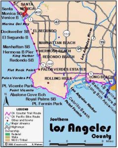
Legend: For details on the icons and trail colors, please click the legend icon on the map above.

Layers: Other layers are available. See the California Coastal Commission and Coastal Conservancy Completed Sections layer for the official completed trail segments. (About progress on the trail completion project.)
Los Angeles Section 4
Malibu Pier to Topanga County Beach
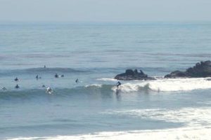
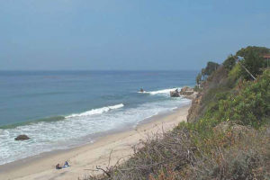
This unique walk along the Malibu coast takes the hiker on beaches lined almost solidly with houses. The route takes you under the houses built out on the beach on pilings, but at higher tides the only alternative is to follow the shoulder of busy Pacific Coast Highway for the entire distance. Be cautious on either route. Along most of the beach, private access is gated and retreat is limited. Inland from the shore and highway, the Santa Monica Mountains rise to towering heights. At Surfrider Beach on a dramatic cove next to the Malibu Pier, a good surf break and the warm climate encourages surfers to indulge their passion here and all along the Malibu coast year round.
From Surfrider Beach walk under the pier and down the beach past the mouth of Jerry's Canyon to pass the beach accessway at ¼ mile named for the famous Doonesberry comics tanning champion, Zonker Harris. Beyond it, houses crowd narrow Carbon Beach, so you may be dodging in and out among the house pilings, especially at higher tides. You may wonder how long these houses can stand up to winter-storm surf.
Walk around a small rocky point at 2 miles where the seasonal creek from Carbon Canyon empties into the Pacific. After rounding the point, continue on La Costa Beach, also lined with homes. At the next point at 2¾ miles, the CCT crosses the mouth of Las Flores Canyon's creek to encounter a large restaurant perched on riprap. Carefully negotiate the rocks to reach Las Flores Beach. If you reach the point when it's impassable, you have two choices. If you are there at high tide, the best choice is to wait for the tide to go out so you can continue down the beach. The only other choice is to turn back because there are no public access points in this area.
Assuming you find a way through, continue along Las Flores Beach, lined with more houses. Around 3½ miles the beach and tidal zone becomes rocky at aptly named Big Rock Beach. Continue along that narrow strand with more houses lining the top of the beach, particularly on its east end. At 4⅛ miles a long metal stairway that descends from 20000 Pacific Coast Highway reaches the beach. Our path rounds a point before 4½ miles, passing another stairway then the mouth of Piedra Gorda Canyon. The beach here is lined with yet more houses, but passable.
Continue along the tideline to Las Tunas County Beach starting around 5⅛ miles, where you find a break in the houses lining the beach for the next ¼ mile.
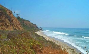
The narrow rocky beach here floods at high tide. You can scramble up to the road shoulder if the tide blocks your passage. If the beach is passable, walk on down the beach along eroding low bluffs. After the mouth of Pena Canyon at 5⅜ miles, walk past more houses lining the top of the beach.
Pass the mouth of Tuna Canyon around 5¾ miles, then continue to the next point where a lifeguard station and parking lot mark the section's end at Topanga County Beach at 6¼ miles. The rocky point here also marks the end of the famed 27-mile Malibu Coast.
Distance: 6¼ miles (10.1 kilometers).
Open to: Hikers.
Surface: Beach, tidal rocks. Road shoulder if the tide is high.
Access point: Malibu Pier.
How to get there: Malibu Pier is south of Highway 1 in the 23000 block, 12 miles west of Santa Monica and a few blocks east of the Malibu City Center.
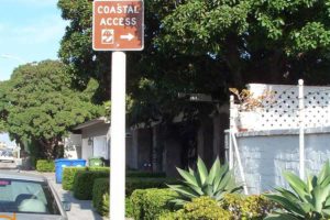
Other access: Zonker Harris Accessway, 22670 block of Pacific Coast Highway. Stairways at 20300 and 19900 Pacific Coast Highway. Las Tunas County Beach, 19400 block of Pacific Coast Highway.
Difficulty: Easy
Elevation gain/loss: Negligible.
Cautions: Beaches close at sunset. Beaches and rocky areas impassable at higher tides so time your walk with a low or outgoing tide.
Further information: Adamson House, State Parks (310)456-8432, Los Angeles County Lifeguard Service, Central Section (310)394-3264.
Facilities: Parking, restrooms, picnic tables and urban facilities at Malibu Beach and Topanga County Beach.
Campgrounds: Malibu Creek State Park campground, 5.5 miles inland on Malibu Canyon Road, has 63 sites. Malibu Beach RV Park (310)456-6052, adjacent to Dan Blocker State Beach, has 50 tent sites and 140 RV sites.
Lodging: Many motels and hotels can be found along Pacific Coast Highway. Santa Monica Hostel (310)393-9913 is near Section 5.
Points of Interest
In the News
Interested in contributing to this project?
Register to add new photos and information, update existing results and share your trip reports.


