
Usage Notes

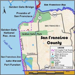
Legend: For details on the icons and trail colors, please click the legend icon on the map above.

Layers: Other layers are available. See the California Coastal Commission and Coastal Conservancy Completed Sections layer for the official completed trail segments. (About progress on the trail completion project.)
Marin Section 10
Rodeo Beach to Golden Gate Bridge North Vista Point, Golden Gate National Recreation Area
This hike starts from a popular beach at a former military base and ends at one of the world's great tourist attractions. Expect variety and dramatic views as you traverse the steep hills of the Marin Headlands. Unless the fog is in, you'll see the entire San Francisco peninsula, San Francisco Bay with Angel and Alcatraz Islands, Oakland and Berkeley on the east shore, and the hills ringing the bay.
From the parking lot at Rodeo Beach, walk south on the sand, or over the bridge if the lagoon mouth is open to the ocean, to the far end of the beach at ¼ mile. Turn inland to a junction. The side trail on the right climbs past World War II military fortifications to the Point Bonita Lighthouse, 3¾ miles round trip. Go left on the Lagoon Trail along the south shore of Rodeo Lagoon at the base of the hill. You climb slightly on sandy tread, then drop back near the lagoon shore and come to the parking lot for the Marin Headlands Visitor Center around one mile.
Across the lot, Field Road and Bodsworth Road intersect. Walk up Bodsworth for 200 feet to find the trail as it climbs steps through an often muddy area. The trail contours along a sidehill then makes a steep but short ascent to a trail junction at 1¾ miles. Turn left and descend. At 2 miles turn right, climbing steeply for less than ¼ mile. Just before a gravel road, the trail turns left and parallels the road ⅛ mile before coming to another junction at 2⅜ miles.
The trail drops downhill to intersect a wide gravel multi-use trail at 2¾ miles. Turn right to follow edge of the old military rifle range then climb gently through coastal scrub behind the range. Watch for fast bikes coming down the hill for the next 1½ miles. At the top at 4¼ miles, the tread ends at the corner of McCullogh Road and Conzelman Road. Step carefully across Conzelman Road for the spectacular views of San Francisco Bay and its entrance, the Golden Gate Bridge, and San Francisco spread out below. The bridge presents one of the world's greatest meetings of a human structure with the natural landscape.
Recross Conzelman Road and walk north down McCullogh Road for a few yards. Take the Coastal Trail (a fire road) on the right to climb steeply. At 4⅞ miles leave the fire road, turning left onto a trail. (The fire road continues to the top of Slacker Hill where vistas include Marin Headlands, Berkeley and Oakland across the bay, and Highway 101 at the bottom of the ridge.) CCT takes the well graded trail, descending a sidehill toward the bridge, coming to Conzelman Road at 5⅝ miles. Cross the road and descend to 6 miles. At the bottom cross a parking area and take the stairway that leads to a catwalk under the bridge. Cross the catwalk to the Golden Gate Bridge North Vista Point at 6⅛ miles, the end of the Marin County chapter of the California Coastal Trail. Visitors from all over the world usually crowd the vista point, and for good reason. The views of the bridge, the Bay, and San Francisco are fantastic.
ALTERNATE ROUTE: This route replaces a short section from the Marin Headlands Visitor Center to the rifle range and eliminates several short steep climbs and good views, but involves a little road walking. From the visitor center walk up Bodsworth Road and instead of taking the Coastal Trail, continue on the road. At ¼ mile pass the Marin Headlands Hostel. Continue along the road as it curves around old military buildings and a parade ground. Come to Bunker Road at ¾ mile. Cautiously walk the road for ¼ mile, then go right on the Coastal Trail along the rifle range as described above.
SUGGESTED ROUND TRIPS & LOOPS: The side trail to Point Bonita offers a good hike. Get a map at the visitor center to find more of the abundant trails and loops in the Marin Headlands portion of Golden Gate National Recreation Area.
Distance: 6⅛ miles (9.9 kilometers).
Open to: Hikers. Bicyclists on part.
Surface: Trail.
Access point: Rodeo Beach.
How to get there: From Highway 101 take the Sausalito exit at the north end of the Golden Gate Bridge. Go north towards Sausalito .5 mile then left on the road marked 'MARIN HEADLANDS VISITOR CENTER." Drive through the tunnel and go about 4 miles to Rodeo Beach.
Other access: Along Conzelman Road.
Difficulty: Moderate
Elevation gain/loss: 940 feet+/820 feet-.
Cautions: Dangerous surf at Rodeo Beach.
Further information: Golden Gate National Recreation Area (415) 331-1540, ask for a TDD line if you need one.
Facilities: Water and restrooms at Rodeo Beach and the Golden Gate Bridge Vista Point.
Campgrounds: GGNRA has several campgrounds. Call (415)331-1540.
Lodging: Many accommodations available in Sausalito and San Francisco. Marin Headlands Hostel (415)331-2777.
Points of Interest
No individual points found.
In the News
Interested in contributing to this project?
Register to add new photos and information, update existing results and share your trip reports.