
Usage Notes

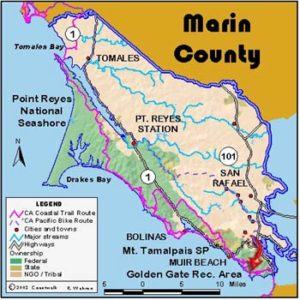
Legend: For details on the icons and trail colors, please click the legend icon on the map above.

Layers: Other layers are available. See the California Coastal Commission and Coastal Conservancy Completed Sections layer for the official completed trail segments. (About progress on the trail completion project.)
Marin Section 9
Muir Beach to Rodeo Beach, Golden Gate National Recreation Area
This challenging section of the Coastal Trail features remarkably steep climbs through wild coastal hills for rewarding ocean and urban views, solitude, and fine coastal sage scrub. Although you can see San Francisco from the ridgetops, the trail has a wilderness feeling. Here the CCT starts a lengthy run through the Golden Gate National Recreation Area. See the feature on the next page. From here the Coastal Trail also follows the shoreline of the Monterey Bay National Marine Sanctuary for the next 360 miles. See The Monterey Bay National Marine Sanctuary essay for more.
From the south end of the Muir Beach parking lot, walk across the bridge over Redwood Creek. The Coastal Trail sign informs you that it's 5⅞ miles to Rodeo Beach. The trail heads inland, meeting the Green Gulch Trail on the left at ⅛ mile. Up Green Gulch Trail ¾ mile east, the renowned Green Gulch Farm shelters a Zen Meditation Center and an organic produce garden. Green Gulch Trail bisects the gardens and continues up into the hills.
Continue on the Coastal Trail, climbing steeply. You ascend 500 feet to the Fox Trail intersection at ¾ mile, where the views of San Francisco and Mount Tamalpais are stunning. Hikers want the Coastal Trail on the right. Bicyclists, not allowed on the narrow steep section ahead, can pedal above it on the Fox and Coyote Ridge Trails. The Coastal Trail contours high above the surf across steep slopes with views down plunging cliffs as it winds through deep drainages. Descend into the largest drainage where tiny Pirates Cove is tucked at the base of rugged cliffs. A spur on the right drops 100 feet to an overlook.
Stay to the left to climb steeply, gaining 450 feet before you meet the Coyote Ridge Trail at 1¾ miles. You have more great views at the junction, or can take the short spur on the right to a bluff overlooking the vast ocean. The Coastal Trail veers left, descending steeply on a wide trail (bikes allowed) to the popular Tennessee Valley Trail at 2½ miles. A right turn leads ⅝ mile to Tennessee Cove Beach. Turn left and follow the Tennessee Valley Trail for 200 feet to another fork. Left leads to the Tennessee Valley Trailhead in 1⅜ miles.
Turn right and descend the Coastal Trail through a meadow. Cross the footbridge over Tennessee Valley Creek at 2⅝ miles and contour along the base of the hill before climbing steeply to Wolf Ridge. At the top at 3⅞ miles, the trail makes a hard right turn to the west. The Wolf Ridge Trail which forks east on pavement climbs ¼ mile to a derelict Nike missile base atop Hill 88 with grand 360-degree vistas. Follow the Coastal Trail, which mostly follows an old paved military road from here, along the ridge towards the ocean. You drop down the ridge past several World War II gun emplacements. At 4⅜ miles the paved road ahead has been closed by a major slide. Take the path down the stairs through dense coastal scrub. Rejoin the paved road by 4¾ miles and descend past another defunct battery to the parking area at Rodeo Beach and this section's end at 5⅞ miles. Across the road, Rodeo Lagoon backs up behind the beach. This valley, site of the former military installation Fort Cronkhite, now hosts peaceful uses in the renovated buildings, including the Headlands Institute Conference Center and the Marine Mammal Center.
SUGGESTED ROUND TRIPS & LOOPS: The choices are too numerous to mention. Get the trail map available at the Marin Headlands Visitor Center on Bunker Road near Rodeo Beach. It shows loops and round trips you can make from Pantoll, Muir Beach, Tennessee Valley, Rodeo Beach and other locations.
Distance: 5⅞ miles (9.5 kilometers).
Open to: Hikers. Bicyclists and equestrians on part.
Surface: Trail, paved trail.
Access point: Muir Beach.
How to get there: Exit Highway 101 at Tamalpais Valley 3 miles north of Golden Gate Bridge onto Highway 1, follow it 6 miles to Muir Beach and turn left into parking area.
Other access: Tennessee Valley Trailhead.
Difficulty: Hard
Elevation gain/loss: 1700 feet+/1700 feet-.
Cautions: Part of this walk is very steep.
Further information: Golden Gate National Recreation Area (415)331-1540, ask for a TDD line if you need one.
Facilities: Water, chemical toilets, and picnic tables at Muir Beach and Rodeo Beach.
Campgrounds: Several backpack and group camps are located in the Marin Headlands. Contact the GGNRA for more information.
Lodging: Mill Valley, Sausalito and other towns along Highway 101 have plenty.
Points of Interest
No individual points found.
In the News
Interested in contributing to this project?
Register to add new photos and information, update existing results and share your trip reports.