
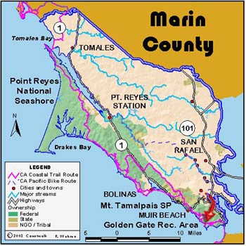
July 15: Marin County
Pan Toll to Rodeo Lagoon. 10.6 miles
At Pan Toll we met our guide, Paul McKown, Andrew Bley, who has joined us for a second day of GIS data gathering, and, David Harp. David is a notable Marin County Land Surveyor. Once out of the forest surrounding the campground area, we could see our entire day’s journey before us. All was in sun save San Francisco, as the fog was coming in the Gate. Almost immediately a Coyote loped away from us far down the trail.
We followed the Coastal Trail but did not take the Heather Cutoff. Instead we continued on until Highway One, crossed the road, and took an ad hoc trail down to the Owl Trail. At this point we were just south of Slide Ranch. This trail ended at the Muir Beach Overlook. Here one of the homeowners in the Muir Beach subdivision told us of a situation wherein some of the property owners had blocked a dedicated trail. We were given an address to write letters of protest and will, if the situation proves to be true. David Harp will check with the recorded map of the subdivision and report to us on the validity of this. Leaving the lookout, we continued through the subdivision using public streets and trail-staircases to Muir Beach itself. Then, again on the Coastal Trail, we ascended and then descended into Tennessee Valley, and then crossed another ridge and went down to Rodeo Lagoon. Along the way we passed bunkers used up until the Second World War as well as Nike missile sites in service until 1974.
Reaching the last ridge we could see the towers of the Golden Gate as well as the City beyond. There has been a rising level of anticipation as we prepare to make the big transition from rural to one of the premier cities in the world. (Jon Breyfogle; photos, Linda Hanes)
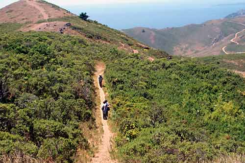
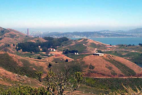
Left: View back of the Coastal Trail. Right: From afar, the Headlands Institute.