

July 14, Marin County
Palo Marin Trailhead to Pan Toll. 12.2 miles
Editor Note: Journals for July 12, 13, 14 have been published on 7-17.
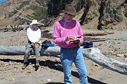
The day begins where we left off the day before. Alan King, from Novato, greets us as our leader for the day. Also present is Andrew Bley, geographic information systems coordinator for the Golden Gate National Parks Conservancy. He will be mapping the day’s hike and has his equipment with him. On a little wooden paddle he has attached a hand-held GPS unit hooked up to a Palm Pilot. Every 30 paces or so he takes a reading. When something special comes up a road crossing, a trailhead, a separate reading is taken. All of this is tied into longitude and longitude so that it can be applied to existing and future data.
Almost immediately, we pass a coast guard station with a new sign, our first brush with the Department of Homeland Security. A largish black dog came out barking; his idea of homeland security was to attempt to knock us over with a wagging tail.
We soon left the road and went cross-country through Golden Gate National Recreation Area lands to Agate Beach. This area, between Palo Marin and Bolinas, needs a trail installed to replace the informal cross-country route. Then, traversing Agate Beach, we came up into the Big Mesa area of Bolinas. On our way, we found a property-corner monument set by the noted Marin County surveyor, Phil Danskin.
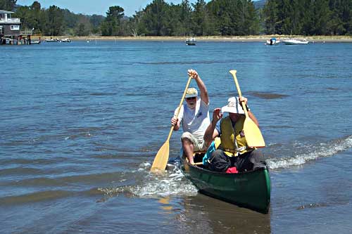
Approaching Brighton Beach, 4 surfers in a Toyota, upon hearing of our walk, responded with “Are you all water signs or something? At the Bolinas Lagoon channel, we found Tom McFarland, canoeist and Coastwalk co-founder, who proceeded to ferry us across to the end of the Seadrift sandpit. The Seadrift community is strictly private, but we can walk upon the beach and do so. At Stinson Beach, we stop to visit Wynn Hoag at his Wildnature photo gallery. Wyn provided cool drinks and cookies, which were very welcome.
Leaving Stinston Beach, we begin walking up the Dipsea Trail and after a mile or so turn off to walk the Steep Ravine Trail. This is a beautiful trail in the shade of tall redwoods with a lovely stream beside it. It is so beautiful that the talk among the walkers soon turns to things spiritual. Someone suggests that the answer to WWJH Where would Jesus Hike? is the Steep Ravine Trail. At an elevation of perhaps 1,500 feet, we reach Pan Toll and the Melmobile. There in the parking lot is Ed Callaert, photographer for the California Coast calendar published by Brown Trout. We have had a contest going for some time: who have we seen at the two most distant points on our journey? A gentleman we met twice on the North Coast was the current winner, but Ed, whom we met in Del Norte, now holds the record. Time will tell if he gets the grand prize.
The day was finished with a drive to Muir Beach and a delightful hot tub-shower-dinner at the home of our hostess, Carol Lankford-Gross. (Jon Breyfogle; photos, Linda Hanes)
Left: Crossing Bolinas Lagoon. Right: Andrew Bley taking GPS reading on a Bolinas beach.”>