
Usage Notes

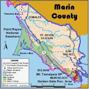
Legend: For details on the icons and trail colors, please click the legend icon on the map above.

Layers: Other layers are available. See the California Coastal Commission and Coastal Conservancy Completed Sections layer for the official completed trail segments. (About progress on the trail completion project.)
Marin Section 8
Pantoll, Mt. Tamalpais State Park, to Muir Beach, Golden Gate National Recreation Area
This section of the Coastal Trail starts high on the flank of Mount Tamalpais, dropping dramatically down to sea level at popular Muir Beach. The trail provides exceptional views when it's clear, but be prepared for wind and fog. Mount Tamalpais State Park, Muir Woods and surrounding lands have been attracting visitors for years because of the beautiful scenery and stunning views from the top of the mountain. Weekends find the extensive trail system full of hikers.
From the main parking area at Pantoll, follow the paved road south past the famous Steep Ravine Trailhead for about 200 feet. Go left down the Old Mine Trail. At ¾ mile you cross the Dipsea Trail. Continue south downhill on the wide Coastal Trail as it follows the ridgetop through grasslands and coyote brush. This fire road trail allows bicycles. Just before 2⅝ miles turn left on the Heather Cutoff. This single-track, carefully constructed trail snakes down a steep hill to Frank's Valley and Muir Woods Road. At 4 miles at the bottom of the hill, turn right past the corrals and large group picnic area, cross the creek on a footbridge up the driveway, and cross Muir Woods Road. Across the road and a short way uphill turn right on Redwood Creek Trail. The trail parallels above the road before dropping down to the pavement just before the intersection with Highway ~ at 4½ miles. Carefully cross the road and walk the shoulder for about ¼ mile to Muir Beach Road. The Pelican Inn, fashioned after an English country pub, is on the corner if you are thirsty or want a place to sleep. Walk down Muir Beach Road about 300 feet to a gated and unsigned fire road on the left. Go around the gate and walk down the fire road to scenic Muir Beach. The road ends at 5 miles at a bridge over Muir Creek. Walk across the bridge to find picnic tables and a parking area. The beach is a few yards away over the low dunes.
SUGGESTED ROUND TRIPS & LOOPS: From Pantoll, trails radiate in every direction, providing many enjoyable hiking routes on Mount Tamalpais.
Distance: 5 miles (8 kilometers).
Open to: Hikers. Bicyclists on part.
Surface: Trail.
Access point: Pantoll, Mount Tamalpais State Park.
How to get there: From Highway 101 at Tamalpais Valley Junction take Highway for 3 miles to Panoramic Highway and turn right. Continue 5 miles to Pantoll.
Other access: Muir Woods Road, Pelican Inn.
Difficulty: Moderate
Elevation gain/loss: 40 feet +/1500 feet-.
Cautions: Take it easy on the steep descents.
Further information: Mount Tamalpais State Park (415)388-2070. Golden Gate National Recreation Area, Marin Headlands (415)331-1540, ask for a TDD line if you need one.
Facilities: Water, restrooms and visitor center at Pantoll. Water, toilets at Muir Beach.
Campgrounds: Pantoll Campground and various campgrounds in the GGNRA
Lodging: Pelican Inn, Muir Beach.
Points of Interest
No individual points found.
In the News
Interested in contributing to this project?
Register to add new photos and information, update existing results and share your trip reports.