
Usage Notes

Legend: For details on the icons and trail colors, please click the legend icon on the map above.

Layers: Other layers are available. See the California Coastal Commission and Coastal Conservancy Completed Sections layer for the official completed trail segments. (About progress on the trail completion project.)
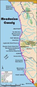
Mendocino Section 19
Anchor Bay to Gualala Point Regional Park Visitor Center
The final Mendocino County section primarily offers yet another span of road walking, most of it along the shoulder of busy Highway 1. But we'll stick our necks out to say that the worst of the highway walking is over as the highway from Anchor Bay to the Sonoma County line has fewer curves and broader shoulders than previous sections. You're even able to get off the highway on several lengths of quiet side road, mostly through residential neighborhoods where the ocean glimmers close by.
Follow the wooded highway shoulder southeast out of Anchor Bay, crossing Quinliven Gulch and climbing over a small rise before descending to cross Getchell Creek at ½ mile where the ocean is once again just west of the highway. Walk the shoulder across gullies, then across St. Orres Creek at one mile. Then walk past the distinctive onion-dome architecture of Saint Orres Inn & Restaurant and dip across Glennen Gulch. You leave the pine forests here for mostly open grasslands.
At 1⅜ miles where unmarked Old Coast Highway forks right, take it for a short but quiet respite from highway walking. It passes sheltered Cooks Beach and climbs over the point that held the 1870 lumber loading chute called Bourn's Landing. A wide gauge railroad ran from Bourn's to the Gualala sawmill, and the CCT follows much of its route for the next 2 miles.
The side road ends by 1¾ miles, returning you to the highway shoulder.
Follow it around a curve, along a straightaway and down to another unmarked fork on the right at 2¼ miles. There you veer right on sleepy Old Coast Highway. Walk it to 2⅜ miles where you must turn left to climb quickly back to the highway. Turn right and walk the shoulder over deep Big Gulch.
At 2⅞ miles the Coastal Trail again veers right, following suburban Robinson Reef Road out onto Robinson Point. Beyond 3⅛ miles you must turn left on Westward Ho Road, then go right on Pacific Drive until it returns you to the highway before 3½ miles. Walk the highway shoulder as it dips across Robinson Gulch, then turn right and follow Sedalia Drive to 3¾ miles. Go right at Hubert Drive on the continuation of Sedalia to unmarked Ocean Drive where you can again go right, staying near the coast to the end of Ocean Drive at 4 miles. Then you must return to Highway 1.
Turn right and follow Highway 1 as it passes through the center of the town of Gualala. After you pass the landmark 1903 Gualala Hotel on the left, the town quickly thins out. By 4⅜ miles you've left town and now overlook the broad estuary of the Gualala River. From here you can follow a wide highway shoulder to the river bridge at 4⅞ miles. Parking is available on the left at the north end of the bridge.
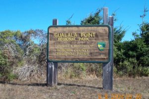
Cautiously cross the narrow bridge, entering Sonoma County about half way across. Just 60 feet from the south end of the bridge, the Coastal Trail veers right to descend a rudimentary trail down a steep embankment. At the bottom you pass through a break in the fence and meet the River Trail in Gualala Point Regional Park. A right turn would lead to the park campground, but the Coastal Trail goes left, crossing the river flat briefly, then ascending the face of the bluff by two switchbacks. When you reach the blufftop at 5⅛ miles, turn right and walk the trail between the park road and the bluff's edge. You pass a pleasant picnic area in ⅛ mile, then come to the parking lot with the visitor center just beyond. Welcome to Sonoma County, Coastwalk's home base.
ALTERNATE ROUTE: None, unless you stay on the highway shoulder and avoid the quieter side roads.
SUGGESTED ROUND TRIPS & LOOPS: The side trails to the shoreline at Collins Landing and Gualala are short pleasant detours to explore the spectacular coast. Longer loops and round trips are available in Gualala Point Regional Park. See Sonoma County Section 1.
Distance: 5¾ miles (9.3 kilometers).
Open to: Hikers. Bicyclists on road.
Surface: Highway shoulder, road shoulder, trail.
Access point: Anchor Bay.
How to get there: On Highway north of Gualala at Milepost 4.45, park near the commercial center of the small community of Anchor Bay.
Other access: Anywhere along highway.
Difficulty: Easy
Elevation gain/loss: feet+/370 feet-.
Cautions: Stay on road shoulder. Watch for traffic. Use extreme caution crossing highway.
Further information: Gualala Point Regional Park (707)785-2377.
Facilities: Restrooms, phone, water at access point. Gualala Point Regional Park has restrooms, phone, water, picnic area.
Campgrounds: Gualala Point Regional Park has a small campground near section's end along the river east of Highway 1. Salt Point State Park has campgrounds 18 miles south.
Lodging: Many in Gualala and Anchor Bay.
Points of Interest

In the News
Interested in contributing to this project?
Register to add new photos and information, update existing results and share your trip reports.