
Usage Notes

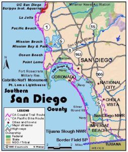
Legend: For details on the icons and trail colors, please click the legend icon on the map above.

Layers: Other layers are available. See the California Coastal Commission and Coastal Conservancy Completed Sections layer for the official completed trail segments. (About progress on the trail completion project.)
San Diego Section 5
San Elijo State Beach to Torrey Pines State Beach
This section of the CCT offers a real variety of landscapes and attractions. It passes three of the nine major coastal wetlands in San Diego County, some attractive beaches and beach towns. Nearby sits a race track built by film stars Bing Crosby and Pat O'Brien and attended by Hollywood's finest. It also crosses paths with a proposed greenway leading to a mountain range 55 miles inland. San Elijo Lagoon offers excellent bird watching.
At the base of the wooden stairs from San Elijo State Beach Campground, turn left and hike south on the rocky beach. If the tide is in, or you want to avoid walking on the rocks, then walk south through the campground to reach the outlet of San Elijo Lagoon. Either way the bluffs end and you meet the outlet channel at ⅜ mile. If the lagoon mouth is open and flowing, use the sidewalk of the highway bridge, then turn right and return to the beach (adds ⅛ mile).
Beyond the lagoon you follow Cardiff State Beach, another rocky strand. The large wetlands lie to the east beyond the highway. At ¾ mile a building atop riprap blocks the beach sO you may need to walk on the sidewalk around the building. Since the sloped, cobble beach presents quite difficult walking, consider following the sidewalk of the nearby highway for an easier path.
You reach the Cardiff State Beach parking lot at 1⅜ miles. In 1998 and 1999 storms carried away the once large sandy beach and severely damaged part of the lot and the concrete walkway overlooking the beach. At press time it looked like a disaster area.
Beyond the parking lot you can walk the narrow beach at the base of eroding yellow cliffs if the tide is low enough. Our described route follows the road's sidewalks. At the end of the lot, take the sandy path up to the highway. Upon reaching Plaza Street at 2¼ miles, you can turn right for a side trip to the beach at Fletcher Cove Park, also hit hard by 98 storms, but since replenished with sand from Yuma, Arizona. The described route continues on the road.
At 3¼ miles Old Highway 101 descends to San Dieguito Lagoon. The mouth of the San Dieguito River lies westward. The vital San Dieguito wetlands, although severely damaged, hold promise for restoration. Part of the damage done before the importance of wetlands was widely understood happened when the Del Mar Racetrack was built in 1937 on the lagoon. Today an ambitious plan calls for restoration of the lagoon and the river with creation of a 60,000-acre greenway featuring a 55-mile long trail all the way from the lagoon's mouth (and the CCT) to the 4000-foot Volcan Mountains near the town of Julien.
If the mouth of San Dieguito Lagoon is closed then walk down to the beach before the bridge. Otherwise cross the highway bridge, then return to the beach along the lagoon to its mouth, or cut down 29th Street a block down the road. Follow the wide sandy beach south, picking up bluffs at 4½ miles. At 4⅝ miles you come to the town of Del Mar's main beach at Seagrove Park, tucked at the base of 60-foot-tall bluffs. You can take a side trip a few blocks inland on 15th Street lO visit trendy downtown Del Mar.
CCT continues down the beach as the bluffs become higher. The steep sandstone bluffs rise 100 feet by 5⅝ miles where you're officially on Torrey Pines State Beach. In the event the beach is flooded at high tide, many locals use the path beside the nearby railroad tracks. Be advised that the tracks are marked "no trespassing" and are patrolled. The third option is to walk up 15th Street and make a right on Stratford Court. At the end of the street you'll find a series of informal paths down to the beach.
Whichever way you go, you reach the mouth of Peñasquitos Lagoon at 6⅜ miles. Use the highway bridge if the mouth is impassable, then return to the beach. The hike ends at 7 miles at the big parking lot for Torrey Pines State Beach where the road passes the parking lot entrance station before heading up the hill to Torrey Pines State Reserve.
SUGGESTED ROUND TRIPS AND LOOPS: Pick a good low-tide day to explore different parts of this route. You will be rewarded with relatively uncrowded beaches and interesting geology along the eroding bluffs as well as many examples of destructive seawalls. Start at Seagrove Park at Del Mar and walk to Torrey Pines State Beach for a 5-mile round trip. You can also start at Cardiff State Beach and walk to Seagrove Park, 6½ miles round trip.
Distance: 7 miles (11.3 kilometers).
Open to: Hikers. Bicyclists on streets.
Surface: Beach, trail, sidewalk.
Access point: San Elijo State Beach campground.
How to get there: Take the Birmingham Drive exit from Interstate 5 at Cardiff-by-theSea south of Encinitas. Drive Birmingham west to its end at Old Highway 101 where San Elijo State Beach campground is directly west.
Other access: Cardiff State Beach, Tide Beach Park, Fletcher Cove Park, Stairs at end of Sea Scape Surf and Del Mar Shores Terrace, Del Mar Bluffs City Park, Del Mar City Beach and Torrey Pines State Beach.
Difficulty: Easy
Elevation gain/loss: Negligible.
Cautions: Parts of the beach route are impassable at higher tides. Cardiff State Beach closes at sunset.
Further information: For San Elijo State Beach and Cardiff State Beach call District HQ (858)642-4200, for Tide Beach Park, Fletcher Cove Park and Seascape Shores call Solana Beach Department of Marine Safety (858)755-1569, Del Mar City Beach (858)755-1524, Torrey Pines State Beach (858)755-2063.
Facilities: Water, restrooms, picnic tables and parking at both ends and Seagrove Park.
Campgrounds: San Elijo State Beach has 171 sites and hot showers. Reserve early.
Lodging: Cardiff-by-the-Sea, Solana Beach and Del Mar have several choices.
Points of Interest
No individual points found.
In the News
Interested in contributing to this project?
Register to add new photos and information, update existing results and share your trip reports.