
Usage Notes

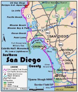
Legend: For details on the icons and trail colors, please click the legend icon on the map above.

Layers: Other layers are available. See the California Coastal Commission and Coastal Conservancy Completed Sections layer for the official completed trail segments. (About progress on the trail completion project.)
San Diego Section 6
Torrey Pines State Beach to La Jolla Shores Beach
This section visits some of the most dramatic scenery anywhere on the California Coast, with great geology and fossils, plant diversity and tranquility and relative solitude within sight of a city of million people. You walk a remote beach at the base of spectacular, eroding 300-foot sandstone cliffs cut by deep ravines. The high route takes you through Torrey Pines State Reserve. If you take the beach route, find time to come back and explore this reserve, one of the jewels of the state park system. See the adjacent feature article for the story of the rare Torrey pines. This walk can be done at low tide only. Time the start of your walk to coincide with an ebbing (retreating) tide. Then if you need to wait for the tide to recede as you walk the beach below the cliffs, you know that the tide is moving favorably. The route follows a mostly sandy beach with a few rocky tidepool areas, encountering piles of sandstone talus, huge boulders and big sheets of smooth rock.
From the parking area head south on the beach with the cliffs rising to 300 feet on your left by ¼ mile. The fantastically eroded light brown and yellow cliffs are dotted with Torrey pines and chaparral. Pass small deep canyons in the cliffs at ⅜ mile and ½ mile. By ⅞ mile you pass the deepest canyon yet. Beyond it at one mile you reach Flat Rock offshore and the lower end of the Beach Trail that descends from Torrey Pines State Reserve above, offering an escape route in case you misjudged the tide. You'll find excellent tidepools around Flat Rock.
At all but the lowest tides you may have to wade around the rocky point near Flat Rock to reach the beach beyond. Once you pass the point you can enjoy a long sandy walk in the relative solitude of lightly used Black's Beach. As you move south, you will encounter more people who reach the beach from the south end, either from Scripps Pier or via steep trails down the bluffs. You round another point at 1½ miles to pass another deep canyon around 1¾ miles. Continue down the sandy tideline past the deep canyon at 2⅜ miles to another canyon at 2⅞ miles where a steep stairway descends from the old glider landing strip at Torrey Pines City Park.
Black's Beach marks the scene of a battle between nude sun worshippers and more puritanical voters who outlawed nudity on this beach in 1977. It's been a standoff ever since, with nudity in serene surroundings being the norm in defiance of uptight rules against nudity. The wide beach allows room for everyone to follow their own peaceful pursuits whether in the buff or dressed for hiking. The northern end of the sometimes nude beach is favored by men, with the middle portion between 2 and 3 miles generally considered co-ed and the portion south of the stairway at 2⅞ miles generally favored by surfers and graced with the largest and best waves. Hang gliders grace the sky above, launching from the blufftop and riding on the thermal updrafts. As far as we know, nude hang gliding has not been outlawed.
Continue down the sandy beach at the base of the towering golden cliffs, passing beneath the 326-foot summit of the palisades. Black's Beach narrows as you near its southern end, marked by the paved service road and access/escape trail that winds down from Blackgold Road at 3⅝ miles.
Beyond Black's Beach the sand narrows even more. Soon the beach becomes slippery with tidal rocks. A steep tramway drops from the bluff 200 feet above to an out-of-place beach house perched atop a concrete column on the sand. The Scripps Pier comes into view as you scramble on rocks to reach the point, then return to sand, rounding the point at 4 miles. It may take a low tide to pass. The world famous Scripps Institution of Oceanography sits on the low bluff near the pier ahead. Walk toward it on the sandy beach or, if the tide is low enough, along the edge of the extensive tidepools beside the shore. Pass the pier at 4⅜ miles. After a final stroll down the wide, gently sloping strand of La Jolla Shores Beach, this section ends at 5⅛ miles at grassy Kellogg Park, marked by tall palm trees at the head of the gentle curve of La Jolla Bay.
ALTERNATE ROUTE: From the parking lot at the access point, walk up the winding entrance road, ascending the bluffs into Torrey Pines State Reserve. Local lore has it that when this was the coastal road in the 1920s, the cars would back up the slope because the steepness was too much for their forward gearing. You reach the attractive adobe building housing the Visitor Center at ⅞ mile where docents and park rangers gladly share knowledge of the Reserve. The little museum within covers much of the natural and human history of Torrey pines. Across the street and behind the restrooms, find the Beach Trail which drops down through dense chaparral and the eroded terrain yielding grand views on the way to Flat Rock around 2 miles. Use caution descending the last few hundred feet of narrow and slippery path. From Flat Rock, continue on the beach as described above.
SUGGESTED ROUND TRIPS AND LOOPS: From the Torrey Pines State Beach parking lot, take the road into the park to the Visitor Center, descend to the beach on the Beach Trail, and return to the parking lot for a stunning 3-mile loop. Take a side trip on one of several loops in the Reserve, the Parry Grove Trail and the Guy Fleming Trail, to visit the main groves of pines and add 1¼ miles to your hike.
Distance: 5⅛ miles for CCT,6⅛ miles for the upland alternate route (8.2,9.9 kilometers).
Open to: Hikers.
Surface: Beach.
Access point: Torrey Pines State Beach parking lot.
How to get there: From Interstate 5, take the Del Mar Heights Road exit or the Carmel Valley Road exit. Turn left on Camino Del Mar and follow it to the large parking lot for Torrey Pines State Beach on the beach side of the road.
Other access: Beach Trail from Torrey Pines State Reserve, Blackgold Road trail, Scripps Beach and Pier.
Difficulty: Easy
Elevation gain/loss: None for Beach Route. Torrey Pines Route: 340 feet+/ 340 feet-.
Cautions: This route must be done at low tide. Make sure you don't get trapped by rising tides. Torrey Pines State Beach parking lot closes at sunset. No dogs allowed. Food is not allowed in Torrey Pines State Reserve.
Further information: Torrey Pines State Reserve and Torrey Pines State Beach (858)755-2063, Torrey Pines Association, PO Box 150, La Jolla CA 92037, for La Jolla Shores Beach, call the San Diego Coastline Parks Division (619)221-8900, Scripps conn Aquarium (858)534-3474.
Facilities: Water, restrooms, picnic tables at Torrey Pines State Beach and La Jolla Shores Beach.
Campgrounds: San Elijo State Beach at the start of Section 5 has 171 sites and hot showers. Reserve early.
Lodging: La Jolla has abundant accommodations mostly on the high end, with La Jolla Cove Suites and the Radisson Hotel the most affordable choices. Or try the Crystal Pier Motel in Pacific Beach at the end of Section 7. San Diego has two hostels, Point Loma (619)223-4778 and Downtown (619)525-1531.

Interested in contributing to this project?
Register to add new photos and information, update existing results and share your trip reports.