
June 27: Mendocino County
MacKerricher State Park to Point Cabrillo Lighthouse. 14 miles
Yesterday, on our layover day, we hit Fort Bragg like the U.S. Navy’s Seventh Fleet hits San Francisco. Except that once free we didn’t head for bars and bordellos but rather to bistros and bookstores, ice cream shops and the laundromat. That all out of our system, our personal MP, Mel, drove us back to MacKerricher State Park, and after a good night’s sleep, we were ready this morning to continue our trek.
Our first guide for the day, Skip Wollenberg, met us at our campsite and at 8 AM, we were on our way. Skip is a consulting geologist working with watershed groups and also with private landowners. As well as showing us our way out of MacKerricher, Skip told us a bit about the geology of the area. It is all somewhat confusing, but in essence this part of the world is extremely unstable with the Pacific and North American plates in a state of active collision here. Added to this instability is a constant rising and falling of the sea’s level due to the coming and going of ice ages. The result is a series of sea terraces marching eastward and upward.
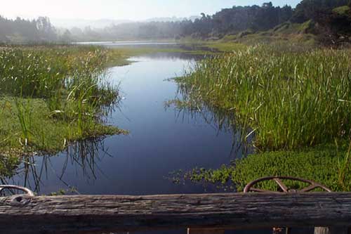
We first walked along a boardwalk to Laguna Point and later followed an old haul road towards Fort Bragg. This private road was built to haul logs to the mill site and now is a part of the State Park. When built, it cut off a lagoon at Cleone Beach from the sea, resulting in Cleone Lake, which converted to fresh water. But recent storms have breached the road, salt water has entered the lake and each storm is helping to convert the lake back into a brackish lagoon.
Fort Bragg, named after Civil War General Braxton Brag, is a town that depends more and more upon tourism and services as the basis of its economy. The Georgia Pacific mill is now shut leaving a 450 acre-vacant site between the town and the ocean. Whatever eventual development occurs on this parcel, it is important that a bluff-top Coastal Trail be a part of those plans.
Sign on a bus in Fort Bragg: “All who wander are not lost.”
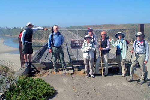
Just before the Noyo Bridge, Skip turned us over to Rixanne Wehren. Besides being our guide for the day, Rixanne is Coastwalk’s mapping consultant, and the one who draws the maps that accompany these journals. She has been active in Coastwalk’s activities with the Coastal Conservancy in implementing the mapping provisions of Senate Bill 908. Within minutes of taking over the reins, Rixanne lost her fine straw hat to a gust of cement truck-generated wind in the middle of the Noyo Bridge. The hat wafted down to a construction site below.
The rest of our day involved a great deal of road walking with a goodly amount of it on U.S. 1. It is still unpleasant, although with time it has become a little less frightening. My greatest fear is that one of us will be hit in the back of the head by the rear-view mirror of a rented RV driven by someone from the Midwest.
We occasionally were able to break away from the highway; we did so at Bromley Creek, where we had lunch on a bluff top overlooking a wonderful pocket beach. We sat on the green herbage of the bluff with lupine and paint brush, daisies and California poppies to brighten our lunchtime resting spot.
Leaving the creek, we regained the road through a gate that a local landowner unlocked for us. She apologized for the gate and wondered out loud, “Any unpleasant experiences?” “Haven’t been bitten by anything yet?”
The day ended as we went through Casper, forded the Casper River after walking through property recently acquired by the Mendocino Land Trust and The Coastal Conservancy, and reached the Cabrillo Lighthouse parking lot. (Jon Breyfogle; photos, Linda Hanes)
For trail section - Mendocino Section 8, Mendocino Section 9