
Usage Notes

Legend: For details on the icons and trail colors, please click the legend icon on the map above.

Layers: Other layers are available. See the California Coastal Commission and Coastal Conservancy Completed Sections layer for the official completed trail segments. (About progress on the trail completion project.)
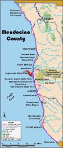
Mendocino Section 8
Pudding Creek Trestle, South End, Fort Bragg to Pine Beach Inn
You can walk many routes through Fort Bragg, but this one keeps you as close to the ocean and out of traffic as possible while still exploring the heart of the downtown area. The civilized amenities will likely be a welcome sight to anyone who has just walked the Coastal Trail through the Lost Coast.
Take the dirt path west across the grassy headlands above the mouth of Pudding Creek. The trail soon turns south along the rocky Pacific shore, passing through an area with abundant wildflowers, including several rare and endangered species. Beyond ¼ mile dip through a gully shaded with cypress, then follow the bluff's edge southwest. You soon overlook Glass Beach, a tideland that was once the city dump where one can find wave-polished glass, pottery and other trinkets. Several side trails descend to the popular beachcombing area.
By ½ mile the fenced lumber yards of Georgia-Pacific block coastal access to the south. Turn left and walk the pavement east to Elm Street at ⅞ mile. Walk the sidewalks of Elm Street one block east, then turn right and walk Stewart Street one block. Turn right and walk Spruce Street one block to its end, then head south on West Street. In this residential neighborhood, you can see the blue Pacific beyond the single row of houses.
After three blocks, West Street ends within sight of the big lumber mill. Turn left on Pine Street and parallel the railroad yard of the Skunk Train, California Western Railroad. Beyond Stewart Street, turn right and walk through the excursion train's parking lot to its depot where trains depart daily (except in winter) for the twisting 40-mile trip east to Willits on Highway 101. When the Skunk Depot or the adjacent Depot Shopping Mall is open, you'll find public restrooms inside. Turn east on Laurel Street, crossing Main Street/Highway 1 in one block.
(One block left is the North Coast Brewing Company, one of California's finest microbreweries.) Continue east on Laurel Street past Headlands Coffeehouse, the "Mount Rushmore of coffee heads." At the next corner, turn right and follow Franklin Street south through downtown. In two blocks you pass a supermarket and the post office around 2 miles. Continue south on Franklin to its end at North Harbor Drive at 2⅞ miles. Turn right and follow the left side of the street to Highway 1, which has the only bridge across the Noyo River.
Follow Highway 1 south over the Noyo Bridge and past McDonald's to the traffic signal at Ocean View Drive where you want to cross the highway. Follow its west side south past the traffic light at Highway 20 and over the Hare Creek bridge at 3¾ miles. Get off the busy highway at the first opportunity on its west side, namely Old Coast Highway, a quiet side street that keeps you off the highway until 4¼ miles.
From Simpson Lane to the Mendocino Coast Botanical Gardens, you must cautiously follow the Highway 1 shoulder. At the Botanical Gardens entrance, walk through their lovely landscaped parking lot. For a small fee, the side trail through the Gardens to coastal access is well worth the time. From the gift shop at the Gardens entrance, walk south through grassy parking lot and turn right a on Ocean Drive, an old section of Highway 1 that keeps you out of heavy traffic for ½ mile. Then turn left and walk east on Boice Lane to 5¼ miles where CCT currently follows Highway 1 south for nearly a mile. To stay off the highway as much as possible, try Alternate Route B.
Assuming you walk the highway, stay as far from traffic as possible on the left shoulder. People drive very fast on this stretch. You will see the sign for the Pine Beach Inn before you notice the road it's on, Ocean Drive. Turn right on Ocean and walk 150 feet to the trailhead on your left at 6⅛ miles, start of the next section.
ALTERNATE ROUTES:
A) Noyo River Route: If you turn left instead of right on North Harbor Drive, you descend to the Noyo River. There hasn't been a bridge from here to the south side in many years, but Noyo fishing village has many boats on which you might catch a shuttle. You car also call or stop by Noyo Pacific Outfitters, 32450 North Harbor Drive, (707)961-0559, if you need a shuttle across the river, and ask them the cost. Walk South Harbor Drive up to Highway 20, then walk the highway's broad south shoulder to Highway 1 near the Hare Creek Bridge. This adds about ⅜ mile to total.
B) Following Boice Lane east and south and Pearl Drive west to highway avoids ¾ mile of highway walking but adds ⅞ mile to total.
SUGGESTED ROUND TRIPS & LOOPS: Walk CCT from access point to Glass Beach and loop back on a different trail, a one-mile circuit. Take a loop to the bluffs at the Mendocino Coast Botanical Gardens, 1¼ miles or more.
Distance: 6⅛ miles (9.9 kilometers).
Open to: Hikers, bicyclists.
Surface: Trail, sidewalk, highway shoulder.
Access point: South end of Pudding Creek Trestle.
How to get there: In Fort Bragg the northernmost street west of Highway is Elm Street. Go west on Elm two blocks, then turn right on Old Haul Road and go .4 mile to parking area at north end of street.
Other access:
Difficulty: Easy
Elevation gain/loss: 200 feet+/160 feet-.
Cautions: Use crosswalks and watch for traffic when crossing streets.
Further information: Mendocino Coast Chamber of Commerce (707)961-6300.
Facilities: None at start. Restrooms, water, phones, campgrounds along the route.
Campgrounds: Harbor RV Park, Pomo Campground and Woodside Trailer Park are private campgrounds along section. MacKerricher State Park has camping 3 miles north.
Lodging: Fort Bragg has more than two dozen choices, from the budget Chelsea Inn and Shoreline Cottages to the deluxe Grey Whale Inn and Avalon House B&B.
Points of Interest

In the News
Interested in contributing to this project?
Register to add new photos and information, update existing results and share your trip reports.