Editor
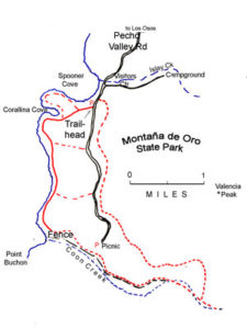
~John Krist Distance: 3.4 miles, out and return; easy Child rating, 5 and up Location: On the coast to the west of San Luis Obispo and south of Morro Bay, the park is located southwest of the town of Los Osos. Follow Pecho Valley Road from Los Osos to the park entrance. Hazards: Poison oak,…
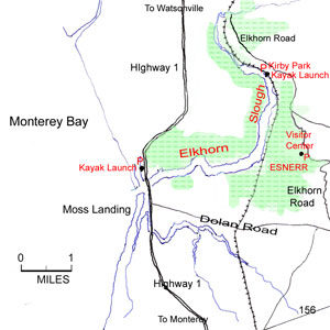
Read More~Ken McKowen Distance: One can spend a few hours or a leisurely day exploring the slough by kayak and/or hiking the trails in the Elkhorn Estuarine National Research Reserve Location: Elkhorn Slough and surrounding coastal wetlands are in Monterey County, just east of the Pacific Coast Highway, roughly midway between Santa Cruz and Monterey; it…
Read MoreJessica Gauvreau provides notes on her 2008 walk of the CCT north to San Francisco with a day pack and hostel stays. There are a fair number of hostels along the California coast, and many hikers have taken advantage of them as they have walked the CCT. In winter of 2008, Jessica Gauvreau hiked most of the Trail from…
Read More~Paul McKown Distance: 8 mile loop, 1,140 ft. elevation change Location: Marin County: near the coast, just west of Muir Woods. The route travels through parts of Muir Woods National Monument, Mt. Tamalpais State Park and the Golden Gate National Recreation Area. Hazards: Poison oak and ticks. Can be cold and windy if foggy. The…
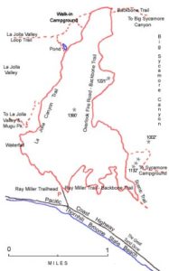
Read More~Milt McAuley Distance:7.5 mile loop trail.Location:Pt. Mugu State Park, in north-western Los Angeles County. Hazards:Poison oak, ticks, rattle snakes in summer and fall. Good year-around, but perhaps best in April-June when the waterfall runs strong and flowers abound. Avoid on the hottest days of summer. How to get there:To get to Ray Miller Trailhead drive west on the Pacific…
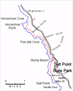
Read More~Richard Nichols Distance:5 miles one-way; shuttle required or R/T; fee to park at Gerstle Cove. Location:Salt Point State Park is on Sonoma County’s north coast. Hazards:Poison oak, ticks, steep cliffs, “sleeper waves”, unmarked routes and trails. How to get there:Salt Point State Park is located about 23 miles north of Jenner on Highway One. Go past…
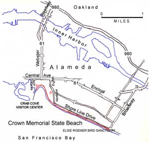
Read More~Elisa Mikiten Location and hours:Crown Memorial State Beach is on the San Francisco Bay-facing shore of Alameda Island, just to the south of Oakland. State Beach gates are open 8 a.m.- 8 p.m. The Visitor’s Center at Crab Cove hours are 10 a.m. – 4:30 Wed.- Sun. (currently open only in the summer). Crab Cove…
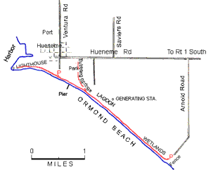
Read More~Tom Maxwell Distance:Four miles, longer or shorter as you like.Location:Port Hueneme State Beach and Ormond Beach are just south of the city and port of Port Hueneme in Ventura county. Hazards:Watch for unexpected high waves coming over the dike or onto the beach. Avoid stepping on least tern and snowy plover eggs. Do not go beyond…
Read MoreImpressions: The California Coastal Trail – San Francisco to the Oregon Border Like an addiction, the urge to merge and exchange the very essence of our being with our surroundings became the guiding force that propelled us out our front door and into the classroom of life. A few weeks in a box to contemplate and bring…
Read More
