
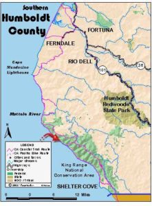
Mouth of the Mattole to Spanish Creek
June 18: Humboldt CountyMouth of the Mattole to Spanish Creek. 10.2 miles “Life would be worsity if we don’t respect the ocean’s diversity.” Sign at the campground at the mouth of the Mattole. At a low enough tide to expose the sea palms on the rocks flanking the beach, we began the backpack portion of…
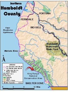
Spanish Creek to Shipman Creek
June 19: Humboldt CountySpanish Creek to Shipman Creek, 8.8 miles As we came into camp yesterday, two glass fishing-net floats were found on the beach. Most of the floats we’ve found so far are plastic: red, yellow, black, pink; at a distance they look like bowling balls with little handles. It is indeed something to be…

Shipman Creek to Shelter Cove/Hidden Valley Trailhead
June 20: Humboldt CountyShipman Creek to Shelter Cove/Hidden Valley Trailhead. 6.2 miles to Shelter Cove, 10.4 miles total to Hidden Valley We had a fairly discreet skunk visit us in the night. After breakfast we begin again our backpack accompanied by bear tracks in the sands. A mile or so out of camp, we come across…

Chemise Mountain to Orchard Camp
June 21: Mendocino CountyChemise Mountain to Orchard Camp, 11.5 miles On a beautiful blue solstice day we hiked up Chemise Mountain. We began at Hidden Valley Trailhead near Nadelos Campground, winding our way up past two small hidden valleys, then up switchbacks for a time. We wound our way gently up the ridge, as wind swished…
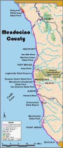
Orchard Camp to Little Jackass Creek
June 22: Mendocino CountyOrchard Camp to Little Jackass Creek, 8 miles We are in the thick of the backpack portion of our trip now. This is serious work. There are two themes at play here: up and down or rather, up, up, up and down, down, down. Whereas during our first days’ backpacking, we had…

Little Jackass Creek to 3 miles past Usal
June 23: Mendocino CountyLittle Jackass Creek to 3 miles past Usal, 10.3 miles The 23rd presents similar terrain as the 22nd. It’s up out of Little Jackass Creek, across the upper slope of Northport Gulch, and down into Anderson Gulch. One more up takes us to an elevation of approximately 1,100 feet and our high…

3 miles south of Usal to Westport Union Landing State Beach
June 24: Menodcino County 3 miles south of Usal to Westport Union Landing State Beach. 15.1 miles We began our day by missing our stopping point from the prior evening. The Melmobile stopped about 0.2 mile past our designated starting point, so those of us who were so inclined walked back to begin the day…
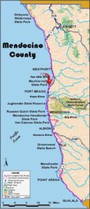
Westport Union Landing State Beach to MacKerricher State Park
June 25: Mendocino CountyWestport Union Landing State Beach to MacKerricher State Park. 17.2 miles All of yesterday’s hard walking seemed worthwhile last night as we watched the sunset over the Pacific. The breeze was mild, the fog was only beginning to introduce itself to us, and our tents were pitched not more than 10 feet…
Layover Day in Fort Brgg
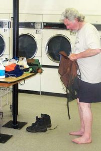
June 26: Menodcino CountyLayover Day in Fort Brgg Hi All, The only pictures for today are from the laundry. The shot of Steve in the laundromat, stripped down to trunks, was too good to resist. None of us had done laundry at the campsite, except maybe efficient Diana, since before the Lost Coast backpack; so…