
Usage Notes

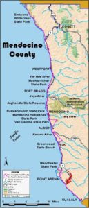
Legend: For details on the icons and trail colors, please click the legend icon on the map above.

Layers: Other layers are available. See the California Coastal Commission and Coastal Conservancy Completed Sections layer for the official completed trail segments. (About progress on the trail completion project.)
Mendocino Section 16
Alder Creek to Stoneboro Road at Highway 1, Manchester State Park
This pleasant walk along an expansive wave and windswept beach currently offers the longest off-road section of CCT between Little River and Sea Ranch. We're working to encourage state legislators and administrators to improve the CCT in southern Mendocino County where extensive agricultural lands still offer an opportunity to acquire a trail corridor for much of the distance that requires road walking as of this writing.
Manchester State Park comprises 5272 acres of recreational land and prime bird habitat. It offers one of the most lightly used of Mendocino's state parks, especially considering its size. The beach cuts across prevailing ocean currents, offering a beachcomber's paradise. Incidentally, the westward sweeping promontory of Point Arena so visible to the south is the closest place to Hawaii on the North American continent.
From the end of the road, walk west at the base of low cliffs covered with wildflowers. In 300 feet where a garden of succulents grows on the cliff of fractured rocks, you cross the San Andreas fault which runs offshore paralleling the coast to the north and angles southeast along Alder Creek and the Garcia River inland from this section.
Veer west to follow the tideline, which offers the best walking south. By ¼ mile beach grass covers the cliffs east of the driftwood-strewn beach. As you follow the tideline toward the Point Arena Lighthouse, sand dunes have replaced the cliffs east of the beach by ½ mile. In 300 feet a small gully makes a gap in the dunes. If you walk east up the gully, you'll reach the walk-in camps in about ¼ mile. CCT continues along the tideline, passing the broad outflow from seasonal Davis Lake at ⅝ mile. The dunes become higher as you walk south, reaching their highest peaks around one mile.
At 1⅛ miles you pass a path leading out of the dunes. It leads to the end of Kinney Road and the park's main campground. The beach becomes more broad as you head south, and low wildflower-covered bluffs replace the dunes. A bright yellow sign proclaims "CABLE LANDING”, the spot where the trans-Pacific cable heads west to Hawaii. Pass the mouth of Brush Creek around 1⅝ miles. At 1¾ miles a lagoon strewn with large driftwood lies east of the beach. It marks the northern end of a broad wildlife area used by abundant bird populations, including flocks of tundra swans that winter in the area.
Continue southwest along the beach as the lighthouse looms ever larger. At 2 miles large Hunter's Lagoon hides in the dunes ¼ mile east. Dunes soon back the beach as you head south.
Around 2¾ miles the Coastal Trail heads east on either of two trails that leave the beach to head through the low dunes. To the southwest the beach continues one more mile to the mouth of the Garcia River, a beautiful peaceful spot with much bird life. The tidal river is most often too deep to ford. Even if you could get across, about ¼ mile of private property stands between the river and the Point Arena Lighthouse. If those two obstacles could ever be overcome, CCT could continue south right along the coast. See HOW TO IMPROVE CCT for this section.
The two trails east soon merge into one. Around 3¼ miles you reach the end of Stoneboro Road. The river and private property to the south force the Coastal Trail to follow sleepy Stoneboro Road as it winds east to Highway 1 at 4⅞ miles, the end of this section and start of another road walking section of CCT. If you need supplies, the tiny town of Manchester about a mile north has a market and post office. The town of Point Arena on the next section has shopping and eating places.
ALTERNATE ROUTE: None, unless you prefer walking the highway shoulder.
SUGGESTED ROUND TRIPS & LOOPS: The large natural area of Manchester State Park offers ample room to explore. In addition to the CCT route, you can take the side hike southwest to the Garcia River mouth, about 3 miles round trip from the end of Stoneboro Road. A one-mile trail between the main park campground and the walk-in camps offers loop possibilities with the beach route. You can also walk the beach north from the access point for 1½ miles until it ends north of Irish Gulch at steep cliffs (see previous section).
Distance: 4⅞ miles (7.8 kilometers).
Open to: Hikers. Bicyclists on road.
Surface: Beach, trail, road shoulder.
Access point: Mouth of Alder Creek, Manchester State Park.
How to get there: Turn west off Highway 1 at Milepost 22.48 north of Manchester onto Alder Creek Road. Go 7 miles to the end of the road.
Other access: Kinney Road, Stoneboro Road.
Difficulty: Easy
Elevation gain/loss: 190 feet+/ 120 feet-.
Cautions: Watch for sneaker waves on beach.
Further information: Mendocino area State Parks (707)937-5804.
Facilities: None at access point. Chemical toilets and picnic area at end of Kinney Road, ⅛ mile east of trail. Phone and water on Kinney Road at campground ½ mile east.
Campgrounds: Manchester State Park Campground on Kinney Road offers primitive camping. The park also has walk-in camping about ½ mile south and ¼ mile east of the access point, but you must register with state parks before your arrival. For more amenities try Manchester KOA east of state campground or Rollerville Junction on Highway at Point Arena Lighthouse Road south of this section.
Lodging: Several in Point Arena to south.
Points of Interest

In the News
Interested in contributing to this project?
Register to add new photos and information, update existing results and share your trip reports.