
Usage Notes

Legend: For details on the icons and trail colors, please click the legend icon on the map above.

Layers: Other layers are available. See the California Coastal Commission and Coastal Conservancy Completed Sections layer for the official completed trail segments. (About progress on the trail completion project.)
Monterey Section 2
Moss Landing to Marina State Beach
This long, quiet, serene and scenic beach walk features extensive dunes, big surf, a national wildlife refuge and soft sand that makes you work harder for each mile.
If you like quaint port towns, Moss Landing Harbor merits a look at its cluttered fishing port: fishing and pleasure boats both in their prime and derelict, old buildings, seafood restaurants, and marine supply stores.
Inland from the harbor, Elkhorn Slough covers 2500 acres of salt marsh, mudflats, channels and salt ponds. This tidal embayment provides important habitat for the hundreds of thousands of shorebirds, more than 250 species, that reside or migrate here. It's also a major nursery for myriad sea and land creatures, including the diverse invertebrates that feed the abundant birds. The endangered brown pelican and California clapper rail nest here, and the golden eagle and peregrine falcon are also seen. Consider a side trip to explore Elkhorn Slough either by kayak or canoe, or on the more than five miles of trails that wind through the reserve.
Historically the Salinas River emptied into the sea at Moss Landing, four miles north of its present mouth. Then in 1909 locals redirected the river by excavating a channel through the sand dunes where the river meets the ocean today. This decreased flooding and made the rich soil of the old riverbed available for farming. Moss Landing's present entrance and harbor were dredged in 1947 to take advantage of the deep waters of the Monterey Submarine Canyon offshore which keeps the mouth free of sandbars. The sand slides into the deep marine canyon instead of piling up along the shore.
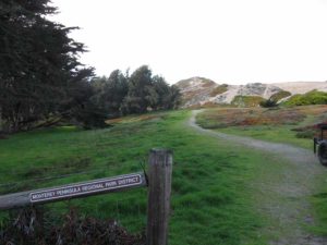
From the south side of the harbor entrance at the end of Sandholt Road, head south along the tideline of the beach. First the southern arm of Moss Landing Harbor lies to the east, then you parallel the Old Salinas River channel. Shorebirds and quiet are the norm here. Not many people make this trek in the soft sand. Beyond one mile you pass the access trail from the end of Potrero Road. Keep walking south with the dunes above the tideline becoming larger as you go. Around 2⅞ miles another access path runs from the beach to the end of Monterey Dunes Way off Molera Road. At 4 miles you reach the mouth of the Salinas River. The mouth is blocked by a sandbar in summer and may be open or closed in winter, depending on river flow and storms. If the sandbar is in place, or when the river is shallow enough to ford, you can continue south along the beach. Otherwise you must retreat to the last access path and follow the Alternate Route.
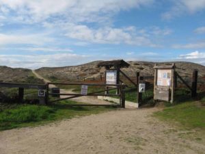
South of the river mouth you walk through the Salinas River National Wildlife Refuge, an area of beach, dune and estuary alive with wildlife including endangered terns, snowy plovers, brown pelicans and many other birds. Take care not to disturb the birds here, especially the snowy plover which nests on the dry upper beach and is very hard to see. A 200-foot long derelict barge resting in the surf creates its own unique habitat with barnacles, mussels and seaweed clinging to the hull, and eddies of sand forming inside the hull. Eventually rust, the pounding waves and sand will claim this derelict.
After lunch and wildlife observation, continue the march down the beach. Keep an eye to the ocean for sea otters and gray whales. Around 5 miles, large dunes rise steeply from the beach. As you continue south, you may see hang gliders launching from the dunes ahead.
At 7¼ miles a long boardwalk reaches the beach. This section of CCT ends here, but the next one continues along the beach. If you're not continuing south, either return the way you came or follow the boardwalk east ⅜ mile to the Marina State Beach main parking lot at the end of Reservation Road.
ALTERNATE ROUTE: When you can't ford the Salinas River, leave the beach at 2⅞ miles to walk Monterey Dunes Way to Molera Road, go south to Highway 1, walk the highway shoulder across the river, turn right into Salinas River National Wildlife Refuge and follow road and trail to the beach south of the river.
SUGGESTED ROUND TRIPS & LOOPS: A walk around Moss Landing followed by a walk on the beach is a pleasant way to spend the day. Walking the beach to the Salinas River and back is 8 miles. Starting at Marina State Beach and walking to the Salinas River and back is about 7 miles. Also consider a walk along the trails at Elkhorn Slough. Call (831)728-2822 for information.
Distance: 7¼ miles, plus ½ mile to South End Access (11.7 + 8 kilometers).
Open to: Hikers.
Surface: Beach.
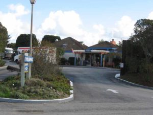
Access point: Moss Landing.
How to get there: From Highway north of Monterey, turn west on Moss Landing Road, cross the bridge, then take Sandholdt Road to its end at .6 mile.
Other access: Salina River National Wildlife Refuge.
Difficulty: Moderate
Elevation gain/loss: Negligible.
Cautions: Salinas River may be unfordable in winter. Soft sand makes this walk more strenuous than a typical beach walk. Watch for big waves on the beach.
Further information: Salina River State Beach (831)649-2836, Marina State Beach (83 1)384-7695, Salina River National Wildlife Refuge (510)792-0222.
Facilities: Chemical toilets at each end. Water at Marina State Beach.
Campgrounds: Marina Dunes RV Park (831)384-6914 is near end of section. Sunset State Beach is about 10 miles north.
Lodging: Available in the city of Marina.

Interested in contributing to this project?
Register to add new photos and information, update existing results and share your trip reports.