
Usage Notes

Legend: For details on the icons and trail colors, please click the legend icon on the map above.

Layers: Other layers are available. See the California Coastal Commission and Coastal Conservancy Completed Sections layer for the official completed trail segments. (About progress on the trail completion project.)
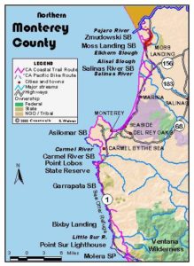
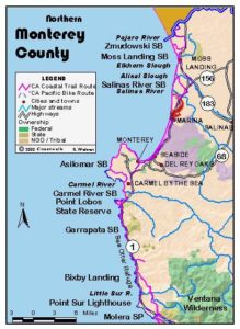
Monterey Section 1
Pajaro River to Moss Landing
The extraordinary and complex Monterey coastline begins in the north with a long sandy beach covered in two CCT sections. The fishing boat harbor at Moss Landing, with the adjacent bird-rich Elkhorn Slough to its east, separates the two long beach walks. This sandy and remote area contrasts sharply with the sophisticated urban environment on the scenic and rocky Monterey Peninsula. All of this gives way in the southern two-thirds of Monterey County to the wildly steep mountains and rugged coastline of legendary Big Sur.
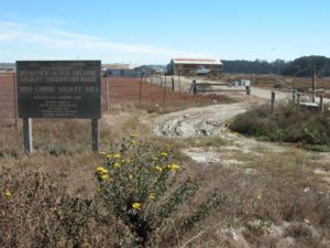
From the parking area follow the boardwalk west through the dunes to the sandy beach. This first section of Monterey begins on the quiet, undeveloped Zmudowski State Beach with only farmland and dunes in the area. If you are on a quest to walk every foot of the California coast, walk the beach north from the parking lot for ¾ mile to the mouth of the Pajaro River, then backtrack south to the parking area. Add 1½ miles to the mileage if you go to the river.
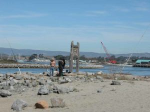
Walk south along the tideline of this lightly visited broad beach. The sand dunes back up against extensive wetlands with good birding, but the land behind the dunes is privately owned. CCT continues south along Zmudowski State Beach to the end, marked by the jetty at the mouth of Moss Landing Harbor. A half mile offshore begins one of the great canyons on the planet, the Monterey Submarine Canyon, rivaling the Grand Canyon in depth. Find the State Park access road at the jetty and follow it back to the around Elkhorn Slough. The Coastal Trail route follows Jetty Road east to Highway 1. Turn right and walk the highway shoulder south, crossing the bridge over Elkhorn Slough. The power plant stacks just ahead rise several hundred feet into the air, a landmark all around Monterey Bay.
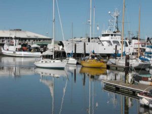
Continue along the highway shoulder past the power plant. Turn right onto Moss Landing Road which leads into the little port town full of fishing boats, funky buildings, antique stores, and eating establishments. Cross the bridge over the bay. The road turns north and becomes Sandholdt Road. You'll pass marine supply stores, the ocean research facility for the Monterey Bay Aquarium, a deli/fish market, and the fleet of boats docked in the harbor. Complete the walk on the beach at the mouth of the bay.
SUGGESTED ROUND TRIPS & LOOPS: From either Zmudowski or Moss Landing State Beaches, walk out and back on the beach for a serene 4½-mile round trip. Moss Landing State Beach at the end of Jetty Road north of the harbor has a parking fee.
Distance: 4⅞ miles (7.8 kilometers).
Open to: Hikers. Equestrians allowed on beach August 16 to April 14.
Surface: Beach, highway shoulder, road shoulder.
Access point: Zmudowski State Beach.
How to get there: On Highway 1, 1.5 miles north of Moss Landing, take Struve Road west, then turn west onto Giberson Road and go about 2 miles to the parking lot for Zmudowski State Beach.
Other access: Moss Landing State Beach. In summer when you can ford Pajaro River, Palm Beach on Beach Road north of river in Santa Cruz County has access.
Difficulty: Easy
Elevation gain/loss: Negligible.
Cautions: If hiking from Palm Beach, you must be able to ford Pajaro River to continue south. Caution parking at Zmudowski State Beach: Locals report cars are broken into. Best to park at Moss Landing.
Further information: Monterey State Parks (831)649-2836.
Facilities: Moss Landing has a few stores and restaurants. Chemical toilets at Zmudowski State Beach and Moss Landing State Beach
Campgrounds: Sunset State Beach on previous section has 90 sites.
Lodging: Watsonville has several choices.
Points of Interest

In the News
Interested in contributing to this project?
Register to add new photos and information, update existing results and share your trip reports.