
Usage Notes

Legend: For details on the icons and trail colors, please click the legend icon on the map above.

Layers: Other layers are available. See the California Coastal Commission and Coastal Conservancy Completed Sections layer for the official completed trail segments. (About progress on the trail completion project.)
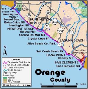
Orange Section 5
Laguna Beach Main Beach to Aliso Beach
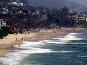
Laguna Beach, first and foremost an art town, shelters more than 90 art galleries and hosts three summer art festivals including the world renowned Pageant of the Masters. This event uses live actors and locals to painstakingly recreate the world's great paintings. Laguna Beach separates itself from the rest of the county not only by its artsy and liberal leaning but also by the rugged Laguna Hills, part of the larger San Joaquin Hills. Much of the Laguna Hills is now protected parklands thanks in large part to the efforts of the Laguna Canyon Foundation, which led the way to save the hills from intense development.
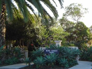
Not far from the beginning of this hike, the art scene bustles with all the galleries along the Pacific Coast Highway and the Laguna Art Museum just inland from Heisler Park. Even along the town's downtown shoreline at Main Beach you'll find an art-deco chess table of tile mosaic and artists sketching local scenes as well as the more typical volleyball and basketball courts and playgrounds.
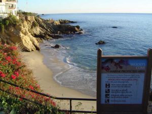
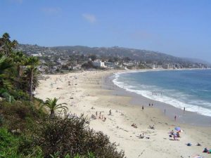
After sampling the local art product, head south along the tideline of busy Main Beach passing hotels and condos perched on the low bluff. As you round Cheneys Point beyond ⅜ mile, the bluffs rise to 40 feet. Continue along the beach around an unnamed point beyond ¾ mile and walk Brooks Beach past Halfway Rock offshore.
Before Cactus Point at 1½ miles, leave the beach and climb the stairs to Agate or Pearl Street. Turn right on Ocean Way and walk it south to bypass several no pass points. You can take side trip to visit Woods Cove at the end of Diamond Street and Moss Point and Moss Beach at the end of Moss Street before returning to the route.
When Ocean Way ends at Moss Street, turn left and walk Moss up to Pacific Coast Highway at 2 miles. Turn right and follow the highway's sidewalk to 2⅜ miles, then turn right and walk down Victoria Terrace Drive. In the 2600 block of Victoria Terrace Drive near the corner of Sunset Terrace, take the stairs wedged between houses ( you may need to look closely to spot them) and descend to attractive, broad and quiet Victoria Beach at 2⅝ miles.
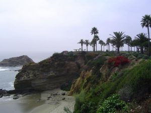
From here to Aliso Beach you stay on the tideline unless the tide is high. For this scenic tidal route, walk down beautiful Victoria Beach, marred somewhat at the far end by an unattractive apartment building squatting on a large seawall. Make your way in front of the seawall to reach Goff Island at 3⅛ miles.
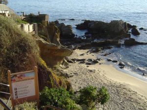
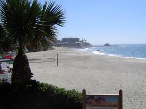
The land above Goff Island is in the process of hotel and resort development. a The plans include a Laguna Beach city park and a public beach. An abandoned road descends from the present mobile home park atop the bluff to end on a large concrete slab marring the shore-attached island where the remains of a small boat landing sit unused. Cross the abandoned road and follow the rugged shoreline along a scenic small cove and around a point. You come to a natural tunnel in the shoreline rocks with Aliso Beach framed in the distance. Walk through the tunnel and down the sandy beach to Aliso Beach and past the lagoon at the mouth of Aliso Creek. This section ends where the pier once was at 4 miles, near the parking lot at the top of the beach beside Pacific Coast Highway.
ALTERNATE ROUTE: If the seawall at the end of Victoria Beach or the shore south of Goff Island is flooded at high tide, you can either wait out the tide or return to Victoria Terrace Drive, follow it to Pacific Coast Highway, turn right and walk the sidewalk to Aliso Beach.
SUGGESTED ROUND TRIPS & LOOPS: From Main Beach walk the tideline south to Cactus Point and return, 3 miles round trip. From Aliso Beach you can walk the shore north to Victoria Beach unless it's high tide, about 2¾ miles round trip.
Distance: 4 miles (6.4 kilometers).
Open to: Hikers. Bicyclists on streets.
Surface: Beach, sidewalk.
Access point: Main Beach in Laguna Beach.
How to get there: Drive Pacific Coast Highway to downtown Laguna Beach. Main Beach is adjacent to the middle of town at the end of Laguna Canyon Road/ Broadway.
Other access: Between Main Beach and Aliso Beach, 16 paths/stairs descend to pocket beaches and rocky coves at these street ends: Cleo St., St. Ann's St., Thalia St., Anita St., Oak St., Brooks St., Cress St., Mountain Rd., Bluebird Canyon Rd., Agate St., Pearl St., Diamond St., Moss St., Sunset Terrace, Dumond Dr., 1900 block, Ocean Way.
Difficulty: Easy
Elevation gain/loss: 80 feet+/80 feet-.
Cautions: Tidal route impassable at high tide. Beaches close at 10 pm.
Further information: For Laguna Beach beaches, call the South Beaches Operation Office of Orange County Harbors, Beaches and Parks (949)661-7013, for Doheny State Beach, call (949)496-6171.
Facilities: Water, restrooms, and picnic tables at Laguna Beach Main Beach and Aliso Beach.
Campgrounds: Just east of Dana Point at the start of Section 7, Doheny State Beach has 120 sites for tents and RVs.
Lodging: Laguna Beach and Dana Point have abundant shelter choices, mostly on the high end like the deluxe Aliso Creek Inn, the 114-year-old Hotel Laguna and the Surf and Sand Hotel in Laguna Beach or the Marriott and Ritz-Carlton in Dana Point. South Laguna has several motels at moderate rates.
Interested in contributing to this project?
Register to add new photos and information, update existing results and share your trip reports.