
Usage Notes

Legend: For details on the icons and trail colors, please click the legend icon on the map above.

Layers: Other layers are available. See the California Coastal Commission and Coastal Conservancy Completed Sections layer for the official completed trail segments. (About progress on the trail completion project.)
Orange Section 6
Aliso Beach to Doheny State Beach
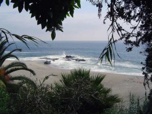
Aliso Beach County Park offers a pleasant byway along the Pacific Coast Highway, with all the accouterments for a fine family outing. The only thing missing is the Aliso Pier, destroyed by storm surf in 1999. The steep beach has large powerful waves popular with board and bodysurfers alike. Families also favor Aliso Beach for its easy accessibility, playground, picnic tables with fire pits, good fishing and concession stands.
From the parking lot at the top of Aliso Beach, walk down to the tideline, turn left and head south. After you round rocky Aliso Point before ¼ mile, watch along the top of the beach for public stairs leading up to West Street. It's the second public stairway, with the first one climbing alongside a condominium 200 feet north of West Street. Leave the beach around ⅜ miles and ascend the West Street stairs to the end of West Street at ⅝ mile. Unfortunately the shoreline ahead is impassable to through foot traffic for the next two miles, first with several pocket beaches guarded by promontories extending into deep water, then by a locked gate housing tract on the bluffs that blocks access along the shoreline. Walk West Street up to Highway 1 and turn right. Walk the sidewalks along busy Pacific Coast Highway through South Laguna.
CCT follows the highway all the way to Ritz-Carlton Drive at 2⅞ miles, but it does pass two beach access paths and stairways where you can descend to the pocket beaches if you want to see what you're missing. The first coastal access descends stairs from Table Rock Drive off Bluff Drive two blocks south of West Street to Tablerock Beach. Continuing along the Coast Highway, at 1⅛ miles you pass a second beach access path at Ninth Avenue. The path called 1000 Steps (actually 219 steps) descends to spectacular 1000 Steps Beach 150 feet below Highway 1, where steep cliffs and offshore rocks frame the isolated cove. Continue along the highway's sidewalk overlooking the gated community between the highway and spectacular Three Arch Bay and Mussel Cove along the shore. You pass Crown Valley Parkway around 2⅛ miles, cross Salt Creek at 2⅝ miles, then come to Ritz-Carlton Drive at 2⅞ miles.
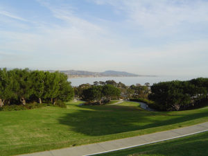
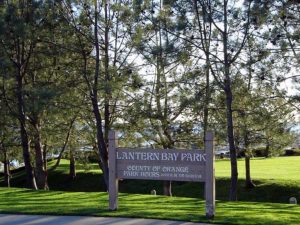
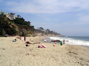
Turn right and walk down Ritz-Carlton Drive to the Salt Creek Beach parking lot. From the west side of the lot, follow the paved path down through Bluff Park to Salt Creek Beach. Walk down to the tideline and turn left. Salt Creek Beach is a 1¾-mile-long, wide sandy gem, framed by Dana Point on the south end. Walk the beach south, rounding an unnamed point at 3¼ miles and continuing to the next public stairway at 3⅝ miles, the beginning of the inland route. At very low tides, you can walk around Dana Point on the rocks, described in Alternate Route A.
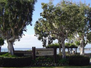
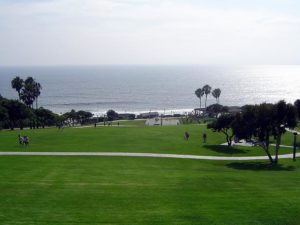
For the high tide route, walk up the long flight of stairs past an abandoned mobile home park on the right to the parking lot and park picnic area. Walk south through the park to its end, where adjacent Dana Strand Road comes to a vehicle barrier at 4⅛ miles. Walk around the barrier onto an overgrown path, following an old road lined with fencing on both sides that's well posted with "NO TRESPASSING" signs. Follow this road across Dana Point, the last undeveloped and unprotected natural land along the Orange County coast, loaded with beautiful coastal sage scrub and cactus. Local residents steadfastly oppose plans to build high-end houses and a resort on the point, preferring to keep the point in open space. See the adjacent feature article for more of this story.
The path descends to meet the end of Scenic Drive not far from the tip of Dana Point. Walk Scenic past the few houses that have been built here. At 4⅝ miles you come to Cove Road. Our main route turns right to descend narrow Cove Road. See Alternate Route B for a different route along the bluffs.
If you walk narrow Cove Road angling steeply down the cliff, do so with extreme caution. It ends at Dana Point Harbor Drive at 5 miles. For a side trip to the Orange County Marine Institute, turn right. The Institute serves thousands of students every year, conducting classes on marine conservation, ecology and history. The brig Pilgrim docks here, a full-size replica of the sailing ship Richard Henry Dana crewed on in 1835 that serves as teaching tool. The original Pilgrim sailed from Boston around the Cape Horn in search of cow hides from the Spaniards for the Boston shoe industry. When the ship anchored in Dana Cove, Dana described the cove in his classic book Two Years Before the Mast as “...the only romantic spot in California.” Now the cove is totally filled by the man-made Dana Point Harbor, created with jetties and massive landfill and jammed with luxury boats and tourist businesses. Dana would hardly recognize it.
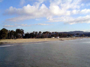
From Dana Point Harbor Drive, you can either walk the sidewalk or meander along the harbor past the boats, restaurants and shops. At the south end of the harbor a big parking area for boat trailers sits along a jetty bordering Doheny State Beach. Walk through the parking lot, climb down the low rock jetty and onto the sand. Adjacent to the wide beach and gentle surf excellent for small children, you'll find that Doheny State Beach offers a grassy palm tree studded picnic area and a visitor center at the entrance station on the other side of the picnic grounds. This section ends here on the beach at 6¼ miles.
ALTERNATE ROUTE A: If the tide is low enough, you can venture around Dana Point on the tidal rocks. Be aware that they are very slippery, requiring careful rock hopping. Avoid walking on the delicate tidal life inhabiting the rocks. The distance from the south stairs at Salt Creek Beach to Dana Cove Park next to the Marine Institute is 1⅜ miles, 1⅝ miles to Cove Drive and Dana Point Harbor Drive.
ALTERNATE ROUTE B: To avoid narrow Cove Road and get great views from the bluff, continue on Scenic Drive which becomes Green Lantern Street. Turn right on Santa Clara Avenue. After short block, detour down Blue Lantern Street to visit the gazebo overlooking the harbor. Then continue along Santa Clara a few blocks and turn right on Amber Lantern Street. At its end, turn left on the boardwalk clinging to the cliff in front of the buildings. This block-long path yields up more great views. Where the path ends, continue on El Camino Capistrano a long block to enter Heritage Park and follow the path curving downhill to the harbor's midpoint. Cross Dana Point Harbor Drive, turn left and walk past the harbor to Doheny State Beach and section's end
SUGGESTED ROUND TRIPS AND LOOPS: Salt Creek Beach Park is worth a visit by itself. A walk the length of the beach and back is 3½ miles round trip. The beach also affords a chance to explore the tidal zone at Dana Point. If the tide is out, you can make it all the way around to the Marine Institute.
Distance: 6¼ miles (10.1 kilometers).
Open to: Hikers. Bicyclists on streets.
Surface: Beach, sidewalk.
Access point: Aliso Beach County Park.
How to get there: Drive Highway 1 (Pacific Coast Highway) south from downtown Laguna Beach for 3.5 miles to Aliso Beach parking lot across from Aliso Creek Inn.
Other access: Salt Creek Beach Park, Dana Point Harbor.
Difficulty: Easy
Elevation gain/loss: 340 feet+/340 feet-.
Cautions: Stay out of Aliso Creek which is usually posted for sewage contamination. The route on the rocks around Dana Point is slippery at all times and impassable at higher tides. Use caution if you walk Cove Road, narrow with no shoulders.
Further information: For Aliso Beach County Park and Salt Creek Beach Park, call the south Beaches Operation Office of the Orange County Harbors, Beaches and Parks (949)661-7013, for Doheny State Beach, call (949)496-6171.
Facilities: Water, picnic tables, restrooms and parking at Aliso Beach and Doheny State Beach.
Campgrounds: Just east of Dana Point, Doheny State Beach has 120 sites for tents and RVs.
Lodging: Dana Point has several shelter choices, mostly on the high end like the deluxe Marriott and Ritz-Carlton. The moderately priced Best Western Marina Inn is at Dana Point Harbor. South Laguna has several motels at moderate rates. San Clemente Hostel (949)492-2848 is three blocks from the beach at end of Section 7.

Interested in contributing to this project?
Register to add new photos and information, update existing results and share your trip reports.
What do the different colors on the map represent and why no Ledgen? Can map be enlarged?
Hi Robert, Thanks for your feedback. The map has a legend available under the icon that looks like a bullet list. (It’s on the left of the map on desktop, at the bottom on small screens.)
As far a enlarging the map, are you thinking of a “full-screen” type of enlarge or a way to make the map twice as tall within the page?
Cheers,
Ben (Web developer for the project)