
Usage Notes

Legend: For details on the icons and trail colors, please click the legend icon on the map above.

Layers: Other layers are available. See the California Coastal Commission and Coastal Conservancy Completed Sections layer for the official completed trail segments. (About progress on the trail completion project.)
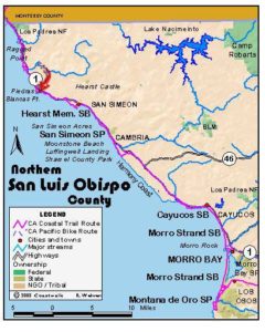
San Luis Obispo Section 1
Ragged Point to Piedras Blancas
Access to the shoreline here in far northern San Luis Obispo County is limited - and obscure. I spent half a day exploring west from the wide turnout at the top of the hill .2 mile north of this access point. A maze of volunteer paths there meanders through pine forests only to lead to a brush-choked headland. I managed to get down to the beach north of Ragged Point by heading west for ¼ mile, then descending a rough, steep path north, but once I reached the beach, the shoreline west and south was impassable and the shoreline north was only passable for ⅛ mile, ⅝ mile at minus tides. The Whole Hikers managed to follow a blufftop path southeast through the pine forest, then bushwhack to bluff's edge and scramble down to the rocky beach, but when I tried to retrace their route in 1999, I got tangled in a huge poison oak thicket. The route described below gets you down to virtually the same spot without such difficulty.
A word about access and topography here: Looking south from San Carpoforo Creek (San Carpojo in local lingo), the mountains crowding the southern Big Sur Coast immediately north suddenly draw back from the shore, providing a broad rolling marine terrace. The vast 77,000-acre Hearst Ranch occupies most of this terrace. While the Hearsts have owned the ranch since the 1860s, locals and travelers, mostly surfers, divers and fishermen, have found and used paths to the tideline at several spots, mostly along creeks and arroyos. We ask that you stay off the bulk of the Hearst Ranch, but we believe that the coastal access paths used by avid coast lovers over the past 130 years provide reasonable shoreline access in an area where access is extremely limited. At press time, the Hearst Corporation generally allows this access by granting a "revocable right to pass" at those locations. Technically, that means they can withdraw that right to pass at any time and ask you to leave. Please respect the private property by staying on the established paths we suggest to reach the tideline and to follow the shoreline up and down the coast. In some places it is necessary to pass along the blufftop to get from one beach to the next. Please observe the following if you walk on the Hearst Ranch: no camping, no fires or smoking, keep dogs leashed.
Descend southwest on the vague path just north of the small turnout, watching for low strands of barbed wire only fifteen feet from the road and poison oak beyond. About 450 feet from the highway, take the left fork and head south. It descends to a sea stack attached to the bluff at ⅛ mile. Descend the path east from the outcrop's shoulder on a short rough descent to the tideline of a rocky beach just east of the small south-pointing promontory.
Walk the tideline south with some rock scrambling required in the first 250 feet followed by easy walking on a gravelly beach. Follow the shore of this pristine cove littered with picturesque rocks offshore. Around ½ mile an obvious escape path climbs east to the highway. Unless you prefer the difficult low-tide route described below that continues along the beach to almost one mile, turn left and follow the escape path to the highway at Milepost 69.97, follow the shoulder south across Arroyo Hondo, then head southwest across the blufftop toward Breaker Point.
The tidal route follows the tideline south past a small dune at ⅝ mile, then passes deep Arroyo Hondo, choked with brush and poison oak. Follow the tideline past a point beyond ¾ mile marked by a rounded 50-foot sea stack at its western tip. A short rock scramble leads to the neck of another small point at ⅞ mile. Walk the tideline south 200 feet to the north rim of the next small cove. Unless it's high tide, the beach continues ⅛ mile to the base of a high point, but you need to find a safe place to scramble up to the blufftop to continue south. The first of three rugged, strenuous choices heads east from the north rim of the cove, a steep scramble up an eroded cliff. The second choice lies 330 feet south, also a rough scramble. took the third choice 200 feet beyond that where, at one mile, a rough volunteer path climbs steeply southeast up the face of an eroded slide. About 200 feet from the tideline, it meets a nylon rope anchored on the blufftop above. The rope provides hand-hold help to climb the final ten near vertical feet to the blufftop. The rough, crumbly path beneath the rope is made more challenging by the steep slope below, not a place for people afraid of heights or carrying a heavy backpack.
Whether you choose one of the three rough scramble paths or leave the beach before Arroyo Hondo, once you get onto the blufftop, the walking improves greatly. Follow the bluff edge south, then head southwest on a gentle descent across a sloping blufftop, passing east of two 40-foot-high promontories, the second of which is Breaker Point at 1⅛ miles. When you return to the bluff edge in 200 feet, follow it south. By 1¼ miles turn southeast then south to follow the bluff edge, passing through gentle grasslands with scattered coastal scrub.
Before 1⅜ miles, you meet a 20-foot-deep arroyo in view of a ranch house east of the highway. Take the overgrown path just inland from its mouth, crossing the gulch just below a small deep pool. Though coastal access lies about 30 feet west, return to the blufftop by an easy short scramble. Follow the bluff edge south, making another easy gully crossing in 450 feet. Continue south, crossing two more small gullies near their heads, then crossing a larger one a at 1½ miles. All three offer easy traverses.
Contour southeast along the bluff edge to 1⅝ miles, then continue south crossing several more small gullies, all easy. Pass a small point at 1⅞ miles with great views up and down the coast. Harbor seals haul out on the offshore rocks. The faint bluff-edge track quickly passes another small point, then turns east toward the highway. Continue east to round the top of a gully at 2 miles, then turn south to cross a deeper gully and follow the blufftop down coast.
CCT reaches a double gully before 2⅛ miles. Here the CCT descends the gully to the tidal zone. (If the tide is above +3.0 feet, you must cut inland to follow the blufftop south near the highway.) If you can walk the rocky coast south, at 2¼ miles you pass a gulch beyond a fragment of wooden fence, nearing the highway. Continue along the shore beyond the next point to a low point at 2⅜ miles where it's an easy scramble twenty feet up a rocky slope to the blufftop. Walk the blufftop south, passing east of the high edge of the unnamed point north of Arroyo de los Chinos. Head south toward a low wind-topped pine, passing it at 2⅝ miles. Soon the coast south comes into view, the sandy face of low and long Point Sierra Nevada lying across a shallow cove, with a sphinx-like rock peeking over its left flank.
Continue south to meet deep Arroyo de los Chinos before 2¾ miles. The best path into it lies about 50 feet east of the sheer bluff edge. Take the distinct path there that descends southeast into the arroyo, encountering some poison oak in the coastal chaparral. When you reach the creek, follow it west to its mouth and a pleasant beach guarded by offshore tidal rocks. Cross the creek and climb back onto the bluff via the steep short path at the south side of the mouth of the arroyo. Geraniums grow wild here. An escape/access path heads east to the nearby highway, but CCT turns south following the bluff's edge. After a small point before 2⅞ miles, follow the bluff edge as it cuts inland, then turns south by 3 miles. Around 3⅛ miles the CCT meets another eroded arroyo. Veer inland 150 feet to find an easy crossing, then follow a cow path south-southwest across the blufftop. When this track bends left, veer right to head south, aiming for the long sandy beach north of Point Sierra Nevada. You'll find an easy descent to the beach at 3⅜ miles.
Walk the tideline southwest toward the rocky point. Just before you reach the rocks at the end of the beach, turn left at 3⅝ miles to head southeast and ascend to the crest of the dunes. Here you must make a choice. At tides below +3.0 feet you can follow the main route of the Coastal Trail, which makes the short descent to the next beach and follows its tideline down the coast with long views of Piedras Blancas Lighthouse and the sphinx-like Harlech Castle Rock near it. If the tide is high, you need to wait for a lower tide or head east through the dunes for ¼ mile, then head southeast toward the highway visible across the grassy field. The high tide route reaches the highway north of Arroyo de la Cruz around 4¼ miles, then follows the shoulder south across the arroyo and up a hill to meet the northernmost gate on the Hearst Ranch at 4⅝ miles.
The tidal route reaches the low-tide-only-passable point at 4 miles, then comes to the creek and marsh at the mouth of Arroyo de la Cruz in just 200 feet. A creek ford is necessary to continue south from here. In winter and spring you'll probably need shorts and bare feet or sandals, while in midsummer or later, it may be a dry crossing. The easiest ford is generally near the mouth where the creek empties into the ocean, but watch for rocks on the uneven bottom. Don't ford when it's at flood stage like it was during my February 1999 visit. In that case, return to the Point Sierra Nevada dunes and take the Alternate Route east. Beyond the mouth of Arroyo de la Cruz, CCT follows the tideline of the sandy beach to 4⅜ miles, then ascends the low bluff to follow a bluff edge track. By 4⅝ miles you can see the Hearst Gate not far to the east with the highway just beyond. This is where the two routes rejoin. Continue down the coast along the narrowing blufftop. Not far beyond 4¾ miles the bluff edge and the highway shoulder become one. Stay west of the highway because by 5⅛ miles you'll find a narrow blufftop strip to walk, though it tapers back to the highway shoulder again by 5⅜ miles.
Walk the shoulder south, crossing Arroyo del Oso at 5½ miles and passing Piedras Blancas Motel at 5⅝ miles. Continue along the shoulder with intriguing Harlech Castle Rock directly offshore. After you cross Arroyo del Corral at 6⅛ miles, look for the turnout on the road's west shoulder at Milepost 64.7, just before 6¼ miles, where this section ends.
ALTERNATE ROUTE: Follow Highway 1.
SUGGESTED ROUND TRIPS & LOOPS: From the Hearst Gate at Milepost 66.55, walk the bluff edge and the beach north to the mouth of Arroyo de la Cruz and return, 1¼ miles round trip. Take the volunteer path south of Arroyo de los Chinos at Milepost 68.2 to the beach and follow the CCT north or south.
Distance: 6¼ miles (10.1 kilometers).
Open to: Hikers. Dogs OK on leash. Bicyclists on road portion.
Surface: Trail, beach, highway shoulder.
Access point: Highway east of Ragged Point.
How to get there: Drive Highway north from Cambria or south from Monterey or Big Sur to San Luis Obispo County Milepost 70.75 where a small turnout west of the highway is just east of unmarked Ragged Point (not to be confused with the Ragged Point Inn 2 miles north). The indistinct dirt turnout is across the highway from a 20-foot-tall pine, .55 mile south of the San Carpoforo Creek bridge.
Other access: Near Breaker Point south of Arroyo Hondo, Arroyo de los Chinos at Milepost 68.2, Arroyo de la Cruz at Milepost 66.9, the Hearst Gate at Milepost 66.55, or anywhere south from there on highway.
Difficulty: Moderate
Elevation gain/loss: 400 feet+/430 feet-.
Cautions: Walking the beach at this section's north end should be timed to coincide with a low tide. Watch for rogue waves when walking beach and poison oak on the bluffs. Stay out of roadway and walk single file when walking highway shoulder. Please stay on established access paths and off the rest of the Hearst Ranch.
Further information: None.
Facilities: None except small store and cafe just south of Piedras Blancas Motel.
Campgrounds: San Simeon State Park on Section 3 has 202 sites, the 132 sites in the San Simeon Creek unit with hot showers.
Lodging: Piedras Blancas Motel has reasonable rates. Ragged Point Inn 2 miles north of access point has rooms at moderate rates. Other lodgings to south in San Simeon and Cambria. Morro Bay Home Hostel, (805)772-9005, is in Morro Bay 40 miles south.
Points of Interest
No individual points found.
In the News
Interested in contributing to this project?
Register to add new photos and information, update existing results and share your trip reports.