
Usage Notes

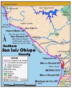
Legend: For details on the icons and trail colors, please click the legend icon on the map above.

Layers: Other layers are available. See the California Coastal Commission and Coastal Conservancy Completed Sections layer for the official completed trail segments. (About progress on the trail completion project.)
San Luis Obispo Section 6
East Fork Villa Creek to Cayucos Pier
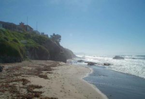
Estero Bay curves gently along the center of the San Luis Obispo County shore, spanning about 15 miles as the seagulls fly. Cabrillo spotted the bay on his 1542 voyage, naming it for the large estero, or estuary, at the center of the bay that contains the more sheltered and famous Morro Bay. In 1769 the Portola expedition camped at the mouth of Villa Creek in the northern crook of the bay. Today the route of the CCT, after the 10-mile road walk from Cambria, returns to the shoreline very near the site of Portola's camp. The broad, gently sloping marine terrace on the ocean side of the highway contrasts sharply with the high hills and steep canyons on the inland side of the road.
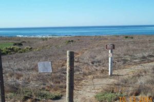
The Trust for Public Land acquired about 275 acres along the north shore of Estero Bay near Cayucos Point at the end of 1998, purchasing it from a group that had been trying to subdivide and develop it. The acquisition was made possible with $2.5 million from the Coastal Conservancy, $2.4 million from the Packard Foundation, and $1 million from a private donor. This land includes 3½ miles of coastline with two streams, coastal terrace grasslands, sandy coves, wetlands, and tidepools. At press time the Trust for Public Land was negotiating the details of what agency would hold title to the land and how it would be managed. Although we cannot specifically tell you to follow the route described here for the first 4 miles of this section's Coastal Trail, public access will be allowed and this is the probable route. We suggest you call the Trust for Public Land or inquire locally before you hike here.
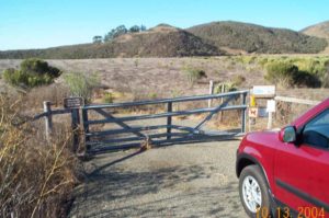
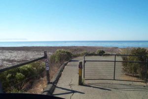
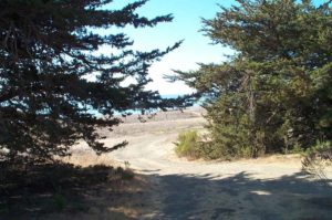
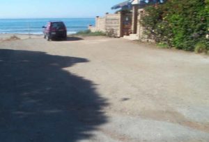
A sign for Villa Creek Ranch stands east of the highway bridge across the creek's unmarked east fork. Find the gate on the ocean side of the highway nearest the ranch sign. This section begins there. The CCT follows the ranch road behind the gate. It quickly swings left to head east to an informal parking area on a knoll around ⅛ mile. From the knoll the CCT follows the vague ranch track as it descends south to a sandy dune area surrounding by wetlands, then continues south to the beach just east of the mouth of Villa Creek. (The newly acquired property extends west less than ¼ mile from there.) CCT turns left and follows the tideline of the beach. By ½ mile intertidal rocks lie offshore from the beach which continues for 350 feet.
From near the end of the beach, CCT climbs above the rocks along the shore to the top of a low dune which overlooks a sandy pocket beach. CCT continues southeast along the coast, either across the second beach or on the bluff edge above it. By ¾ mile it reaches a small point between the second beach and a third, smaller one. CCT contours along the bluff edge track to another small point, then follows the bluff edge as it angles east above a fourth small beach before turning southeast across the blufftop beyond ⅞ mile.
CCT reaches the most prominent point so far on this section at one mile, then continues across the blufftop before dipping through a gully on one of several steep cowpaths. It then follows the bluff's edge past an eroded point to dip through another gully at 1¼ miles. The Coastal Trail winds inland to pass above two small gullies, then crosses a rocky gully at 1⅜ miles. Contour along the grassy blufftop above rust-colored tidal rocks, coming to a fenceline west of a high hill before 1½ miles.
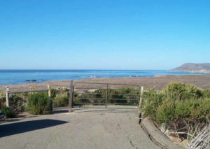
To continue along the CCT, one climbs carefully over a well-strung barbed wire fence, then contours along the bluff edge, crossing the heads of two gullies. The route offers good vistas southeast to Morro Rock and other volcanic peaks on its left, and south to Point Buchon beyond Montaña de Oro State Park. From 1⅝ miles CCT follows the edge of the bluff south toward a point, passing a spur at 1¾ miles that descends to a surf-scoured beach. At 1⅞ miles a second spur on the right leads 200 feet to a south-facing point. CCT continues along the bluff edge, passing another fenceline at 2⅛ miles, then following the coast east around a rocky cove with a narrow beach.
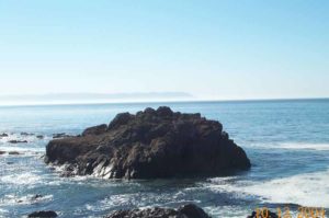
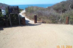
At 2¼ miles the path forks, the left fork heading for a turnout on Highway 1. CCT follows the vague right fork east across the blufftop toward an uplifted sea stack, staying inland of several eroded gullies. Beyond the last gully, CCT angles right to follow the distinct track heading southeast to a young cypress at bluff's a edge beyond 2½ miles. The route veers left along the bluff edge, coming to the tip of Cayucos Point at 2⅝ miles, where a sandy beach below invites exploration.
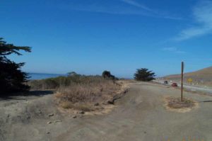
Beyond the point CCT follows the bluff edge track northeast, then east, finally passing the uplifted sea stack to your left at 2¾ miles. From there you can see the Cayucos Pier backed by the town. Soon the track veers inland to eucalyptus trees west of a small arroyo. Where CCT reaches the trees beyond 2⅞ miles, it leaves the track heading for the highway to head southeast, descending to cross the small pocket beach near the mouth of the arroyo. It ascends to the blufftop beyond the beach at 3 miles and follows the bluff edge east. After rounding a small cove, CCT crosses another seasonal creek around 3½ miles. Contour east along a coast with many small offshore rocks, passing four small points. The latter two are more pronounced promontories, with the fourth point at 3⅞ miles having an extensive offshore reef. Beyond the fourth point, the Coastal Trail heads northeast toward the highway. It meets the west end of North Ocean Avenue near where the street meets Highway 1, beyond 4 miles.
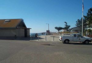
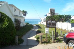
Climb over the fence, turn right and walk the shoulder of Ocean Avenue east toward Cayucos. It crosses a creek and meets the west end of Lucerne Road at 4¼ miles. Continue along Ocean until you reach the east end of Lucerne Road around 4½ miles. Then turn right and walk Lucerne briefly, looking for a path that descends to the beach between two-story condominiums. The paved path is signed "NO MOTOR HOMES, CAMPERS, BOATS OR ORVS BEYOND THIS POINT." That means pedestrians are OK, so descend the path and stairs to the beach, reaching the tideline by 4⅝ miles. Turn left and walk the tideline past Cayucos Creek lagoon. Beyond it you enter Cayucos State Beach, continuing to Cayucos Pier at 4¾ miles, where this section ends and the next begins.
ALTERNATE ROUTE: The only other way would be to walk the shoulder of Highway 1.
Distance: 4¾ miles (7.6 kilometers).
Open to: Hikers. Bicyclists on road portion.
Surface: Trail, beach, ranch road, road shoulder.
Access point: East Fork Villa Creek bridge.
How to get there: On Highway about miles south of Cambria, or 3.3 miles up highway from northern Cayucos exit, park on west side of road opposite the Villa Creek Ranch sign, near Milepost 39.85.
Other access: Highway east of Cayucos Point, North Ocean Avenue.
Difficulty: Easy
Elevation gain/loss: 135 feet+/175 feet-.
Cautions: Stay on described access path. Do not disturb any natural features. No dogs please. Stay out of posted closed areas.
Further information: Trust for Public Land (415)495-5660, Cayucos State Beach (805)549-3312, Cayucos Chamber of Commerce (805)995-1200.
Facilities: None except pier at south end has restrooms, water, phone, picnic area at adjacent Veteran's building.
Campgrounds: San Simeon State Park north of Cambria has 202 units. Town of Morro Bay to south has camping in 2 state parks and 2 private campgrounds.
Lodging: Several choices in Cayucos. Morro Bay Home Hostel (805)772-9005 is miles south of section's south end.
Points of Interest

In the News
Interested in contributing to this project?
Register to add new photos and information, update existing results and share your trip reports.