
Usage Notes

Legend: For details on the icons and trail colors, please click the legend icon on the map above.

Layers: Other layers are available. See the California Coastal Commission and Coastal Conservancy Completed Sections layer for the official completed trail segments. (About progress on the trail completion project.)
Santa Barbara Section 4
Gaviota State Park Pier to Refugio Creek, Refugio State Park
The CCT finally returns to the coast at Gaviota to follow a mostly narrow strip of sandy and rocky beach along the east-west running shore. You'll need a medium to low tide to get around the first rocky point just beyond Gaviota Creek, and encounter more tidal bottlenecks along the way. None of them are as tight as the final 1⅜ miles of beach before Refugio Creek, passable in summer only at tides below +1.4 feet. That low-tide stretch has an alternate path through a defunct nursery up on the blufftop, but it requires a steep rocky scramble to get up to the nursery from the trail's 8-mile point. Before starting this section, you might walk out the Gaviota Pier to peruse the narrow coastal strip you'll be walking.
State parks plan to build a bicycle/pedestrian path all the way along the blufftop between Gaviota and Refugio. This project was to begin in 1999, but El Niño winter storms caused washouts and landslides along much of the route, requiring further planning with no firm completion date set yet. The paved path eventually will link with the Aniso Trail between Refugio and El Capitan State Beaches (see next section).
West of Gaviota Pier lies a rocky shoreline passable only at minus tides in summer. Only a mile west of the pier, the area above the tideline belongs to the vast Hollister Ranch which allows no public access to the blufftops. If you time a shoreline walk west from Gaviota at the lowest tides in summer (definitely requires a minus tide), you can walk west along the tideline of the Hollister Ranch coast. It's 7½ miles one way to Arroyo San Augustin, 14 miles to Government Point, beyond which there's no beach to walk and thus no legal way to hike the final 1½ miles to Point Conception. Without gear for an overnight bivouac along the high tideline, there's no way, even at the lowest tides, to cover more than the 15 miles round trip to San Augustin in a day hike. Even that distance offers a difficult trek that must be timed with the tides. Hikers who walk the Hollister Ranch bluffs without written permission have been arrested for trespassing.
Walk south from the south end of the Gaviota State Park day-use parking area, passing beneath the tall railroad trestle and meeting the foot of the pier in 200 feet. Turn left and walk the tideline east. Before ⅛ mile you must ford Gaviota Creek and round a rocky point with the narrowest passage in the first ½ mile, passable in May 1999 at tides below +3.0 feet.
Follow the narrow beach down coast, walking beneath cliffs of near-white Monterey shale that soon rise 100 feet on your left. At ½ mile pass the tiny creek of Cañada del Barro flowing from a tunnel, then scramble past a rock shelf requiring a tide similar to the first point. Beyond the shelf, the beach is broader except for a scramble past a recent slide at ¾ mile. Around one mile a small creek provides a seasonal waterfall.
CCT continues along the tideline. Walk the section's narrowest beach to this point from 1⅛ lo 1¼ miles, then meet a broad canyon. The fenced canyon, jammed with lush foliage, is the mouth of both Canada del Cementerio and Cañada Alcatraz. Continue around a high rocky point if you can, remembering that you may need to return this way at an equally low tide. After scrambling past another tight spot at a high cliff at 1⅜ miles, walk a slightly broader beach with eucalyptus trees on the bluff above you until 1⅝ miles, then a sandy beach scattered with low rocks.
Pass a concrete abutment at 1¾ miles marking the mouth of Cañada del Leon, where people walk down to the beach from the nearby highway. Continue along a broad pleasant beach toward a point with a beached sea stack. Scramble past a rocky point at 2⅛ miles and walk another broad beach to the 30-foot sea stack at 2¼ miles marking the mouth of Cañada San Onofre. The wooded canyon, jammed with lush foliage, has a well-beaten path up the west side of its stream that climbs steeply to the highway. CCT rock hops down the beach past the canyon's broad mouth, which extends to 2⅜ miles.
Beyond Cañada San Onofre, you reach a narrow passage requiring a tide of +2.5 feet or lower. Then walk east along a sandy beach sprinkled with large rocks. Pass slabs of layered light shale around 2½ miles. By 2⅜ miles you walk a broadening sandy beach below jumbled cliffs, passing a tunnel marking the mouth of Cañada de las Zorrillas.
Before 3 miles you pass a monolithic panel of Monterey shale. Continue past a minor narrow spot to round a point with slabs of shale, passing the deep mouth of Cañada del Molino at 3⅜ miles. Pick your way over uneven loose rocks of assorted sizes, then walk a narrow sandy beach northeast, with fingers of rocks crossing the narrow strand. The above-head-high rock finger at 3½ miles offers a close scramble at tides above +2.0 feet, the tightest passage yet.
Follow a narrow beach with greatly layered and twisted cliffs. A rock ledge at 3¾ miles offers the trickiest passage yet only because it requires brief rock scrambling at tides above +2.0 feet. Be sure to use good all-hands-and-feet scrambling technique. Pass Cañada de la Posta around 3⅞ miles and walk a narrow beach beneath scrambled and patterned blond cliffs, passing a few narrow rocky points that may require scrambling.
Beyond 4¼ miles the bluffs dip to only 30 feet tall with a rock outcrop forming an alcove, a sheltered spot to pause beside a waterfall and greenery. CCT continues east on a narrow beach with more rock fingers. Pass the usually tiny stream of Cañada de Guillermo at 4½ miles. It doesn't have much of a canyon at its mouth, but has a striking setting and an escape trail. Round a jumbled point around 4¾ miles, then walk a broadening beach to Arroyo Hondo at 5 miles.
As you approach the broad, deep mouth of Arroyo Hondo, the sandy beach gives way to a striated, mostly level rocky tidal zone at the base of sculpted cliffs. People often surf fish here. Pass the mouth of the creek at 5 miles, where the railroad trestle towers overhead with five-arch highway bridge just upstream.
Continue to the canyon's east wall, where you'll find a seawall that runs along the top of the beach for the next ⅝ mile. Because the wall is nearly eight feet tall and protrudes into the low tide zone, you need to climb onto it and walk it east at all but the lowest minus tides. The first part of the seawall is very old, deteriorating and broken-be careful. By 5⅛ miles, where you pass a jumble of varied rocks on the land side of the wall, the wall walking improves but you still must watch your step. Round the first bend in the wall by 5¼ miles with the railroad tracks often visible above you. Cross a spillway at the mouth of Cañada de la Huerta.
By 5⅜ miles you reach a newer section of seawall dated 1919. The seawall walking becomes easy from here except for ducking under or around big culverts around 5½ and 5⅝ miles. Reach the end of the seawall at 5⅝ miles. It's a bit tricky to get down to the beach here, about a ten-foot drop to the rocky and sandy beach below. Scramble down carefully only after considering that it's even harder to get back onto this end of the seawall if you need to return this way.
Beyond the seawall, it's easy walking east along the beach at anything but high tide. A few eucalyptus trees grow atop the bluff above the seawall's end. As you walk east, the railroad tracks angle away from the edge of the bluff. By 6 miles the beach broadens with more eucalyptus on the bluffs above. Pass some houses perched on the bluff edge between the beach and the trees, then pass the mouth of Arroyo Quemado at 6¼ miles. Continue along a narrowing beach to another seawall at 6¾ miles. Walk along its base or top, depending upon the tide, until the seawall ends around 7⅛ miles. Then walk the beach to a point at 7¼ miles. From the point, a broad beach cuts back in to the mouth of Tajiguas Creek.
CCT then follows a narrow beach east with the railroad tracks perched on the bluff 60 feet above. The beach narrows with the sandy beach soon ending. Round a point of jumbled rocks, pass two tall palms on the bluff above, a then a seawall around 7⅞ miles. It isn't long but is ten feet tall, so it's fortunate you can usually walk along its seaward side.
By 8 miles, you've entered the unmarked west end of Refugio State Park, rounding another rocky point beneath sloughing, jumbled bluffs. Beyond the point, look east along the bluffs to see an old chain link fence descending part way to the beach from the blufftop. A rough, steep track climbs up the bluff and along the east side of the fence. It requires a scramble but can be done with caution. If you're afraid of heights or crumbly cliffs, don't do it alone. At the top of the bluff, you'll gain a narrow level terrace just south of the fenced railroad tracks with the highway beyond.
Turn right and head east along the blufftop. After crossing a gully, the path passes to the left of pines, then a palm at 8⅛ miles. Continue east along the narrow strip of blufftop between the tracks and beach. Where the path forks before 8¼ miles, stay to the right. You quickly hit pavement. On your left a gap in the fence leads across the tracks to the highway. Continue east across the head of another gully. Contouring east, you might notice flowering plants on your left, then a seawall on the beach below on your right. Continue winding east along the path through the old nursery grounds, passing more pines, palms and eucalypti.
By 8½ miles you cross a larger gully on a makeshift bridge. Pass a short overgrown stretch and return to pavement. Contour through the heart of the nursery past an array of naturalized plants. Before 8¾ miles the blufftop terrace narrows and you leave the nursery. Continue along a path beside the railroad tracks-if a train comes, give it plenty of room.
Before the tracks bend left, your trail veers to the right to follow the bluff's edge. Reach a junction before 9 miles. The right fork leads 250 feet to a wonderfully sited picnic table atop the point overlooking palm-lined Refugio Beach and cove. CCT takes the left fork and descends to the day-use parking lot for Refugio State Beach at 9⅛ miles. Continue east along road or beach until you see the mouth of Refugio Creek, then walk north to find the bridge where the road crosses the creek at 9⅜ miles. This section ends here, with Section 5 beginning at the start of Aniso Bike Trail on the east side of the creek.
ALTERNATE ROUTE: The only other choice follows busy Highway 101, mostly freeway.
SUGGESTED ROUND TRIPS & LOOPS: From Gaviota, walk east to Arroyo Hondo and back, 10 miles round trip. Another pleasant choice heads west from Refugio's day-use lot up to the nursery and return, up to 2½ miles round trip. For the latter hike, consider a picnic at the bird's-eye picnic spot overlooking Refugio Beach.
Distance: 9⅜ miles (15.1 kilometers).
Open to: Hikers.
Surface: Beach, trail at end.
Access point: Gaviota State Park day-use parking lot and Pier.
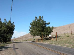
How to get there: Turn west off Highway 101 at the Gaviota State Beach exit, 33 miles west of Santa Barbara. Drive past kiosk and campground to day-use parking area below railroad trestle.
Other access: From Highway 101 at Vista del Mar/Cañada del Leon at MP.44.3, Cañada San Onofre at MP.43.85, Cañada de Guillermo at MP.41.7, Arroyo Hondo/Vista Point at MP.41.0, Tajiguas Creek at MP.38.4.
Difficulty: Moderate
Elevation gain/loss: 70 feet+/70 feet-.
Cautions: Requires tide below +2.0 feet to pass. In winter, displaced sand may require an even lower tide, may be impassable in spots. Section also requires a short, rough steep climb about 1⅜ miles before south end. Day use open 8 a.m. to sunset. No overnight parking in day-use lot.
Further information: For Gaviota State Park and Refugio State Park, call Channel Coast District of California State Parks (805)968-1033.
Facilities: Restrooms, water, phones, picnic areas and seasonal stores at both Gaviota and Refugio State Parks. No facilities in between except the picnic table at 9 miles.
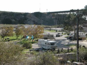
Campgrounds: Gaviota State Park has 55 units available on a first come, first serve basis. Refugio State Park has 85 units, all on the state park reservation system.
Lodging: Several choices at Buellton 11.5 miles north on Highway 101, many more in Santa Barbara to east. Banana Bungalow is in Santa Barbara, (800)346-7835.
Points of Interest

In the News
Interested in contributing to this project?
Register to add new photos and information, update existing results and share your trip reports.