
Usage Notes

Legend: For details on the icons and trail colors, please click the legend icon on the map above.

Layers: Other layers are available. See the California Coastal Commission and Coastal Conservancy Completed Sections layer for the official completed trail segments. (About progress on the trail completion project.)
Sonoma Section 3
North Boundary to Salt Point, Salt Point State Park
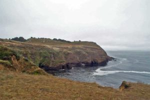
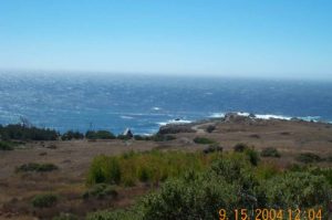
In contrast to the last section's highway walk past privately owned coastal property, this fine walk unfolds entirely within Salt Point State Park, exploring a saw-toothed coast of jutting promontories and rocky inlets. It's one of the most dramatic and scenic walks in Sonoma County and for this author's money, in the state.
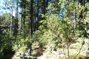
This hike begins at the turnout just north of the Salt Point State Park boundary, which is marked by a sign. Walk the shoulder south briefly past the sign, then locate an unmarked trail plunging down slope through the brush. If it's too overgrown, continue ⅜ mile on the shoulder, then turn right where a well-worn trail heads straight down to the shore from a wide shoulder parking area. To hike the first trail, drop from the road and head south through a stand of trees, across a small gully before ¼ mile, and gently downhill past more trees.
Cross a wide grassy area, then meet the second trail from the road. You can turn right and descend to the bluff's edge to overlook steep Horseshoe Point and the dramatic cove.
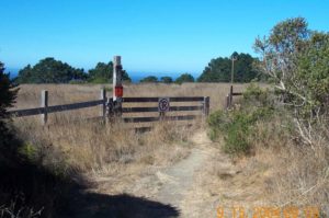
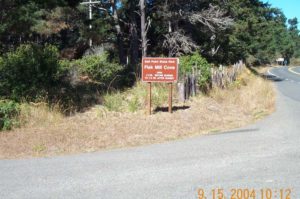
Walk east along a ravine, then cross it heading south on the first obvious path. Then cross the sloping terrace above dense bush lupines and head for the notch in the ridge defining the point. Top the notch at one mile. Before you descend, consider a short climb to the point for a great view. Then follow the old ranch road south, soon leaving the ridge to drop to the blufftop at 1¼ mile. The big rock outcrop jutting seaward invites exploration of its nooks and crannies carved by the surf. The trail meanders south past fantastically shaped sandstone. Round a point and turn east to the north end of Fisk Mill Cove at 2¼ miles. As you follow the bluff overlooking the cove, watch for a heavy ring attached to the rocks. This 19th century relic moored the lumber schooners that called at this small cove. As you round the cove, cross a small gully, then meet a trail from the highway. Stay to the right and reach a steep banked gulch at 2¾ miles. A path near the bottom forks right, descending to a rocky beach. The Coastal Trail climbs out of the gulch, through an old fence and into a grassy area. After several hundred leet a side trail forks right to a cemetery for the Fisk family who settled here in 1860, operating a ranch for many years.
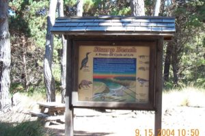
The main trail soon merges with the spur and passes another trail from the road. Turn right, pass through another fence, and dip through another steep gully. Ascend through lovely Bishop pine forest. Reach an unmarked trail junction at 3 miles. Left leads ⅛ mile to Fisk Mill parking area with water, picnic tables and restrooms. CCT takes the right fork 150 feet to another junction. The spur climbs steeply to the viewing deck atop Sentinel Rock overlooking the cove 120 feet below, Horseshoe Point to the north and Salt Point to the south.
The Coastal Trail turns left to descend south. It then contours above the bluff's edge through magical forest, crossing two bridges and passing two rock outcrops. After the second rock, descend to a picnic table with a grand coastal view south. (Fisk Mill South parking area lies just east.) Follow the wooded bluff past another rock outcrop, cross a bridge and leave the forest for open headlands at 3⅝ miles. Follow the bluff's edge to ford Chinese Gulch Creek before 3⅞ miles. It cascades over rock shelves with flowers sprouting from cracks and clear pools to cool your weary feet. Across the creek, step carefully to the cliff edge to view the mossy waterfall.
Climb the bank, wind past a brushy hill almost to the highway, then drop south to follow the bluff's edge. At 4⅛ miles you ford Phillips Gulch Creek above another waterfall. Climb a steady incline along bluff's edge to an overlook high above dramatic, deep Stump Beach Cove. The trail skirts the cliff, enters forest at 4⅜ miles, then drops into a gully. Descend steeply to Stump Beach at 4½ miles. Walk across the beach, ford the creek, and climb west up the steep eroded track to a grassy terrace.
CCT follows the main track veering left toward Gerstle Cove, or you can follow a lesser path along the bluff edge, pausing to explore the bizarre eroded rocks called tafoni, most impressive around 5¼ miles. Both paths ford Warren Creek around 5¾ miles, then pass rocks quarried in the 1870s to supply San Francisco with stone. Reach the large Salt Point parking area at 6¼ miles.
SUGGESTED ROUND TRIPS & LOOPS: From Fisk Mill Cove, Stump Beach or Salt Point parking areas, walk the trail out and back on a hike suited to your time and energy. Or get the park map and take either the 2⅝- or 5-mile loop up to the Pygmy Forest east of the highway.
Distance: 6 ¼ miles (10.1 kilometers)
Open to: Hikers
Surface: Trail
Access point: North boundary of Salt Point State Park
How to get there: Park in the wide shoulder on the west side of Highway I at Milepost 44.54, 4.6 miles north of the Gerstle Cove Campground entrance.
Other access: Fisk Mill Cove and Stump Beach parking areas.
Difficulty: Easy
Elevation gain/loss: 260 feet +/380 feet-
Cautions: This trail is mostly unmarked.
Further information: None.
Facilities: Restrooms, water and picnic tables at Fisk Mill cove, stump Beach, and Salt Point parking areas.
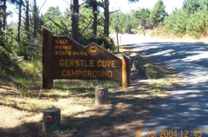
Campgrounds: Salt Point State Park has Gerstle cove and Woodside campgrounds, plus a group camp and hike and bike camps.
Lodging: Salt Point Lodge is just south of the park on the next section.

Points of Interest
In the News
Interested in contributing to this project?
Register to add new photos and information, update existing results and share your trip reports.