
Usage Notes

Legend: For details on the icons and trail colors, please click the legend icon on the map above.

Layers: Other layers are available. See the California Coastal Commission and Coastal Conservancy Completed Sections layer for the official completed trail segments. (About progress on the trail completion project.)
Del Norte Section 9
Klamath River, South Bank, to Carruthers Cove Trailhead, Prairie Creek Redwoods State Park
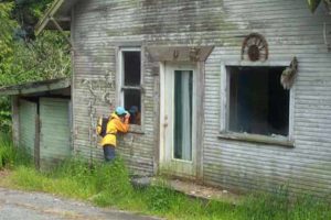
The verdant and pristine Flint Ridge Section of the Coastal Trail climbs to a wooded ridge above the mouth of the Klamath River, exploring some wind gnarled virgin forest. Just before the west end of the trail descends to Coastal Drive, quiet Flint Ridge Camp offers pleasant walk-in camping.
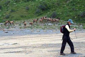
The rest of the section follows lightly traveled Coastal Drive. Of course you CAN drive the road portion of this CCT section, barring closures for slip outs and other acts of nature, but walking it reveals breathtaking hidden vistas of a rugged and elusive coast that you're not likely to notice from your vehicle. Coastal Drive offers one of the great road walks along the Coastal Trail. I've driven the road many times, but walking it revealed unexpected treasures: abundant grouse calling from the alder forest between the road and the wild coast, changing vistas of the immense, elusive dome of Split Rock, even a Yurok brush dance pit hard by the banks of the churning Klamath River near its mouth.
If you take a boat across the Klamath River, ask the captain if he can drop you near the Douglas Bridge parking area or at Riverwoods Campground on the south bank. If not, he'll probably have to land around the old Dad's Camp near the river's mouth. If so, walk up the access road to meet Coastal Drive just south of South Klamath Overlook, missing the Flint Ridge portion of CCT and knocking 3⅝ miles from the total distance. Walk up Coastal Drive to the western Flint Ridge Trailhead around ½ mile.
If you're day hiking this section or if the shuttle boat drops you near the Douglas Bridge, cross Klamath Beach Road to the parking area and find the start of the Flint Ridge Trail just south. Flint Ridge Trail descends through dense alder forest to cross a bridge over Richardson Creek then heads upstream to Marshall Pond. After wrapping north and west around the pond, your trail switchbacks to the right around ¾ mile and ascends by many switchbacks through dense forest. As you gain the ridge around 2 miles, you might glimpse the deep river canyon to the north. The trail climbs west with the ridgetop, passing redwoods to 12 feet in diameter, most with broken tops because of the harsh coastal winds. By 2½ miles it stays south of the ridgetop through several short ups and downs. From 2¾ miles you descend steadily for ½ mile, then climb to a second summit at 3¾ miles where alders start to mix with the giant redwoods. Soon alders dominate the forest as you descend by switchbacks toward the coast.
After a power line at 4¼ miles, watch for the side trail to Flint Ridge Camp on the right. Ten sites in a grassy clearing provide tables, metal food lockers (remember the bears), and a composting toilet, but no water. Flint Ridge Trail drops to Coastal Drive at 4½ miles.
CCT follows the road south, contouring across a steep slope with dense forest on the left. A side trail forks right at 4⅞ mile, descending ⅛ mile to a World War II era radar station. Your road dips and climbs, passing another side trail on the right at 5⅝ miles. A road descends ⅛ mile to High Bluff Picnic Area where a short paved path offers a breathtaking view south.
The Coastal Drive climbs to a junction with Alder Camp Road. Turn right and follow the pavement as Coastal Drive contours above the shore weaving in and out of forest. From 6¾ miles you climb to a high point of nearly 600 feet, then make a roller-coaster descent with intermittent views toward the shore below. After the descent bottoms out around 7½ miles, ascend to two more grand vista points at 8 and 8½ miles. At the second, Carruthers Cove Overlook, a stone wall turnout provides an eagle's view of the rugged coast 600 feet below with Carruthers Cove and Gold Bluffs Beach to the south and Split Rock to the north. Continue along Coastal Drive through forest to 9⅛ miles, where Carruthers Cove Trail, start of the next section, descends west from the road shoulder. The spot is easy to miss if the trailhead sign isn't in place. The Humboldt County line is ⅛ mile south. Coastal Drive turns inland, ending at Drury Parkway in one mile.
SUGGESTED ROUND TRIPS & LOOPS: Flint Ridge Trail offers the best hike. You might walk the least traveled part of Coastal Drive from South Klamath Overlook south to High Bluff Picnic Area and return, 3½ miles round trip. The best loop would be Flint Ridge Trail, returning via Klamath Beach Road, 7¾ miles.
Distance: 9⅛ miles from Douglas Bridge Parking Area or 5½ miles from south bank of river near mouth (14.7 or 8.9 kilometers).
Open to: Hikers. Bicyclists, equestrians allowed on road.
Surface: Trail, gravel road, paved road.
Access point: Douglas Bridge Parking Area (or South Klamath Overlook).
How to get there: Unless you're taking a boat, turn west off Highway 101 just south of the Klamath River bridge and follow Klamath Beach Road 1.8 miles to Douglas Bridge Parking Area at Alder Camp Road.
Other access: Anywhere along Coastal Drive.
Difficulty: Hard
Elevation gain/loss: 1370 feet+/750 feet-. From river mouth: 850 feet+/290 feet-.
Cautions: Coastal Drive is prone to slip outs and may be closed to vehicle traffic at times. During road closures may be the ideal time to walk this section, but inquire first.
Further information: Redwood National and State Parks (707) 464-6101, ext. 5265. For boat shuttle, call Rivers West (707) 482-5822 or (800) 887-5387.
Facilities: None at access point. Chemical toilet, but no water at Flint Ridge Camp. Picnic area and wheelchair -accessible toilets at High Bluff.
Campgrounds: Flint Ridge Camp has walk-in camping. Car camping is available at Prairie Creek Redwoods State Park to the south. Riverwoods Campground, (707)482-5591, is near access point.
Lodging: Motels are in Klamath to the north and Orick to the south.
Points of Interest

In the News
Interested in contributing to this project?
Register to add new photos and information, update existing results and share your trip reports.