
Usage Notes

Legend: For details on the icons and trail colors, please click the legend icon on the map above.

Layers: Other layers are available. See the California Coastal Commission and Coastal Conservancy Completed Sections layer for the official completed trail segments. (About progress on the trail completion project.)
Humboldt Section 3
Redwood Information Center, Orick, to Dry Lagoon, Humboldt Lagoons State Park
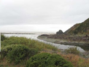
For the next eight miles three immense lagoons dominate the coastal terrain. The first, Freshwater Lagoon, is landlocked and east of Highway 101, presenting no challenge to your passage along the coast. You must make a short highway detour around the Gyon Bluffs south of Freshwater Lagoon. Both 521-acre Stone Lagoon and 1470-acre Big Lagoon breach their barrier beaches during the rainy season. When the lagoons breach, so does the Coastal Trail. In that case the powerful surge channels flowing into and out of the lagoons, depending on the tides, are impassable, requiring either a boat shuttle or a highway detour.
In summer, given the appropriate low tide at the bluffs south of Dry Lagoon, you generally can walk the next two CCT sections without other detours. This is one of the most marine segments of CCT, a salt-watery world where you'll seldom be far from the churning surf. One exception follows a pleasant, recently constructed trail over the wooded ridge between Stone Lagoon and Dry Lagoon for 2½ miles.
From the Redwood Information Center at Orick, walk south along the beach tideline. By ⅜ mile you pass the wooded hillside of Lookout Point which rises 693 feet one half mile east. By ½ mile CCT begins its crossing of the barrier beach of Freshwater Lagoon where recreational vehicles camp along Highway 101 just east of your route.
At 1½ miles the Gyon Bluffs rise from the beach. You can't get around the steep bluffs along the tideline. CCT detours east to follow the highway shoulder for ⅝ mile, then follows Stone Lagoon Road to the beach at 2⅛ miles where large Stone Lagoon looms to the south. When Stone Lagoon breaches its barrier beach at the south end of the sand spit (generally winter and spring, but inquire first), you'll have to detour farther along the highway by the Alternate Route unless you find a boat shuttle across the lagoon.
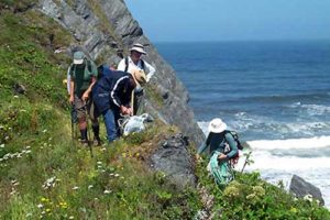
When Stone Lagoon isn't breaching, CCT simply continues along the beach, crossing the dry breach channel from about 2⅝ to 2¾ miles. The barrier beach ends at 2⅞ miles where the wooded hills around Sharp Point rise west of Stone Lagoon. Follow the lagoon shore east on vague track through grasslands near a the base of the bluff. (Sharp Point blocks through passage south along the beach.) By 3 miles you pass several large cypress in draw on your right. After rounding a rocky point shrouded in dense coastal scrub, the path turns southeast. By 3⅛ miles the brushy hillside forces you along the lagoon's rocky shore.
At 3¼ miles, where the shore cuts east and gets brushy, look for a path westsouthwest into the forest. It may be somewhat overgrown with twinberry, alders and willows. Follow the path, crossing a short boardwalk in 100 feet, then ascending gradually southeast and east. You top a wooded rise around a 3½ miles. Before 3⅜ miles CCT drops to meet a spur trail on the left which descends ⅛ mile to a pleasant boat-in/walk-in camp in the forest above a small cove on the lagoon shore. CCT takes the right fork, descending slightly, then contouring along a wooded canyon with bleeding heart and feral lilac. After crossing a gully at 4 miles, CCT ascends east. Pass a view of Stone Lagoon at 4¼ miles and cross a cantilever bridge, climbing to this section's summit at 4⅜ miles.
Your trail contours, passing a last glimpse down to Stone Lagoon's south end at 4½ miles. Descend gradually, winding through lush ferns and greenery. Beyond 4⅞ miles you descend near a ridge. CCT soon turns west, descending through dense spruce forest around 5⅛ miles. Soon a brushy clearing offers a view west to the Pacific and south over the marshes of Dry Lagoon.
A winding descent down a scrub-filled gully drops to the flats. Walk west to the beach's high tideline by 5½ miles. Follow it south for ½16 mile, then walk east 300 feet, coming to the Dry Lagoon parking area at 5⅞ miles.
ALTERNATE ROUTE: From about December through April, Stone Lagoon's barrier beach is usually broken by a powerful surge channel which isn't fordable. Unless you can arrange a boat to a carry you across the lagoon east of the channel, you must detour along Stone Lagoon Road, Highway 101, and Dry Lagoon Road, a distance of 5⅞ miles.
SUGGESTED ROUND TRIPS & LOOPS: The hike from Stone Lagoon to Dry Lagoon makes a worthwhile day trip. When Stone Lagoon breaches the barrier beach and you cannot reach the trail portion from there, you can start from Dry Lagoon and hike north as far as the surge channel.
Distance: 5⅞ miles (9.5 kilometers).
Open to: Hikers.
Surface: Beach, trail, highway shoulder.
Access point: Redwood Information Center.
How to get there: Turn west off Highway 101 one mile south of Orick. Day hikers park in Information Center parking lot, open 9 a.m. to 5 p.m. daily. If you need to leave your car overnight, either park in rest area lot south of Information Center or go to Information Center and make special arrangements.
Other access: Beach at Freshwater Lagoon or Stone Lagoon.
Difficulty: Easy
Elevation gain/loss: 320 feet+/320 feet-.
Cautions: At Stone Lagoon an impassable surge channel breaches the lagoon's barrier beach during the rainy season and sometimes into early summer. In that case you must either find a boat shuttle across the lagoon east of the channel or make a long highway detour. Call ahead and ask if the beach is passable from Stone Lagoon Picnic Area to the trail around Sharp Point.
Further information: Humboldt Lagoons State Park (707) 488-2041, Redwood Information Center (707) 464-6101, ext.5265.
Facilities: Restrooms, water, phone and picnic area at access point. Stone Lagoon and Dry Lagoon have picnic areas and chemical toilets.
Campgrounds: Freshwater Lagoon has wayside camping between beach and highway. Inquire at Redwood Information Center. Stone Lagoon Environmental Camps are ⅛ mile off CCT on west shore of Stone Lagoon. Dry Lagoon Environmental Camps are a short walk from section's end. Several private campgrounds are in Orick and near Dry Lagoon.
Lodging: Several motels in Orick.

Interested in contributing to this project?
Register to add new photos and information, update existing results and share your trip reports.