
Usage Notes

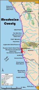
Legend: For details on the icons and trail colors, please click the legend icon on the map above.

Layers: Other layers are available. See the California Coastal Commission and Coastal Conservancy Completed Sections layer for the official completed trail segments. (About progress on the trail completion project.)
Mendocino Section 11
North Mendocino Headlands to Chapman Point Trailhead
At Mendocino Headlands the trail meanders along the edge of a convoluted bluff with numerous choices for shorter or longer routes. While you may not want to walk out to every point, you won't want to rush by this spectacularly twisting shoreline either. If you were to walk every twist of this serpentine shore, you would walk about 3 miles just from the north parking lot to Big River Beach, a north-to-south distance of only ¾ mile.
Immediately south of Mendocino, since Big River is too deep to ford, you need to arrange a boat shuttle or detour across the highway bridge. Call Catch-a-Canoe on the river's south shore and ask if they can provide a shuttle, when, and how much it costs. The first mile of shoreline south of Big River is privately owned, but a quiet stretch of old highway and two broad turnouts allow you to keep off the highway for all but a few hundred feet.
Walk north behind the restrooms through the cypress grove to find the trail along the edge of the bluff. Turn left and follow the trail west, not the well-beaten side trail that heads north to a point. By ⅛ mile CCT leads back toward Heeser Drive, drawing beside it briefly before meandering along the bluff edge. Descend to a north-facing promontory with views of several islets to the west and Point Cabrillo up the coast.
Before ⅜ mile the trail turns south, passing another parking lot, then a side trail out to a narrow peninsula. CCT draws alongside the road briefly before turning west to round Mendocino headland's westernmost point around ⅝ mile where a side trail heads west to the point's rocky tip. Follow the path along the bluff's edge which leads back beside Heeser Drive at ¾ mile, then out to the bluff overlooking an inlet between you and Goat Island offshore. After passing the first trees since the start of the section, look west to see a natural bridge on the headland just south of Goat Island.
The CCT turns vague as it comes to large parking lot at ⅞ mile. Circle the west end of the lot, then head south to a point at one mile. The trail twists east, north and south to round two stunning coves, then wanders farther south along the shore of the southernmost peninsula which juts out into Mendocino Bay. The southern tip of the point is marked by a wooden carving. These old virgin redwood posts were first used to tie down ships that anchored in the bay, much later carved into the fanciful shapes you see today. The southeastern tip of the point holds the ruins of the loading chute.
CCT turns north to pass the blowhole and continue toward the town's picturesque Main Street. Soon the trail broadens and turns east, passing benches and a stairway to tiny, south-facing Portuguese Beach around 1¾ miles. A nearby plaque commemorates artist Emmy Lou Packard who led the fight to save these headlands from development.
CCT continues east along the bluff's edge, heading for the mouth of Big River. Around 1⅞ miles after dipping through a small gully, you meet a trail forking left into town. CCT continues along the bluff with several choices for shorter or longer routes.
As you pass the town's landmark white Presbyterian Church, the trail descends to the stairway to Big River Beach at 2⅛ miles. If you have arranged a boat shuttle across Big River, descend to the beach and meet your shuttle near the highway bridge around 2⅜ miles. Otherwise you want to detour on Alternate Route B.
CCT heads east along Big River Beach, then catches a shuttle across Big River. Walk up the road from Catch-a-Canoe, then turn right and walk the shoulder of Comptche-Ukiah Road briefly to Highway - at 2⅝ miles. Cautiously cross the highway to pick up Brewery Gulch Road on the west side.
Brewery Gulch Road serves as the CCT for the next stretch. This old piece of the coast highway hugs the shore of Mendocino Bay while offering fine views. Just 200 feet from Highway 1, a short side trail on the right leads right to the bay's edge. CCT continues uphill to the end of the road, then turns right and follows the edge of the vista point which overlooks Brewery Gulch Cove and Chapman Point south of Mendocino Bay.
From the vista point, CCT follows Highway 1 briefly to cross Brewery Gulch, then comes to private Chapman Point Road at 3⅜ miles. It's state park land south of the southernmost driveway. While there is no developed trail at press time, cross the fence and walk south, paralleling the highway on state land. Ascend to the top of a rise at 3¾ miles and meet a well traveled path heading west along a fence. The grassy parking area directly to the east is the starting point for the next CCT section.
ALTERNATE ROUTES:
A) Here's a shortcut if you don't have time to walk the whole headlands. Take the trail 50 feet west of the driveway across the street from the access point. Walk south through the Mendocino High School grounds, then descend Kasten Street to Main and walk the path south to CCT.
B) From the top of the stairway to Big River Beach, go north past the church to Main Street. Turn right and head east to Highway 1. Go right again and cross Big River bridge, then take the first right onto Brewery Gulch Road.
SUGGESTED ROUND TRIPS & LOOPS: Walk the headlands loop to 1⅞ miles and return via the high school, a 3-mile loop. Extend that loop with a side trip to Big River Beach.
Distance: 3¾ miles (6 kilometers).
Open to: Hikers on whole section, bicyclists on road sections.
Surface: Trail, beach, road shoulder, highway shoulder.
Access point: North Mendocino Headlands.
How to get there: Turn west off Highway at Mendocino's only traffic signal at Milepost 50.85 onto Little Lake Road. At the stop sign, turn right on Lansing Street and go .3 mile. Turn left on Heeser Drive and go 2 mile to parking lot on right.
Other access: Anywhere along the route.
Difficulty: Easy
Elevation gain/loss: 280 feet+/200 feet-.
Cautions: Stay back from steep crumbly bluff edge. Don't try to ford Big River.
Further information: Mendocino area State Parks (707)937-5804. For boat shuttle, call Catch-a-Canoe(707)937-0273.
Facilities: Restrooms, water, picnic area at access point. Phones in town.
Campgrounds: Mendocino Campground (private) at corner of Highway 1 and Comptche-Ukiah Road is open April to October.
Lodging: Many choices in Mendocino.

Interested in contributing to this project?
Register to add new photos and information, update existing results and share your trip reports.