
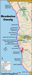
Usage Notes

Legend: For details on the icons and trail colors, please click the legend icon on the map above.

Layers: Other layers are available. See the California Coastal Commission and Coastal Conservancy Completed Sections layer for the official completed trail segments. (About progress on the trail completion project.)
Mendocino Section 12
Chapman Point Trailhead to Van Damme Beach, Van Damme State Park
Of Van Damme State Park's nearly 2400 acres, more than 300 acres west of Highway 1 acquired since 1974 provide an ideal, gorgeous setting for this CCT section. Three separate acquisitions puzzled together the first two miles of trail. While the northern and southern chunks became state park lands in 1975, only in 1996 did state parks acquire the centerpiece 162 acres offered to the state by the Spring family. All three parcels formed part of the original Beall ranch settled in the 1850s. The Bealls sold to the Kents in 1857, who later sold to the Springs. The Coastal Trail here enjoys solitude and a remote feeling despite being close to the historic towns of Mendocino and Little River. The headlands offer great whale watching in season and access to choice tidepools at low tide.
The Coastal Trail heads west from the parking area along a path bordered by a fence on the left and Monterey pines on the right. You soon descend gradually toward the shore with glimpses of Mendocino to the north. After climbing a small rise, the path descends to the first marine terrace. As the descent eases beyond ¼ mile, CCT takes the left fork to continue west. You can take the side trail on the right to explore the north end of this state park property. The left fork quickly comes to level open headlands.
At ⅜ mile just before you reach the bluff's edge, the fence jogs south and SO does the Coastal Trail. You quickly meet a break in the fence. Walk east through the break, then south onto the recently acquired Spring Ranch headlands. Although the trail is vague, you simply follow the bluff's edge as it winds east and south. At ⅝ mile CCT jogs west with the bluff edge, passing above a pretty pocket beach. After heading south through a fence, you veer west again across a tiny stream where watercress grows. Then follow the western edge of the headlands south. Alter a jog east before one mile, your bluff-edge path again angles south. You quickly pass through a fence line, leaving the Spring Ranch portion of Van Damme State Park for land acquired in 1975. CCT lords a tiny stream and meanders generally south near the bluff's edge, passing clusters of cypresses. On your left you might notice two side trails that explore the pine-spattered grasslands to the east.
Around 1¼ miles, the Coastal Trail turns east past a short side trail heading south to the tip of a small promontory. Follow the main trail east past the head of a deep rocky cove. Before 1⅜ miles the path turns northeast across a grassy field. You soon start climbing up to the second terrace. Around 1½ miles you merge with a side trail from the west. (Turn west for a loop back to the trailhead.) Walk east 150 feet. When the main trail veers right toward houses, take the narrow track forking left to ascend through grasslands with scattered pines. After heading east over a hill, you draw near Highway 1 around 1¾ miles. Veer right at a fork and head south paralleling the highway, descending toward Rachel's Inn.
Just before you get to the inn at 1⅞ miles, turn left through the break in the fence and walk the highway shoulder south briefly to paved Peterson Lane. Turn right and walk ⅛ mile west on Peterson Lane, then take the signed path that descends south. It winds down through a gully filled with wildflowers and escaped domestic fuchsias, coming to the northern end of the long crescent of Van Damme Beach. Turn left and walk the beach east and south to a ford of Little River. After you cross the small stream, walk east to the parking lot, start of the next CCT section.
ALTERNATE ROUTE: At high tide, especially in winter, you may not be able to get around a rocky point just west of the Little River ford. In that case retrace your steps to Peterson Lane, walk east to Highway 1, then turn right and walk the highway shoulder to the Van Damme Beach parking lot.
SUGGESTED ROUND TRIPS & LOOPS: You can make a 1¼-mile loop around the northern headlands from the access point. The southern headlands offer a small loop around its southwest quadrant and several other side trails.
Distance: 2¼ miles (3.6 kilometers).
Open to: Hikers.
Surface: Trail, highway shoulder, beach.
Access point: Chapman Point Trailhead.
How to get there: Turn west off Highway at Milepost 48.94, south of Mendocino, north of Little River, into grassy parking area opposite Gordon Lane.
Other access: Peterson Lane.
Difficulty: Easy
Elevation gain/loss: 100 feet+/250 feet-.
Cautions: Stay off adjacent private property.
Further information: Mendocino area State Parks (707)937-5804.
Facilities: Only at south end, chemical toilets, picnic area, phone across highway at entrance kiosk.
Campgrounds: Van Damme State Park at south end, Mendocino Campground on previous section open April to October.
Lodging: Several in Little River, many in Mendocino.
Points of Interest
No individual points found.
In the News
Interested in contributing to this project?
Register to add new photos and information, update existing results and share your trip reports.