
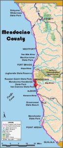
Usage Notes

Legend: For details on the icons and trail colors, please click the legend icon on the map above.

Layers: Other layers are available. See the California Coastal Commission and Coastal Conservancy Completed Sections layer for the official completed trail segments. (About progress on the trail completion project.)
Mendocino Section 10
Point Cabrillo Preserve to North Mendocino Headlands
Point Cabrillo Preserve was snatched from the hungry jaws of land speculators when the Coastal Conservancy completed its acquisition in 1992. The preserve's 300 acres offer a prime example of the abundance of the northern California coast's rich biological diversity. You may see whales, seals and sea lions offshore, and a rich selection of raptors and other birds, deer and wildflowers within the preserve boundaries. Human history is abundant too. The farming community of Pine Grove sprang up here around 1860 and the lighthouse service established the still operating light in 1909.
This route explores the gorgeous headlands around the lighthouse. You can also follow a side trail or loop north to the preserves northern boundary, or take a ⅛-mile detour to the lighthouse, from which you can continue to the very tip of Point Cabrillo.
The short segment of CCT through Russian Gulch State Park barely touches on the diverse spectacular scenery there. Two short side trails seaward are highly recommended, and the longer Waterfall Trail is also worth a trip if time allows. The park's name originated in tales the local Pomo people told of seeing Russian fur hunters there, probably in the late 18th century.
Follow the narrow, semi-paved north road (just north of the new parking lot) through a cypress grove and down the hill, enjoying expanding ocean vistas. The pavement ends around ⅜ mile as the path forks. The side trail on the right heads north to overlook Frolic Cove at the preserve's northwest corner. If you take the right fork, you can loop back along the bluffs to rejoin CCT ahead, adding about ½ mile to your hike. The Coastal Trail continues west to the bluff's edge at ⅝ mile where you meet the bluff trail. To the north you can see Caspar Point with the Lost Coast visible beyond on the clearest days.
A right turn follows a side trail north to Frolic Cove, but the Coastal Trail turns left, heading south toward the lighthouse. After dipping across a wooden bridge, you pass through a fence line at ¾ mile and come to the paved lighthouse road. You can take a short detour west along the pavement for a closer look at the recently restored vintage lighthouse, to use the picnic tables, or to explore the eroded tip of Point Cabrillo northwest of the lighthouse.
The Coastal Trail turns east, following the pavement briefly. Before ⅞ mile opposite the second house, the Coastal Trail turns right to follow a semi-paved track angling southwest over the grassy headlands. (An outhouse is 250 feet east along the paved road.) When the semi-paved track ends, veer west then south on a grassy track. By one mile it follows the bluff's edge where offshore rocks beyond a small cove often have harbor seals resting. Follow the grassy track south along the blufftop, then across a sturdy bridge over a small creek. Pass through a fence line and follow the track south toward a rocky point. As you reach the point at 1⅛ miles, the trail dips, then veers left up a short hill into lush growth. A short spur on the right leads to the rocky shelf and views of cove with surge tunnels and a small waterfall. To the south you can see the Mendocino headlands with the round swell of Stilwell Point rising beyond Little River.
The CCT veers left to cross a bridge over a verdant creek just above where the creek plunges over a cliff into the sea with a surge tunnel invisible below. Follow the bluff trail past a razor-thin promontory as CCT turns northeast, passing a healthy patch of kinnikinnick and circumventing a deep cove on your right. a At the head of the cove, the trail turns east and south.
Before 1¼ miles as the path becomes vague, you meet a track climbing northeast. Turn left and follow it east for 300 feet until it merges with a track climbing northeast through the grasslands toward a broad pine up the hill. Follow it ⅛ mile until you pass to the left of the pine and through a fence line. Continue climbing northeast then east.
Near the top of the hill you pass the blank side of a sign. On the front of it are posted the preserve regulations. The main path heads east onto the private property of a trailer park. You want to turn southeast climbing on a vague track along the property line. In 200 feet as you pass a row of pines, look southeast for a utility pole on Point Cabrillo Drive. Make your way to the pole which is easily visible as you Lop a rise south of the trailer park before 1¾ miles. You reach the pole and a break in the fence leading to Point Cabrillo Drive around 1⅞ miles.
Turn right and walk the shoulder of Point Cabrillo Drive south to the entrance to Russian Gulch State Park at 2¾ miles. From the entrance kiosk, descend south along the shoulder of the main park road. By 2⅞ miles, a side road on the right heads west to the park's spectacular north headlands. It's ⅜ mile to the Devil's Punchbowl, about ½ mile to land's end. CCT continues on the main park road, descending under the highway bridge. At 3⅛ mile, CCT turns right on the road signed "BEACH.' The park's pleasant campground is to the east as is a popular 3-mile side trail to the Russian Gulch Waterfall.
Follow the beach road briefly to the Group Campground on the right. Across the road, ascend the South Trail through a lush understory in tall forest. When the path forks, turn right and walk under the highway bridge to a junction. Either fork leads to the CCT. The right fork is recommended, although it's slightly longer. It descends around a wooded high headland with stunning views of rugged Russian Gulch Cove on your right, then rounds a wooded point and ascends southeast to meet the other fork. Turn right and follow the trail south around another cove.
By 3⅞ miles you come to a paved cul-de-sac. Follow the pavement for 400 feet, then descend along the dirt path on the right through a stand of Monterey pines. When you pass the last of the trees and come to open grasslands, the CCT veers left on a path south. A pleasant short side trail continues west ⅛ mile to the tip of the point. The CCT soon reaches the convoluted south shore of the promontory where a blowhole hides among the trees. Turn left and return to the pavement at 4⅛ miles, then turn right and follow this old stretch of the coast road (Road 500D) to Highway 1.
The only way to cross the chasm of Jack Peters Gulch is on the highway bridge, so cautiously walk the highway shoulder south over the bridge. You immediately turn right and follow Lansing Street south above Agate Cove. At 5 miles, turn right onto Heeser Drive and descend the road shoulder to a parking lot and restrooms, start of Section 11.
ALTERNATE ROUTE: You can save 1½ miles by staying on the shoulder of Point Cabrillo Drive, but you'd miss much of this section's beauty.
SUGGESTED ROUND TRIPS & LOOPS: At Point Cabrillo, take the short walk to the lighthouse and back, or loop all around the headlands of the preserve. At Russian Gulch State Park, walk the splendid short side trail west to the Devil's Punchbowl and the point beyond, or hike the longer side trail east to the waterfall up the canyon. Either of these choices has a short loop option near its end.
Distance: 5¼ miles (8.4 kilometers).
Open to: Hikers. Bicyclists on road.
Surface: Trail, road shoulder, very short highway shoulder leg.
Access point: Point Cabrillo Light Station and Preserve.
How to get there: Turn west off Highway I south of Caspar and north of Mendocino at Milepost 54.66 onto Point Cabrillo Drive. Go 1.7 miles to Point Cabrillo Preserve. This section starts by heading west on the semi-paved road north of the new parking area.
Other access: Point Cabrillo Drive south of Indian Shoals, Russian Gulch State Park, Road 500D south of Russian Gulch, Lansing Street north of Heeser Drive.
Difficulty: Easy
Elevation gain/loss: 370 feet+/470 feet-; 170 feet+/160 feet- for Point Cabrillo portion.
Cautions: Some uneven footing requires caution beyond the lighthouse. Please observe marked closed areas. Dogs must be leashed while in Preserve.
Further information: Point Cabrillo Light Station and Preserve (707)937-0816, Mendocino area State Parks (707)937-5804.
Facilities: Point Cabrillo Preserve has chemical toilet near caretaker's house, flush toilet and water only when the lighthouse is open, picnic tables near the lighthouse. Russian Gulch has restrooms, water, picnic area, phone.
Campgrounds: Russian Gulch State Park campground open April through October. Other times, or when that campground is full, try Caspar Beach RV Park, opposite Caspar Beach on Point Cabrillo Drive.
Lodging: Many lodgings in Mendocino 3 miles south.

Interested in contributing to this project?
Register to add new photos and information, update existing results and share your trip reports.