
Usage Notes

Legend: For details on the icons and trail colors, please click the legend icon on the map above.

Layers: Other layers are available. See the California Coastal Commission and Coastal Conservancy Completed Sections layer for the official completed trail segments. (About progress on the trail completion project.)
Monterey Section 7
Point Lobos State Reserve
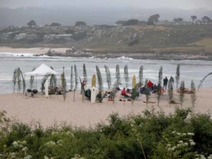
Point Lobos State Reserve may be the jewel of the entire California coast with its diverse habitats packed in a compact 1300 acres, about two square miles, with more than half of it underwater. Landscape painter Francis McComas called it "the greatest meeting of land and water in the world," and no one has quibbled with his description. Here you'll find wooded and grassy wildflower-rich headlands, rocky and sandy coves and beaches, tidepools, Monterey cypress groves and pine forests, meadows, creeks, granite domes, and offshore rocks of every size. Point Lobos offers one of the richest marine environments anywhere. One reason for this is the presence of submarine Carmel Canyon, 600 feet deep just ⅜ mile from the north shore.
The whole adds up to so much more than all the wonderful parts that Point Lobos State Reserve sometimes seems in danger of being loved to death. Yet the state park system has taken numerous measures in the past 20 years that protect this stellar place from overuse, the most important of which is a limit of 450 visitors allowed into the reserve at one time. On busy days this may mean that people arriving at the entrance as soon as two hours after the 9 am opening time will need to wait until other visitors leave to enter. Other rules and restrictions are listed in our cautions and in the park brochure.
Point Lobos also offers a rich and varied history. Shell middens and mortar holes indicate that the Ohlone people visited here to harvest the rich bounties of both land and sea. The Spaniards settled the Monterey area in the late 18th century, giving Point Lobos its name but otherwise using the land only for grazing livestock. After California became a state, granite was quarried at Point Lobos and shipped to San Francisco for building, including the San Francisco Mint. In 1862 Portuguese whalers set up a shore whaling station, hunting whales from small boats and boiling whale blubber in cauldrons on the beach. Robert Louis Stevenson visited Point Lobos in 1879, using the landscape as inspiration for the setting of Treasure Island. After a mining company acquired land here, coal was mined nearby and loaded onto ships anchored in Whalers Cove. They subdivided parts of today's reserve and sold 25-foot-wide lots in "Point Lobos City." From 1897 until 1922 a substantial abalone cannery operated at Whalers Cove, shipping their harvest fresh to California restaurants and canned to Japan.
In 1898 A. M. Allan bought 640 acres from a mining company and began buying up the residential lots. Allan and his wife wanted to save this place rather than exploit it. Visitors began coming to explore the beauty. The Allans foresight led to a movement to establish Point Lobos as a park. With funds from Save-theRedwoods League and public support, Point Lobos became part of California's new state park system in 1933.
From Highway 1 at the park entrance, the CCT follows the pedestrian path on the north side of the park entrance road into Point Lobos State Reserve. When you reach the entrance kiosk, continue another 30 feet, then turn right on the Carmelo Meadow Trail. It dips downhill through pine forest with a dense understory. Reach a more open understory by ¼ mile where you can see Whalers Cove and the parking area on its left.
CCT comes to a T junction above the rim of the cove. CCT's through route turns left here. Consider exploring the side trail on the right, which follows the shore north and east past Coal Chute Point and Granite Point (spur on left beyond ¼ mile), crossing grassy treeless marine terrace to end after ⅝ mile at a a small rocky point overlooking the northeastern boundary of the state reserve, with Monastery Beach of San Jose Creek State Beach beyond a fence.
From the T junction, CCT turns left to follow the rim of Whalers Cove, meeting a paved road at the historic Whalers Cabin, now museum. Turn right and a walk the road north to the parking lot at its end beyond ½ mile, where restrooms are on your left.
From the end of the lot, CCT climbs stairs on the North Shore Trail to top Cannery Point, passing a short view loop on the right. Continue up steps to the next junction where CCT and North Shore Trail go left. (A 75-foot detour along the spur on your right offers a breathtaking vista of nearby Guillemot Island and wooded Big Dome to the west.)
After a short climb, the CCT/North Shore Trail dips toward Bluefish Cove, then ascends and dips again to a junction with the Whalers Cabin Trail on the left. Continue straight on the North Shore Trail, climbing through forest above the shore. Alter passing the short Guillemot Island spur on the right, contour through open pine forest to meet the Whalers Knoll Trail on the left at ⅞ mile. CCT continues straight on the North Shore Trail to rise and dip through dense forest along the northwest face of Whalers Knoll, with views across Carmel Bay to Cypress Point and Point Santa Cruz beyond. Beyond a spur on the right before one mile, follow the North Shore Trail through cypress forest to overlook small sparkling Big Dome Cove at 1⅛ miles, then pass another junction with the Whalers Knoll Trail.
CCT descends west on the North Shore Trail, passing above Cypress Cove at 1¼ miles. You soon pass a short spur on the right that leads to a view of the old Veteran Cypress above Cypress Cove. CCT climbs through dense coastal scrub dominated by poison oak to reach the end of the North Shore Trail by 1⅜ miles. On the right the Cypress Grove Trail makes a shady ⅞-mile loop through the Allan Memorial Cypress Grove, a worthy side trip.
The CCT turns left, quickly reaching a parking lot. Walk south through the lot 200 feet, then veer to the right beside cypress trees on the Sea Lion Point Trail. It soon crosses dense coastal scrub overlooking Headland Cove. Above the cove at 1½ miles you gain a rocky ridge with views north and south. One can continue west to Sea Lion Cove and onto Punta de los Lobos Marinos (source of the park's name), but CCT turns left to climb south above a rocky shore. Follow this Sand Hill Trail to overlook Sand Hill Cove and the rugged shore to the south.
At the next junction, CCT veers right to descend the South Shore Trail past Sand Hill Cove at 1¾ miles. Continue past two spurs to tideline and reach a small parking area at 1⅞ miles. A restroom and picnic area are tucked between forest and meadow to the east. CCT continues south along the narrowing South Shore Trail, gaining open coastal vistas. The light rocks ahead are Pelican Point and Bird Island near the preserve's south boundary with Yankee Point beyond.
Your trail passes another small parking area before 2⅛ miles with a welcome drinking fountain. South Shore Trail/CCT soon returns to the shore and the bluff edge above it, then winds east beside pebbly Weston Beach. The trail winds away from the road and over a small knoll where you see the first trees along the shore since Allan Grove. Wind above a convoluted rocky shoreline with trees crowding the coastal scrub, drawing near Bird Island.
Pass another drinking fountain around 2½ miles and meet a short spur on the right that drops to tiny, sheltered Hidden Beach. Continue down coast on the South Shore Trail, coming to road's end at 2⅝ miles where you'll find a final pleasant picnic area and drinking fountain.
CCT continues south, following the Bird Island Trail over rocky knoll shrouded in trees and coastal scrub. Reach the junction with the spur to lustrous China Cove and China Beach at 2¾ miles. CCT veers left toward Gibson Beach. In just 150 feet it meets a T junction. CCT goes left to leave the Point Lobos shore, but consider another side trip first. Both China Cove and Gibson Beach are treats, but my favorite is the ⅜-mile loop on the Bird Island Trail, which goes right to head west from the T junction.
From the T junction, CCT heads east. In only 50 feet the Gibson Beach Trail forks right. CCT stays left on the South Plateau Trail, climbing over Vierra's Knoll around 2⅞ miles, then descending north through forest to return to the reserve entrance, the only way out of the park. The trail climbs then dips again to meet the Pine Ridge Trail on the left at 3¼ miles. CCT continues north on South Plateau Trail, rising over another knoll, then dipping to the entrance road and kiosk beyond 3½ miles. Turn right and walk out to Highway l and section's end at 3⅝ miles.
ALTERNATE ROUTE: Of course you can skip the loop through Point Lobos State Reserve to save 3⅝ miles, but you would miss a fabulous experience.
SUGGESTED ROUND TRIPS & LOOPS: If you follow the entire loop and take all the side trails, you'll cover about 7 miles and see virtually all the Point Lobos shore.
Distance: 3⅝ miles of Coastal Trail, 7 miles with all the side trips (5.8 to 1.3 kilometers).
Open to: Hikers.
Surface: Trail.
Access point: Point Lobos State Reserve Entrance.
How to get there: Drive south on Highway 1 from the Monterey Peninsula. Only 2 miles from the Carmel River bridge, the only entrance to Point Lobos State Reserve is west of the highway at Milepost 70.4. No fee daytime parking on highway shoulder near entrance.
Other access: Drive into Reserve. You can reach the CCT from every parking area.
Difficulty: Easy
Elevation gain/loss: 390 feet+/390 feet- for CCT. Add 400 feet+/400 feet- for all spurs.
Cautions: Reserve open 9 am to 5 pm, later in summer. Do not disturb natural features. No dogs, stoves, fires or trailers allowed. No motor homes allowed on weekends and holidays, nor Memorial Day through Labor Day. Picnics allowed only in the three picnic areas. Access may be limited on busy days. No charge to walk in.
Further information: None.
Facilities: Restrooms, water, phones, picnic areas at various places in the Reserve.
Campgrounds: Veteran's Memorial County Park is in Monterey near the Presidio, about 6 miles north. Bottchers Gap Walk-In Camp lies 9 miles up Palo Colorado Road from Garrapata State Park on Section 8 in Los Padres National Forest. For showers and other facilities, try Saddle Mountain Recreation Park up Carmel Valley Road.
Lodging: Asilomar Conference Center at start of Section 5 has 315 rooms. Also see Lodging for Section 6.

Interested in contributing to this project?
Register to add new photos and information, update existing results and share your trip reports.