
Usage Notes

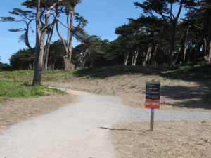
Legend: For details on the icons and trail colors, please click the legend icon on the map above.

Layers: Other layers are available. See the California Coastal Commission and Coastal Conservancy Completed Sections layer for the official completed trail segments. (About progress on the trail completion project.)
San Francisco Section 1
Golden Gate Bridge North Vista Point to the Cliff House, Golden Gate National Recreation Area
As you begin this dramatic walk into a dramatic city, you'll walk across one of the greatest tourist attractions anywhere. The Golden Gate Bridge not only provides the route of the California Coastal Trail across San Francisco Bay, but also the route for three other major trails. See the feature article: The Golden Gate Bridge: A Magnet for Trails. San Francisco City and County has both the shortest Coastal Trail and the only fully complete Coastal Trail of California's fifteen coastal counties. San Francisco's Coastal Trail is also one of the most diverse trails, going from a world renowned bridge, through undeveloped park land, into one of the most expensive neighborhoods in California, past historic and military sites, and on to the windswept Ocean Beach. The trail has all of this plus easy access to one of the most exciting cities in the world.
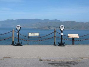
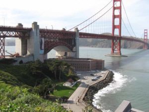
Begin at the North Vista Point of the Golden Gate Bridge. Mingle with tourists from around the world as they stand in awe of the views of the bridge, San Francisco, Angel and Alcatraz Islands, and the cities of Oakland and Berkeley below the East Bay hills. As you begin your walk across the bridge, its overwhelming size and elegant design become apparent. In the middle of the bridge the immense cables sweep down to the walkway with the bay's water moving 220 feet below and the towers 526 feet overhead. Before you reach the south end, look over the railing and straight down on Fort Point, a Civil War era (1861) fort built to guard the entrance to San Francisco Bay. Reach the Toll Plaza at 1½ miles with several interpretive displays about the bridge, the visitor/gift center, and more great views looking back across to the Marin Headlands.
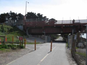
From the plaza CCT passes just east of the visitor/gift center back towards the bridge and drops down an incline for 100 feet to a trail intersection. The Coastal Trail turns left here and heads west under the bridge. Meet the bike path climbing on the left as the Coastal Trail turns right on a dirt path into the Golden Gate National Recreation Area. In the next ⅜ mile, the trail traverses high on the bluffs past several concrete coastal defense batteries from the 1890s. The trail climbs wooden steps and passes two informal parking areas. At the second parking area the Bay Area Ridge Trail branches left to head inland. Around 2 miles the Coastal Trail parallels Lincoln Boulevard along the guard rail.
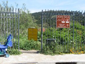
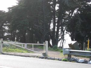
At 2½ miles the trail turns right on a red gravel-surfaced road and winds down to Baker Beach. Around 2⅝ miles CCT passes through Battery Chamberlin. If the gate is locked, walk a few yards to the beach to walk around the installation. Just beyond 3 miles, leave the beach and pick up the path as it heads up steps and meets a gate to 25th Avenue North, a dead end street. If the gate is unlocked, walk 25th Avenue North to Seacliff Avenue, turn right and follow it to El Camino del Mar. If the gate is locked, backtrack about ⅛ mile and walk south along the parking lot, then follow the sandy path through the cypress trees up to Lincoln Blvd. Hop the low traffic barrier, and turn right on the sidewalk. You can also follow the driveway from the parking lot to Lincoln Blvd. In either case you come to Lincoln Blvd. Walk Lincoln west to 25th Avenue. There it becomes El Camino Del Mar, the main street through Seacliff, one of San Francisco's most exclusive neighborhoods with many elegant mansions.
At 3¾ miles Seacliff ends and the trail returns to the GGNRA. Turn right to leave the street, coming immediately to a viewing deck. The deck affords another stunning view of the bridge and the Marin Headlands. Continue west on the trail as it parallels a fairway of the Lincoln Park Golf Course. Soon the trail follows the edge of the bluff, climbing up and over several landslides before dropping back down to follow the route of the Ferries and Cliff House Railway. Around 4¼ miles a broad side trail on the left leads uphill to the Palace of the Legion of Honor, a museum designed like the Napoleonic Legion of Honor in Paris, and home to a fine collection of Rodin sculptures and the largest collection of French art in the U.S.
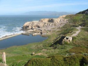
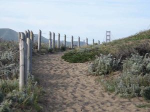
The Coastal Trail continues on the roadbed, following it high above the coastline. Just before the trail swings south it passes a stairway leading to a World War II memorial. Five hundred feet past the stairs take the unmarked trail west as it cuts into the trees and in about ⅛ mile comes out at a large gravel parking lot at mile 5, overlooking Point Lobos and the Cliff House. The ruins of the gigantic Sutro Baths lie below just above the tidal rocks. You can explore them via a side trail dropping down from the parking area. The bathhouses accommodated up to 24,000 people at a time before falling into disuse by 1937, eventually burning in 1966. Another interesting side trip is the walk through Sutro Heights Park just across Point Lobos Avenue. Here on the grounds of the Sutro mansion, all that remains are some statues, overgrown gardens and a big rock deck overlooking the ocean. The main entrance is at the intersection just uphill from the parking area. To finish the section, walk the path in front of the parking area and turn right on Point Lobos Avenue/Geary Boulevard and walk the sidewalk down to the Cliff House at 5½ miles.
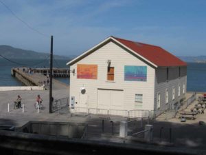
At the Cliff House you can have a drink or eat at the restaurant, or check out the GGNRA Visitor Center and Camera Obscura on the lower deck and the free museum full of hundreds of antique and curious mechanical games, many of which were acquired from the Sutro amusement palace when it closed.
SUGGESTED ROUND TRIPS & LOOPS: Take the San Francisco Bay Trail from the bridge east along the waterfront to the Marina District, Fort Mason and Fisherman's Wharf. Take the side trail down to the rugged coast to explore the ruins of the Sutro Baths or walk through Sutro Heights Park.
Distance: 5½ miles (8.8 kilometers).
Open to: Hikers. Bicyclists on the bridge.
Surface: Sidewalk, trail.
Access point: Golden Gate Bridge North Vista Point.
How to get there: From San Francisco take the Vista Point exit at the north end of the Golden Gate Bridge into the parking area for the North Vista Point. From Marin County, take the last exit, Golden Gate National Recreation Area, before the bridge. Make an immediate left, and then another left into a parking area. Walk the catwalk underneath the bridge to the North Vista Point.
Other access: Golden Gate Bridge Toll Plaza, Seacliff Avenue, Camino del Mar.
Difficulty: Easy
Elevation gain/loss: 300 feet+/425 feet-.
Cautions: Cyclists must use the sidewalk on the west side of the bridge on weekends and holidays.
Further information: Golden Gate National Recreation Area (415)331-1540 (ask for a TDD line if you need one), Presidio (415)561-4323, TDD(415)561-4314.
Facilities: Restrooms, water, picnic tables, telephones at access point.
Campgrounds: Pantoll Campground on Mt. Tamalpais has walk-in sites. Marin RV Park in San Rafael for RVs.
Lodging: San Francisco Hostel at Fort Mason (415)771-3645. Many choices in San Francisco.
Points of Interest

In the News
Interested in contributing to this project?
Register to add new photos and information, update existing results and share your trip reports.