
Usage Notes

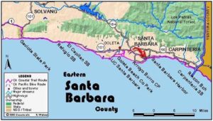
Legend: For details on the icons and trail colors, please click the legend icon on the map above.

Layers: Other layers are available. See the California Coastal Commission and Coastal Conservancy Completed Sections layer for the official completed trail segments. (About progress on the trail completion project.)
Santa Barbara Section 9
Arroyo Burro Beach County Park to Stearns Wharf, Santa Barbara
This section completes the transition to a fully urban waterfront. At the west end, the high bluffs east of Arroyo Burro Park offer seclusion and drama to the beach. The shore becomes increasingly urban as you pass below or through splendid Shoreline Park, then lose the bluffs altogether at Ledbetter Beach. On this section's final mile, you'll find motels, restaurants, college, city parks, ball fields, tennis courts, boat rentals, fishing charters, municipal pool, harbor, 2000-foot long Stearns Wharf, even concerts and crafts fairs all within ¼ mile of the CCT.
Walk down the path at the south end of the parking lot and cross the beach to the tideline, about 150 feet. Turn left and walk the tideline east. After you cross the mouth of the little creek that flows seasonally out of the slough, high bluffs rise 150 feet on your left, now protected as the Douglas Family Preserve.
CCT continues east along the narrowing, wild beach to round a point at ½ mile. Beyond the minor point, the beach turns broad again as you walk east. Reach the Mesa Lane stairs at ⅞ mile, a coastal access path that ascends 150 feet to the suburban bluff. Follow the beach east, rounding another point around one mile. The beach narrows on the way to a canyon before 1½ miles. You can usually get through at all but high tide, except during storm surf in winter. Above the canyon the Santa Barbara Lighthouse perches on the bluff 100 feet above.
Walk the beach east with the bluffs becoming shorter as you go. When you reach the stairway ascending to the end of Santa Cruz Boulevard at 1⅞ miles, the bluff is about 60 feet high. At high tide you'll probably need to climb these stairs, known as One Thousand Steps, and walk Shoreline Drive east, then continue east on the paths of Shoreline Park.
If you can, continue east along the narrow beach below the bluffs. By 2 miles, Shoreline Park perches atop the bluff. Continue to the Shoreline Park stairway at 2⅜ miles, which offers another escape if you cannot get around Santa Barbara Point at 2⅝ miles, which requires a tide below +3.0 feet.
If you round the point, follow the tideline of the beach north. As you go, the beach broadens and the cliffs angle away from the shore and become lower. By 2¾ miles follow the tideline of broad Leadbetter Beach northeast. Soon a grassy park at the top of the beach offers restrooms, picnic tables and a snack stand. a Reach the east end of Leadbetter Beach by 3⅛ miles. Continue along the waterfront to Point Castillo at 3¼ miles. Straight ahead lies the breakwater protecting Santa Barbara Harbor. Turn left and walk the waterfront past the Yacht Club and Naval Reserve Center, then follow the shoreline as it turns right to head north overlooking more docks. Pass the municipal pool on your left, then the pier at 3⅝ miles that defines the east end of the marina.
Beyond the pier, you come to West Beach. You can walk the tideline of the often crowded beach or follow the pedestrian boardwalk that's also popular with bicyclists and skaters. By 3⅞ miles West Beach and this section end at Stearns Wharf, a mecca for seafood lovers, fishermen, tourists and strollers. See the next section for more about the wharf.
ALTERNATE ROUTE: At high tide, you may need to bypass the shoreline between One Thousand Steps and the west end of Leadbetter Beach. In that case, follow Shoreline Drive and the paths of Shoreline Park between those points.
SUGGESTED ROUND TRIPS & LOOPS: From the access point, walk the secluded beach east as far as time or tides will allow. Another choice would be to stroll through pleasant Shoreline Park and down to Leadbetter Beach. If the tide is low enough, you can loop back on the beach around Santa Barbara Point, returning to the blufftop via the Shoreline Park stairs or One Thousand Steps.
Distance: 3⅞ miles (6.0 kilometers).
Open to: Hikers. Dogs OK on leash.
Surface: Beach, paved trail.
Access point: Arroyo Burro Beach County Park.
How to get there: Exit Highway 101 in west Santa Barbara onto Las Positas Road. Go south on Las Positas 1.8 miles to its end, go right on Cliff Drive .2 mile, then left into Arroyo Burro Park lot.
Other access: Mesa Lane stairs, Shoreline Park, Ledbetter Beach.
Difficulty: Easy
Elevation gain/loss: Negligible.
Cautions: Day use open sunrise to sunset. No overnight parking in day-use lot.
Further information: Arroyo Burro Beach County Park (805)687-3714.
Facilities: Restrooms, water, phone, picnic area and snack stand at access point, where the Brown Pelican Restaurant serves excellent breakfasts.
Campgrounds: El Capitan State Park 16 miles west has 142 units on the state park reservation system plus several hike/bike sites.
Lodging: Many choices in Santa Barbara. Banana Bungalow (805)963-0154 is only seven blocks from the beach near Stearns Wharf.
Points of Interest

In the News
Interested in contributing to this project?
Register to add new photos and information, update existing results and share your trip reports.