
Usage Notes

Legend: For details on the icons and trail colors, please click the legend icon on the map above.

Layers: Other layers are available. See the California Coastal Commission and Coastal Conservancy Completed Sections layer for the official completed trail segments. (About progress on the trail completion project.)
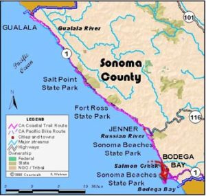
Sonoma Section 8
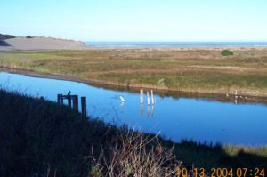
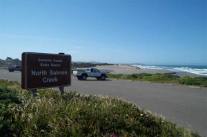
Salmon Creek Beach to Campbell Cove, Bodega Head, Sonoma Coast State Beach
This wonderful walk explores sandy beach, windswept dunes and Bodega Head hard by the San Andreas fault. The Head offers dramatic views of forty miles of coastline, while Sonoma County's longest sandy beach offers great beachcombing, surf fishing, surfing and family outings. Our description begins at Salmon Creek, but look at the creek's mouth to decide exactly where. In the winter it usually flows into the surf, and in summer a sand bar usually forms. If the mouth is flowing, walk or drive to the South Salmon Creek parking lot.
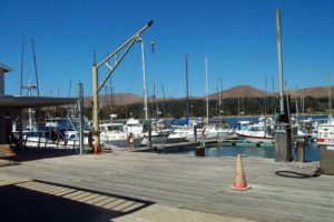
Coastwalk, CalTrans, the Bodega Bay Grange and Sonoma County are exploring the possibility of building a walking path from the north end to the south end of town. Such a route would be an good Alternate Route for CCT since, in addition to serving the town, it would not require a boat shuttle as the current CCT route does south of Campbell Cove.
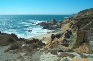
Walk the beach south toward Mussel Point, the northern end of Bodega Head in the distance. In winter the beach narrows so that waves may run to the base of the dunes. In that case you must retreat to the dunes to pass. In summer a wide Mat beach makes passage easy.
Around one mile from Salmon Creek, a wheelchair-accessible ramp crosses the dunes to a parking area. You pass through the San Andreas Rift Zone here as it comes ashore to cross the dunes. As you approach Mussel Point start looking for a notch in the dunes. Find the notch at 2¼ miles, about ¼ mile before the beach ends at cliffs. The trail through the notch, often unmarked, is the third trail into the dunes south of the ramp. Before taking it, consider a side trip to explore the end of the beach, which has a cave with a freshwater spring and three narrow low tide channels.
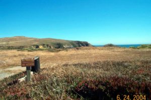
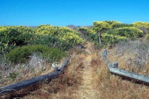
Take the trail into the dunes. If you've found the right trail it soon comes to a low structure of peeled logs marking a junction. Go straight, heading toward tall dunes in the distance. The shifting sand can make the trail tricky to follow so watch for the most trodden trail, marked with green posts with an angled top. At the base of the dune, the trail veers to the right and climbs the face of the dune. Climb to a saddle between the high dunes, then descend to another junction at 3 miles. Take the trail straight ahead marked "Bodega Head - 1.7 MILES." The other trails return to the beach or lead to Bodega Dunes Campground. At 3⅓ miles you pass through a stile in the fence marking the University of California Marine Lab property. Please stay on the trail here to avoid disturbing research projects in the area. Follow the trail winding through the dunes, crossing a narrow paved road to the lab around 37 miles.
This road marks a transition from dunes to the soil and rocks defining Bodega Head's hilly terrain. Climb the trail south to a junction at 4¼ miles. The short side trail on the right climbs to a hilltop for a view of the marine lab beside scenic Horseshoe Cove, with green Mussel Point stretching seaward and Salmon Creek Beach beyond. CCT follows the trail on the left, descending to the main parking area on Bodega Head at 4⅝ miles. This popular spot set high on cliffs overlooking a rocky shoreline has great gray whale viewing. From the parking area you have two choices. One choice is to walk down the road to Campbell Cove, ending the walk at 5¼ miles. The longer choice follows the spectacular trail around the perimeter of Bodega Head. To do so, take the trail that climbs gently south along the edge of the cliffs. It circles the Head's high bluffs, with great views south to Bodega Rock, Tomales Point and Point Reyes and east to Bodega Bay. At 5⅞ miles you come to the east parking lot. From here you must follow the road, snaking downhill to Campbell Cove at 6⅝ miles. It passes the "Hole in the Head," a massive excavation for the foundation of a nuclear power plant that was never built. In one of California's first maior environmental battles, outraged citizens effectively organized to scuttle the project.
SUGGESTED ROUND TRIPS & LOOPS: From Salmon Creek walk Salmon Creek Beach south to its end and back, about 5 miles. From either Bodega Head parking area, walk the loop trail around Bodega Head, 1¾ miles.
Distance: 10 ½ miles (16.5 kilometers)
Open to: Hikers, Bicyclists
Surface: Beach, trail highway shoulder
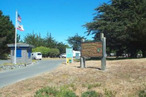
Access point: Campbell Cove at Bodega Head
How to get there: Turn west off Highway 1 at the north end of the town of Bodega Bay onto Eastside Road, then turn west on Bay Flat Road and go 3 miles to the Campbell Cove parking lot where the road makes a sharp turn uphill.
Other access: Doran Regional Park, Pinnacle Gulch Trailhead, along Highway 1.
Difficulty: Easy
Elevation gain/loss: 420 feet+/380 feet-
Cautions: It is best to arrange a boat ride across Bodega Harbor ahead of time. The south end of Doran Beach may be flooded at high or medium tide.
Further information: None.
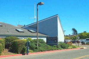
Facilities: Picnic tables at Campbell Cove, water and restrooms at Doran Regional Park, store and restaurants at Valley Ford.
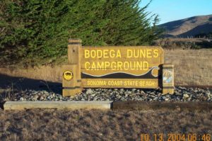
Campgrounds: Doran and Westside Regional Parks and Bodega Dunes State Campground are all nearby.
Lodging: Lodges and B&Bs in Bodega Bay and Valley Ford.


Points of Interest
In the News
Interested in contributing to this project?
Register to add new photos and information, update existing results and share your trip reports.