
Usage Notes

Legend: For details on the icons and trail colors, please click the legend icon on the map above.

Layers: Other layers are available. See the California Coastal Commission and Coastal Conservancy Completed Sections layer for the official completed trail segments. (About progress on the trail completion project.)
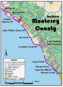
Monterey Section 10
Andrew Molera State Park to Ventana Inn at Highway 1
Andrew Molera State Park, spanning the lower reaches of the Big Sur River to its mouth, occupies the northern heart of the Big Sur coast. The gentle terrain around the river's mouth belies the steep, rugged coast that winds south all the way into northern San Luis Obispo County. From the river mouth, the Bluffs Trail offers a pleasant, easy trek. Then the Panorama Trail requires an invigorating ascent, gaining the ridgetop to reveal the dramatic sweep of rugged coast to the south. Since private property lies between the ridge and the coast south, CCT follows the Ridge Trail north, then the South Boundary Trail east to descend to Highway 1. After 2 miles along the highway shoulder, trails through Pfeiffer-Big Sur State Park offer a pleasant respite. The section concludes by ascending the highway shoulder south briefly section's end at the Ventana Inn turnoff. That's the start of the 43-mile backpack that follows or the Alternate Route's 26⅜ miles of highway shoulder walking.
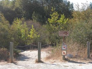
Two trails leave the Molera parking lot heading for the beach. From the parking lot's north end, the Camp Trail leads to a fine walk-in campground in ¼ mile, continuing to the beach at 1⅛ miles. That route requires fording the lagoon at the river mouth just before the beach unless the summer bridge is in place. From the parking lot's west side, the Creamery Trail, marked "BEACH-1.0 MILE," is preferable unless the river, only 75 feet from the lot, runs too high to safely ford. From about May to November a temporary bridge crosses the river at that spot. The Creamery Trail contours to a junction in 300 feet. Turn right on the trail signed "BEACH." It contours through riparian woodland around ⅛ mile, then continues downstream with the river hidden in dense vegetation on your right. Pass a large cottonwood around ¼ mile and contour west across a grassy flood plain.
By ¾ mile you can see the Big Sur River on the right. You quickly reach a junction with the Ridge Trail. Veer right and pass the river bank, then contour west on a sandy path. At ⅞ mile the rock outcrop on your left marks the base of Pfeiffer Ridge.
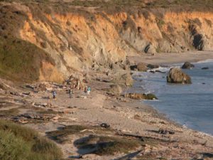
In only 200 feet the beach lies straight ahead as you meet a junction with the Bluffs Trail on the left. The CCT turns left here, but consider a side trip 150 feet to the magnificent driftwood strewn beach. At low tide you can walk the beach south, but it takes a very low tide to continue to the bottom end of the Spring Trail 1¾ miles south.
CCT follow the Bluffs Trail as it quickly ascends CO 50 feet elevation, then contours along the bluff edge with grand views south along the shoreline to rocky Cooper Point and west to nearby Molera Point with Point Sur rising beyond it. To the east Pico Blanco and the rugged Santa Lucia Range rise steeply.
Around 1⅛ miles the Bluffs Trail passes two unmarked left forks that connect with the Ridge Trail visible to the east. (You can also return to the parking lot that way, taking the next left fork.) CCT continues along the Bluffs Trail on a gentle ascent, angling away from the bluff edge.
At an unmarked fork before 1¼ miles, veer right for the Bluffs Trail and CCT, returning to bluff's edge and following it down the coast. By 1⅜ miles your trail climbs gradually, again angling away from the brushy bluff edge. The Franciscan Rocks stand in the surf zone below.
Meet a deep eroded gully beyond 1½ miles. The trail turns east to merge with the upper path and wind through the gully, crossing its seasonal creek at 1⅝ miles. Return to the bluff, then dip through a second gully at 1¾ miles. Wind a above a third gully at 2 miles, then dip and rise to a fourth. Contour along the blufftop, with no bikes allowed beyond 2¼ miles. Dip and rise, then cross an uplifted dune around 2⅜ miles.
Descend through coastal scrub into the biggest gully yet. The trail climbs above the arroyo, then contours across the bluff to a junction around 2⅝ miles.
The Bluffs Trail ends here. CCT continues as the Panorama Trail on the left. On the right the Spring Trail makes a winding ⅛-mile descent to the beach at the mouth of the next big gulch, which has a year-round creek. From the beach at low tides when the surf is not too big, you can walk a mile to Cooper Point. People have scrambled over rocks there and beyond to Pfeiffer Beach, but that extremely rugged, exposed route is not recommended.
CCT follows the Panorama Trail down through the deep, unnamed gulch, then climbs along the steepening bluff. You soon turn east on a steep, winding a ascent of a scrub-covered slope. Climb past a thicket of young redwoods on the left around 3 miles. Ascend to a view south to Cooper Point at 3⅛ miles, then to a view north to the tip of Pico Blanco.
Gain the ridgetop at 3¼ miles where a welcome contour offers a break. After dipping through a small gully, resume climbing moderately along a brushy ridge. After another glimpse of Cooper Point before 3½ miles, it disappears behind the brushy ridge to your south. Your ascent eases through a brush-choked gully, then turns moderate again through grasslands with a view north to Molera Point and Point Sur. Resume a steady ascent through coastal scrub with abundant California fuchsia.
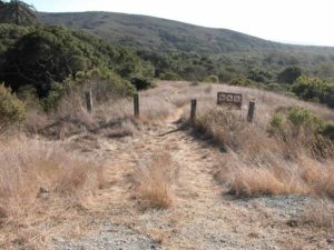
At 4 miles you gain a hilltop beside the fence marking the park's south boundary. Suddenly the panorama expands to include the rugged Big Sur coast to the south with the Santa Lucia Range behind it. Rounded Pleiffer Point lies below on the coast with Sycamore Canyon in front of it, but private property lies in between. After a break to savor the view, continue up the Panorama Trail along the south boundary. Gain the section's summit at 4¼ miles, marked by a junction and a rest bench. While the Panorama Trail climbs quickly to top one more hill, the CCT turns left and descends the Ridge Trail. Enjoy the views north as you desend chaparral-cloaked slopes, but also watch for bikes which are allowed on this broad, well-graded track.
By 4½ miles you leave the brushy slopes for a mixed woodland of coast live oaks, chinquapins, pines and redwoods with a lush understory. Contour through the forest past an eight-foot-diameter redwood, then descend gently through a grove of corkscrew redwoods as the Big Sur River canyon appears on your right. From 4⅞ miles, the trail drops fitfully through grasslands with scattered brush and glimpses of the coast.
Make a right turn on the South Boundary Trail at 5 miles. Follow this broad track over a rise, then down through grasslands on a winding, fitful roller-coaster descent to a gate around 5¾ miles. Leave the broad track there, turning left to descend steadily on narrow path through mixed forest. After a seasonal creek a at a 6 miles, descend a grassy ridge to 6⅜ miles, then wind down through forest to the canyon floor beyond 6½ miles.
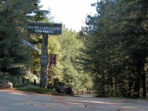
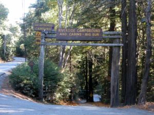
When you reach a marked junction, turn left and head down canyon beneath sycamore trees. Where the trail meets the river around 6¾ miles, the summer bridge may be in place for an easy crossing. If not, a wet ford is required-not advisable during high water. The trail quickly ends at Highway 1. Day hikers can veer left just before the road and follow the River Trail back to the parking area. CCT turns right and follows the highway shoulder upriver, crossing Pheneger Creek and Juan Higuera Creek, then passing three private campgrounds in the 2 miles before entering Pfeiffer-Big Sur State Park. At 9 miles CCT leaves the highway, turning right onto a fire road behind a green gate. It swings south through forest to cross a seasonal bridge over the Big Sur River. Stay to the left as you contour past two group camps. Beyond 9⅛ miles you pass a water faucet beside a campfire center. Climb a short hill to a junction, then turn left and ascend the Buzzards Roost Trail for ⅛ mile to the next junction. Turn left and descend past redwoods, then follow the trail upriver.
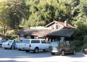
At 9½ miles, turn left and follow the trail under the highway bridge, then the park road's bridge. By 9⅝ miles you reach another seasonal footbridge. Cross the river on it, or climb to the park road if the bridge is missing. Where the trail forks beyond the river, take the path on the left to cross the park road and come to the Big Sur Lodge (store, cafe, lodging). Walk to the right around the lodge and out to Highway l. Turn left and follow the highway shoulder uphill past Big Sur Station (information, campfire permits) at 10⅛ miles. Continue up the shoulder, passing Sycamore Canyon Road west of the highway at 10¾ miles and the small commercial center of Big Sur just beyond, at 11⅞ miles reaching the turnoff on the left for Ventana Inn where this section ends.
ALTERNATE ROUTE: If the fords/seasonal bridges are impassable in winter or spring, the only alternative is to follow the highway to Ventana Inn.
SUGGESTED ROUND TRIPS & LOOPS: A pleasant, easy 2-mile loop follows the CCT to the beach, returning via the Camp Trail-a river ford may be required. For a 7⅛-mile loop, continue along the Ridge Trail beyond the South Boundary Trail, returning via Hidden Trail and River Trail. For a 91/-mile loop, follow the River Trail downstream from the bottom of the South Boundary Trail. Another option is to explore the many fine trails in Pfeiffer-Big Sur State Park, especially the Pfeiffer Falls, Oak Grove, and Valley View trails.
Distance: 11⅞ miles (19.1 kilometers).
Open to: Hikers. Bicyclists on first 2¼ miles of trail and paved road portion.
Surface: Trail, highway shoulder.
Access point: Andrew Molera State Park.
How to get there: From the Monterey Peninsula, drive south on Highway 1. In 21 miles from the Carmel River Bridge, turn west off Highway at Milepost 51.2 into Molera State Park. Descend .25 mile, turn right and pass entrance kiosk, then park.
Other access: North end of South Boundary Trail, anywhere along highway portion.
Difficulty: Easy
Elevation gain/loss: 2450 feet+/ 1130 feet-. Easy for first 2⅝ miles and final 5 miles, moderate to strenuous from 2⅝ miles to 6¾ miles.
Cautions: Trail may be inaccessible in winter and spring when river runs high-do not ford river when unsafe. Marauding raccoons can cause trouble at Molera Walk-In Camps keep all food in car when not actively cooking. Use extreme caution walking the shoulder of busy highway leg.
Further information: Molera State Park (831)667-2315, Big Sur Station (State Park & USFS) (831)667-2315.
Facilities: Chemical toilets, water, phone at access point. Picnic tables, restrooms, phones at or near Big Sur Lodge. Small store with deli, post office, phones on highway portion.
Campgrounds: Molera State Park Walk-in Camps near start are delightful and inexpensive. Pfeiffer-Big Sur State Park has 218 car camping units, while three private campgrounds offer alternatives just up the highway. Private Ventana Inn's Campground at section's end is for tenters only.
Lodging: Big Sur Cabins, Glen Oaks Motel and Ripplewood Resort on highway portion and Big Sur Lodge are the most economical choices in area. Post Ranch Inn and Ventana Inn at section's end are luxury resorts.
Points of Interest

In the News
Interested in contributing to this project?
Register to add new photos and information, update existing results and share your trip reports.