
Usage Notes

Legend: For details on the icons and trail colors, please click the legend icon on the map above.

Layers: Other layers are available. See the California Coastal Commission and Coastal Conservancy Completed Sections layer for the official completed trail segments. (About progress on the trail completion project.)
San Diego Section 12
Imperial Beach Pier to Mexican Border, Border Field State Park
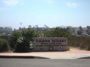
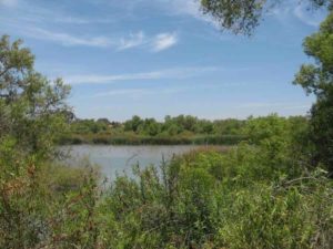
After the convoluted route through the urban sprawl of San Diego, this last CCT section encounters a windswept natural preserve of wetlands and an estuary backed by rugged desert hills. The natural environment here is blemished yet intact. Sewage and sedimentation severely pollute the 2500-acre Tijuana Marine Estuary. The river waters and the lovely crashing waves on the beach remain much too polluted to swim in. However, efforts by U.S. and Mexican officials in recent years have improved sewage disposal in Tijuana and controlled sedimentation on both sides of the border. Recent plans by the U.S. Immigration Service to rebuild the border fence into a massive structure requiring severe grading would result in further damage to the estuary. The fence also stands as a terrible symbol of the contrast between the Mexican and United States economies. Illegal immigration continues in spite of the "keep out" signaled by the fence.
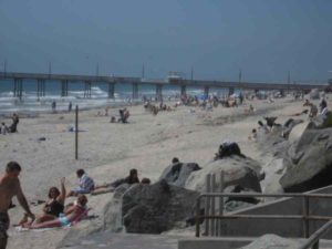
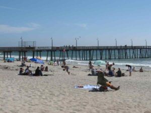
So far, the beach front part of the working class town of Imperial Beach remains the same as it has tor years, relatively uncrowded and distinctly unbusy. Planning is under way, however, for a massive "Pier Plaza Renovation," dubbed Surfhenge by the locals. For now the pier is still the main attraction when the fish are biting. Fisherfolk may catch bonita, mackerel, perch, halibut and a variety of other fish from the pier. Imperial Beach is also popular with surfers, being one of the few San Diego area beaches remaining with no restrictions on surfing.
For a good vantage point from which to survey this last section of the CCT, walk out on the Imperial Beach Pier. Down coast you can see the border fence jutting out into the surf. Behind it looms the Bullring by the Sea, home to the Mexican passion of bullfighting.
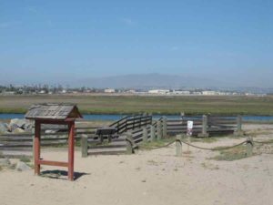
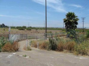
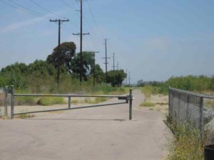
Head south from the pier on the wide beach. Beyond ¾ mile you encounter riprap in front of a housing development. You can walk the tideline past the rocks unless the tide is high. At high tide detour up one of the short streets to follow Seacoast Drive south to its end. Seacoast Drive fronts the estuary. At the street's end sits a wildlife viewing platform overlooking Oneonta Slough. From here, the detour returns to the beach. Continue south along the tideline toward the river mouth. Stay off the protected dune habitat.
You reach the mouth of the Tijuana River around 1⅞ miles, which usually requires a challenging crossing. At low tide during the dry season you may be able to wade or walk a sand bar across. If you wade, be advised the water may be severely polluted. However, don't let the river stop you less than 2 miles from the border. If the river is too deep to cross near its mouth, you can pack a small one person raft and 200 feet of light rope. If your party consists of more than one person, then tie rope at each end of the raft. The lead person must paddle across while the rope plays out. Then the other hikers pull the raft back while the first person plays out the rope, then the lead person pulls the next person across. Once you've solved the crossing, make a dash for the border on the wide, pleasant, empty beach. You reach the tall imposing border fence at 3¼ miles. Across the fence you can glimpse the bull ring and part of the immense, sprawling city of Tijuana.
If you are finishing a walk of the entire coast, you may feel the way Coastwalk's Whole Hikers did at the end of their 112-day walk on September 20, 1996, after 1156 miles. With elation we all touched the fence together and stuck our feet through the bars to step on Mexican sand. We were greeted by a Mexican couple who had heard about our arrival and congratulated us on the journey. After the tearful, happy ending, the group retired to the Tijuana Estuary Visitor Center where 70 people celebrated the successful journey with awards, speeches and a delicious Mexican banquet.
When you're ready to leave the beach and bid farewell to the coast, walk east to find the parking lot and restrooms on top of the bluff at 3½ miles. A stone marker here commemorates the establishment of the border in 1849.
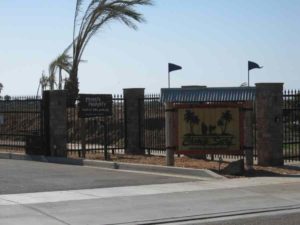
SUGGESTED ROUND TRIPS AND LOOPS: Visit the Tijuana Estuary Visitor Center at 301 Caspian Way in Imperial Beach to see displays on wildlife and the estuary. About four miles of trails around the estuary start at the Visitor Center.
Distance: 3½ miles (5.6 kilometers).
Open to: Hikers.
Surface: Beach.
Access point: Imperial Beach Pier.
How to get there: From Interstate 5 about 9 miles south of San Diego, take the Palm Avenue exit and go 3 miles west. Turn left on Ocean Lane and go .25 mile to the pier.
Other access: South end of Seacoast Street, Border Field State Park.
Difficulty: Easy
Elevation gain/loss: Negligible.
Cautions: The Tijuana River mouth may be too deep to ford at high tide or high runoff. Also the river is notoriously polluted because it runs through Tijuana, a border town with major sewer problems. Illegal immigration from Mexico remains a dilemma, but a heavy U.S. Border Patrol presence has recently reduced the flow of illegals in this area. The dunes area is closed to protect bird breeding habitat.
Further information: For Imperial Beach, call Imperial Beach Lifeguard Station (619)423-8328, for Border Field State Park, call Tijuana Estuary Visitor Center (619)575-3613.
Facilities: Imperial Beach has parking, restrooms and water near the pier plus cafes and stores nearby. Border Field State Park has restrooms, picnic tables and parking.
Campgrounds:
Lodging: Imperial Beach has several motels and hotels.
Points of Interest
In the News
Interested in contributing to this project?
Register to add new photos and information, update existing results and share your trip reports.